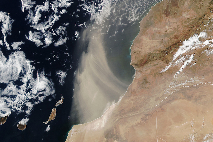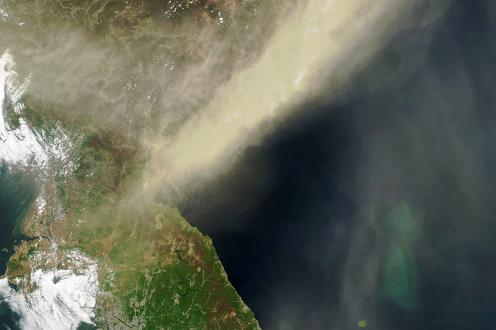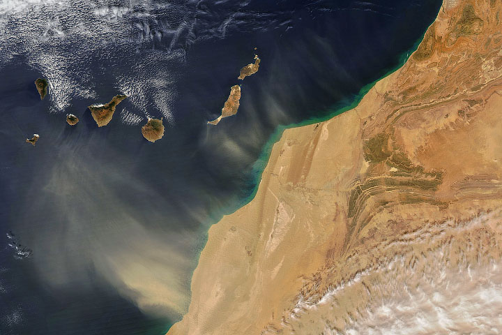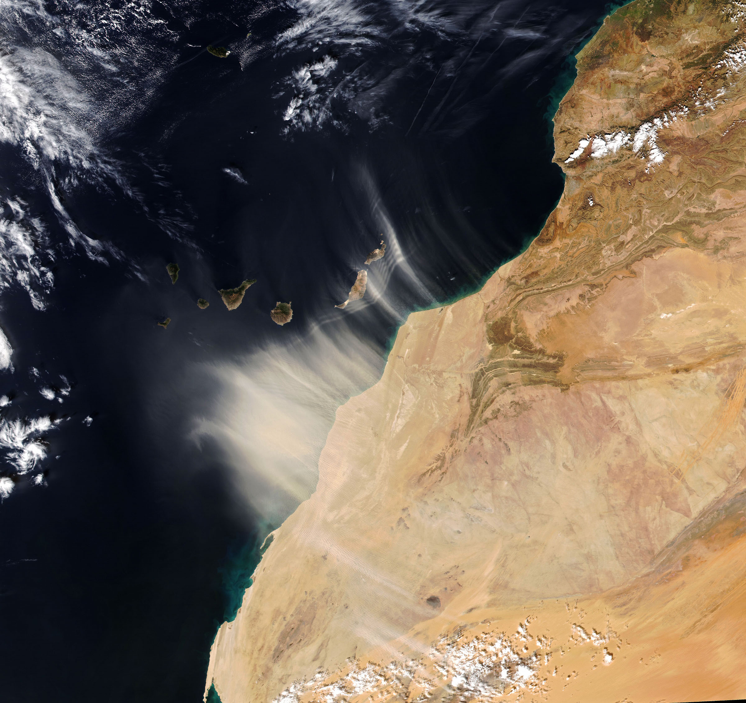
In mid-January 2022, dust from northwest Africa washed over the Canary Islands, causing skies to turn orange, visibility to drop, and air quality to decline. Such events, known to islanders as “la calima,” generally happen around this time of year as strong seasonal winds carry sand and dust away from the Sahara.
The Visible Infrared Imaging Radiometer Suite (VIIRS) on the NOAA-20 satellite acquired an image (above) around 1:45 p.m. local time on January 14. At the time, Spain’s meteorological agency (AEMET) had issued a warning to the islands of Lanzarote and Fuerteventura for high winds and suspended dust. Later that evening, the warning was extended to Gran Canaria and Tenerife.
With the arrival of the dust, visibility dropped to 1.6 kilometers (1 mile) at the airport on Gran Canaria and 1.8 kilometers (1.2 miles) on Fuerteventura and Tenerife South, according to local news reports. The Ministry of Heath advised people, especially those with respiratory issues, to stay inside with doors and windows closed. Wind gusts reached 70 kilometers (40 miles) per hour.
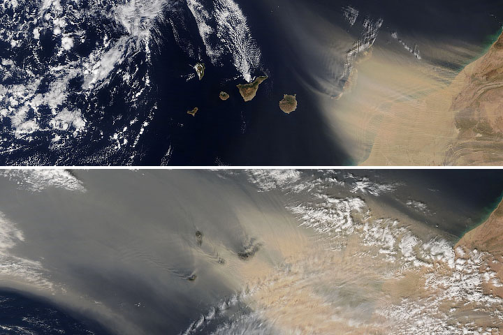
The storm was not much more than a hazy orange nuisance to people on the ground. But when viewed from space, interesting patterns emerge. Notice that the dust has organized into a series of linear bands close to the archipelago’s eastern islands. The dust is likely organizing along otherwise invisible waves in the atmosphere. Such waves can be caused by the rise and fall of an air mass that has been disturbed. In this case, the air mass coming off the west African continent was disturbed by the lower-altitude air mass near the sea surface.
“Note that the shape of the wave train matches with the west African coastline rather well, with some distortion of course due to different wind speeds at different latitudes,” said Tianle Yuan, an atmospheric scientist at NASA’s Goddard Space Flight Center and University of Maryland Baltimore County.
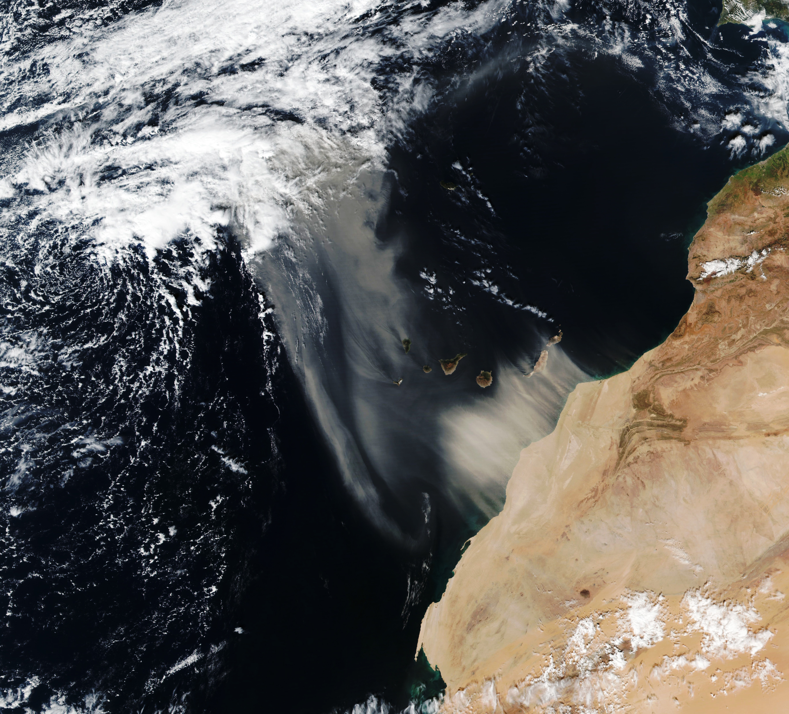
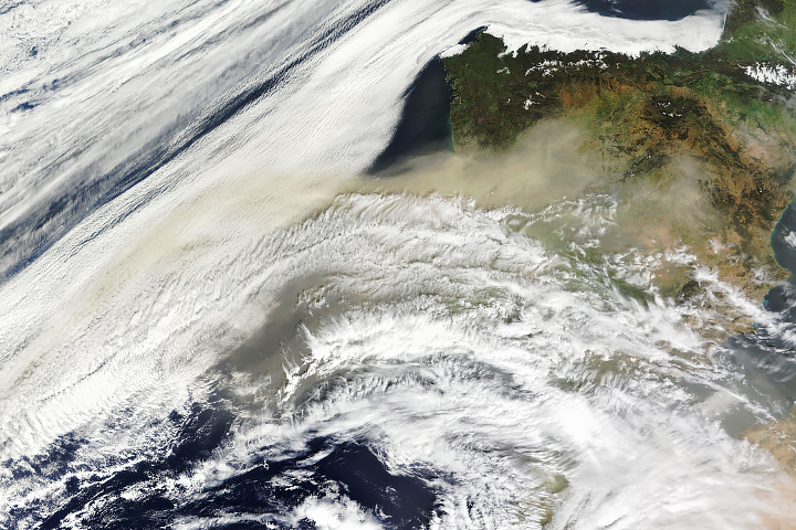
Over the weekend, dust continued to stream from the African coast. The second image, acquired with VIIRS on the Suomi NPP satellite, shows dust engulfing the archipelago’s westernmost islands by January 15. Notice the plume of dust billowing beyond La Palma to the north-northwest. Forecasts suggest the dust will keep moving north this week toward Ireland, Scotland, and Iceland.
Large plumes of Saharan dust can arise at any time of year, but the dust tends to blow higher in the atmosphere during the summer. For example, dust from the historic “Godzilla” storm of June 2020 rose as high as 4 kilometers (2.5 miles) and crossed the Atlantic Ocean. In contrast, lower altitude dust carried by the northeast trade winds frequently affects people in the Canaries during winter and spring.
NASA Earth Observatory image by Joshua Stevens, and Lauren Dauphin using VIIRS data from NASA EOSDIS LANCE, GIBS/Worldview, and the Joint Polar Satellite System (JPSS). Story by Kathryn Hansen.