
At the very top of North America, more than 36,000 islands large and small mingle with the icy waters of the Arctic Ocean. Collectively they comprise the Canadian Arctic Archipelago, and the region’s landscapes and waterscapes are stunningly beautiful. They are also quite remote, making satellite images a good way to explore the region.
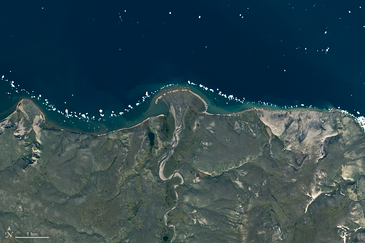
The northern side of Banks Island—the archipelago’s westernmost island—is visible in this image acquired on a rare cloud-free day in July 2015. Centered in the lower half of the image is Thomsen River, a remote destination within the Aulavik National Park that is well-known among canoeing enthusiasts. Visitors to the park—about a dozen in a typical year—are surrounded by Arctic tundra inhabited by muskox, snowy owls, and snow geese.
Although summer was in full swing when the Operational Land Imager (OLI) on Landsat 8 acquired this image, bits of seasonal sea ice persisted offshore and within Mercy Bay. “Particularly obvious is the ‘pearl necklace’ of small ice floes worn by the coast,” said Robie Macdonald, a scientist at the University of Manitoba and the Canadian Department of Fisheries and Oceans. “These lines of bergy bits indicate grounded ice that has collected at delta fronts, or along a thin shore margin at the point where the sea bottom rapidly deepens below ice keel depths.”


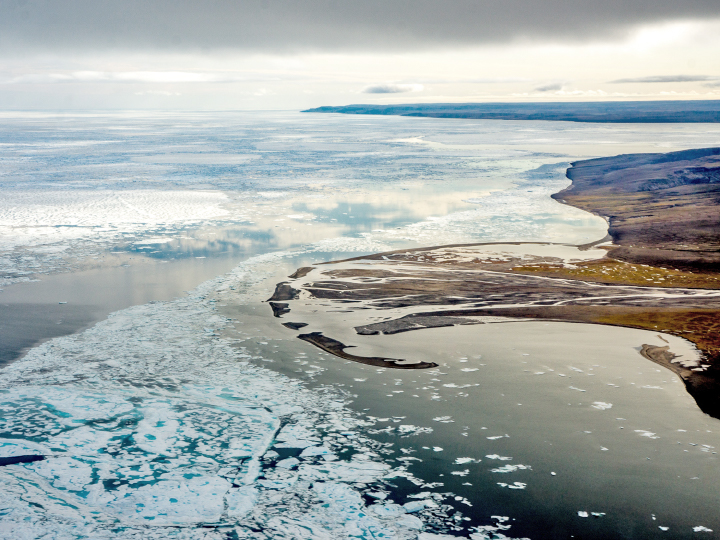
The satellite image above shows the phenomenon in more detail, where pieces of ice trace the coastline and a delta just east of the Thomsen River and Castel Bay. The photograph, shot from an airplane by Macdonald in August 2015, shows an even closer view. The icy bits continuously melt, warmed by river water and heat from the Sun absorbed by the ocean. But just as quickly as they melt, they are replaced by new pieces supplied by a cohesive mass of sea ice (outside the view of these images).
In addition to stark-white ice, the water is awash with colorful shades of green and brown, a result of turbid river water and coastal erosion. The Thomsen carries a huge amount of suspended sediment—so much so that the embayment at the mouth is almost entirely filled with sand and silt, carried and left there by the river water. The material and the shallow water depth contribute to Castel Bay’s light green color, in contrast with the deeper, dark blue waters of M’Clure Strait.


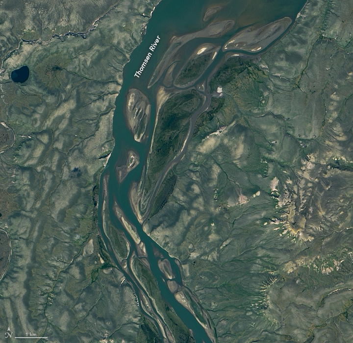
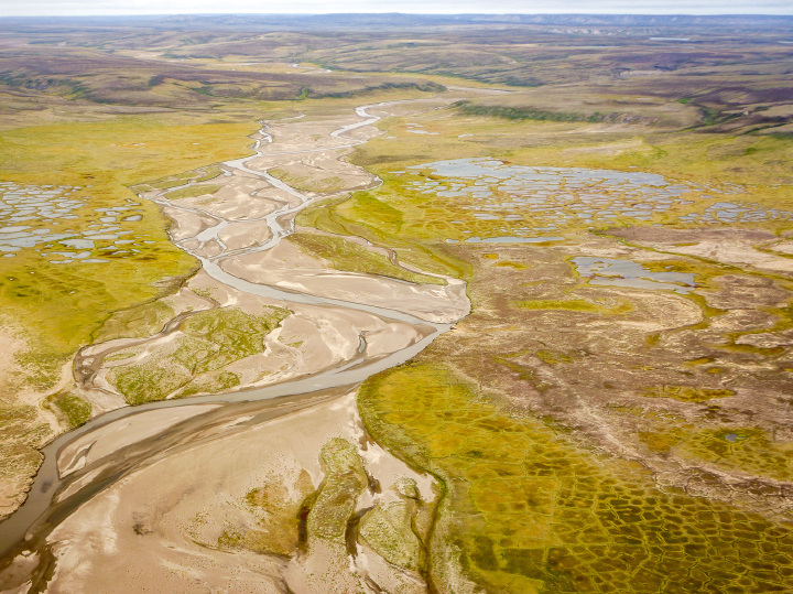
Sedimentary formations across Banks Island provide an unsorted mix of material, from clay to boulders, across a low and flat landscape. The recipe is just right for the formation of braided rivers with numerous channels that split off and rejoin. The detailed satellite image and photograph above show clear views of river-braiding along the Thomsen.
The photographs above were shot by Macdonald, who performed summer fieldwork along the river from 2014-16. His work was part of a project to collect geochemical measurements for small rivers across the Canadian Arctic Archipelago. Collectively, the water from these small rivers play an important role in regional ocean properties and processes, affecting how the water circulates and mixes, as well the ocean’s vulnerability to acidification.
“The science community has tended to neglect the thousands of small rivers in favor of the four big rivers—the Lena, Ob, Yenesie, and Mackenzie,” Macdonald said. “And yet these little rivers, which lie entirely within the Arctic, are in the vanguard of Arctic warming.”
NASA Earth Observatory images by Lauren Dauphin, using Landsat data from the U.S. Geological Survey. Aerial Photography and image interpretation by Robie Macdonald/University of Manitoba/Dept. of Fisheries and Oceans. Story by Kathryn Hansen.