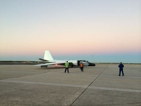
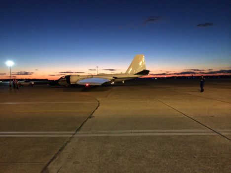
The WB-57 prepares for takeoff on Friday, October 17th, 2014 from MacDill Air Force Base.
On Friday morning, at 7:40 AM EDT, our WB-57 took off for a third, and final flight over Hurricane Gonzalo. At the time of our flight, Gonzalo was a Category 3 storm located south of Bermuda. While we were flying Gonzalo, one of the NOAA P-3s was also investigating Gonzalo. The data the P-3 collected will be particularly useful for the WB-57 instrument teams to validate our results. For example, HIRad is very similar to the Stepped Frequency Microwave Radiometer (SFMR) onboard the NOAA P-3. We can use SFMR data that is collocated with HIRad data to validate our results over the coming weeks.
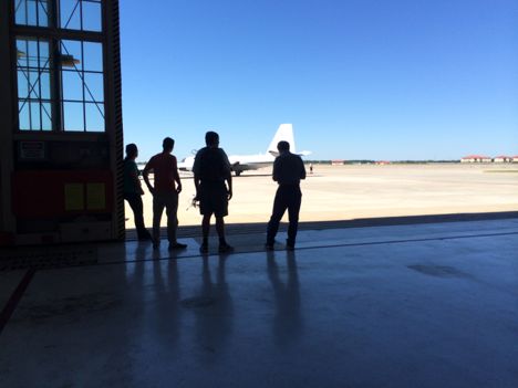
Members of the instrument teams wait for the WB-57 to taxi back to the hangar after the third science flight over Hurricane Gonzalo.
We still have through the end of October for science flights, so the forecasting team is looking for the next target we can fly over. The National Hurricane Center has given a disturbance in the Gulf of Mexico, related to Tropical Storm Trudy, a medium chance of tropical cyclone formation in the next five days. There is still a lot of uncertainty in the forecast, but it’s worth keeping an eye on the Gulf next week. We always stay prepared for flights on the off chance that something turns out to be a better target for us than originally forecast. Stay tuned!
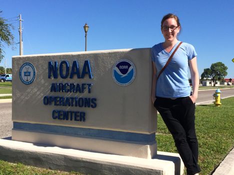
The folks at the NOAA aircraft operations center were kind enough to share some space with us for the few days we were based out of MacDill. Here, I am, exhilarated after three long, but successful, days of science flights.

The WB-57 crews and pilots prepare for take-off from MacDill Air Force Base on October 16, 2014
Today was another interesting day here at MacDill. Our WB-57 took off around 11:16 EDT for Hurricane Gonzalo. During the science flight, Gonzalo’s maximum sustained winds were 145 mph as it continued on its track towards Bermuda. During the ~6 hour mission we were able to cross over the eye three times.
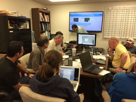
Based on satellite imagery, it looks like the flight planners did a good job at nailing the eye crossings. The team here spends a lot of time planning out coordinates in advance in order to create flight tracks that will give us the best view of the storm. It’s not as simple as just forecasting the center position of the hurricane because we also have to consider the other parts of the hurricane environment that we want to study. All the instrument teams have preferences for the types of data they want to get, but in the end we need to compromise and find a track that works for everyone. Today’s track put us in a good position to look at the inner core of the storm as well as upper level outflow. We cannot wait to get a look at the processed data to see how well the flight track worked out.
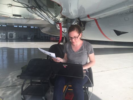
Sitting under the WB-57, I hide from the hot Florida sun and download HIRad data from today’s flight.
The plan for tomorrow is to get one last flight over Hurricane Gonzalo, but we’ll have to get an early start, taking off at 7am, in order to make the most out of the WB-57’s range. Due to range limitations, we will probably only get two passes over the eye this time, but it’s better than nothing. After tomorrow’s flight, the researchers will head back to their respective homes until we find a new suitable target to fly over.
After a second successful flight over Hurricane Gonzalo, crews prepare the WB-57 for the next flight from MacDill Air Force Base.
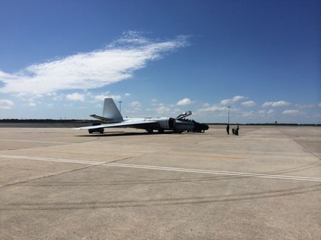
Maintenance crews and the pilots prepare for departure from MacDill Air Force base on October 15, 2015
HS3 UAV flights officially ended a couple of weeks ago, but there has been a successful extension of the HS3 mission through a new NASA/Navy collaboration. Two instruments from HS3 that didn’t get to fly this hurricane season due to aircraft issues, HIRad and HIWRAP, are now loaded onto a manned WB-57 and will be flying over storms through the end of October.
Members of the team collaborate as they launch dropsondes into Hurricane Gonzalo during a science flight on October 15, 2014
Things are looking up for the HIRad and HIWRAP teams, as we just finished our first successful science flight over Hurricane Gonzalo today. Hurricane Gonzalo is undergoing an eyewall replacement cycle and has a maximum sustained wind of 125 miles per hour. Headed towards Bermuda, Gonzalo is expected to maintain its major hurricane status through Friday. Luckily, Gonzalo is in range of the WB-57, which will be based out of the MacDill Air Force base in Tampa, FL through Friday. The team here is working hard to get as much data as possible. Stay tuned!
The WB-57 lands after completing its first science flight at MacDill Air Force base on October 15, 2015
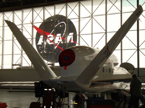
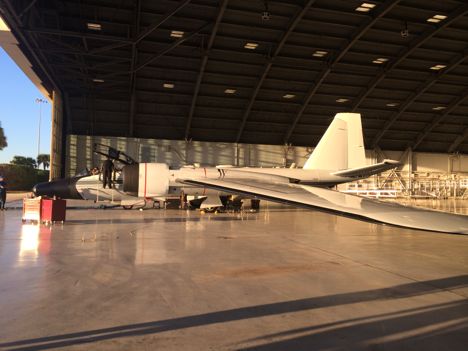
AV-6 in the hanger at Wallops Flight Facility
Since I last posted, HS3 has decided to give up on trying to fix AV-1, thus ending my time at NASA Wallops this hurricane season. We came to this decision so we would still have some time to get two of the instruments, including the one I work with, off AV-1 and moved onto a WB-57 for the rest of the hurricane season. So not all hope is lost! While I am disappointed that my time at Wallops will be cut short, it is important for us to move on. If everything goes smoothly, we could be ready to fly the WB-57 in a little over a week.
Although I would have wished to detail more of my “field work” experiences here, I think my experiences, or lack thereof, is also important to portray. Like most jobs, this one has its up and downs. This campaign has taught us all how to adapt to difficult situations and make the most of every opportunity.
HS3 scientists are making the most of this situation right now with the use of our other UAV, AV-6, which is currently heading towards tropical depression six. In just this past week, AV-6 has been able to successfully investigate two other systems: Tropical Storm Dolly and a weaker system off the African Coast.
September 11, 2014 – AV-6 (green icon) flies from WFF to Tropical Depression Six as seen in GOES infrared imagery overlaid on a Google map
AV-6 will be returning to Wallops tomorrow. In other news, I hope to introduce a new blogger soon: someone who is actually at Wallops! A new perspective is exactly what this blog needs. Thanks for reading!
Since I last posted, AV-6 flew a successful mission over Cristobal. Meanwhile, AV-1 is still stuck in California until crews can figure out the electrical issues that are affecting the aircraft. Those of us on the AV-1 instrument teams, which includes the team I’m on, are starting to get pretty jealous of AV-6’s ability to actually fly. One of the most frustrating parts of being on an instrument team is waiting around until both your aircraft is available to fly and there is a good target for your aircraft to fly over. When we do get to fly, every instrument team has to staff the Global Hawk Operations Center, or GHOC. Thanks to multiple shifts of researchers and pilots, we can fly the UAVs for long lengths of time—all from the comfort of our desks! In the GHOC, researchers don headsets and monitor our instruments to make sure they are working properly; which is less flashy than it sounds. However, I still cannot wait to be a part of a flight. I’m staying patient and thinking positively about getting AV-1 here at Wallops.
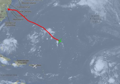
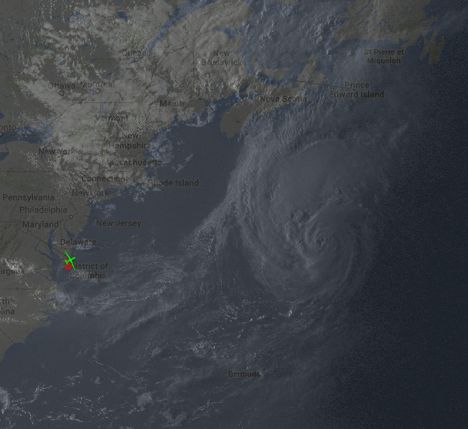
On Thursday, August 28th, I was able to watch AV-6 take off from Wallops Flight Facility. The black plane that you can see in the linked video is flown as an added safety precaution as it follows the UAVs during take off to make sure no other aircraft crosses its path. The photo below shows what Cristobal looked like shortly after take off around 7 pm from the Geostationary Operational Environmental Satellite (GOES):
Slightly after AV-6 (green aircraft icon) took off from Wallops Flight Facility on August 28, 2014, Hurricane Cristobal was located just off the East coast of North America. This image is a combination of GOES visible imagery and a Google map for reference.
One of the challenges for mission scientists during this flight was that Cristobal was moving rapidly. Throughout the night, forecasters and scientists were altering the flight plans to account for the fast motion of the storm as well as commercial air traffic in the region, in order to get the best possible coverage of Cristobal. Overall, the flight was a success and the mission’s objectives were achieved.
While I was tracking AV-6 on the way home from Cristobal, I had fun looking at the imagery that was taken from a camera on the bottom of the aircraft. Below is a photo captured on the way home from Cristobal on August 29th:
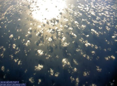
Imagery from AV-6 on the way home from sampling Cristobal; Sunlight reflects off the Atlantic Ocean and clouds cast shadows onto the sea surface
After the excitement of Hurricane Cristobal, forecasters and scientists are looking for the next storm to target. The National Hurricane Center has given a tropical wave over the northwestern Caribbean a 60% chance of tropical cyclone formation over the next 5 days. This system will likely be AV-6’s next target in the Bay of Campeche on Tuesday, September 2nd. If you would like to follow along with the flight you can track AV-6 on this page.
