
At first, the geography of Antarctica might seem a little confusing. From space, much of Antarctica looks featureless and white, meaning there are few features to guide you. It’s one thing to know that Pine Island Glacier is in West Antarctica, but for some it might be unclear which part of the frozen continent is which.
In the most general terms, Antarctica can be divided into three major areas: West Antarctica, East Antarctica, and the Antarctic Peninsula.
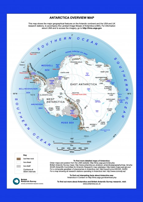
An overview map of Antarctica produced by the British Antarctic Survey to accompany the Landsat Image Mosaic of Antarctica, or LIMA.
The Antarctic Peninsula is probably Antarctica’s most prominent geographical feature and home to scientific stations operated by the United States, the United Kingdom, France, Australia, and other nations. This curved extension of the continent extends nearly 250 miles north of the Antarctic Circle and points toward the southern tip of South America. The Antarctic Peninsula has a number of glaciers and floating ice shelves that are changing rapidly because this region is warming faster than the rest of the continent.
Running along the length of the peninsula, and extending across the continent is a mountain chain known as the Transantarctic Mountains. In addition to supplying spectacular views, the Transantarctics serve as a sort of dividing line separating East and West Antarctica.
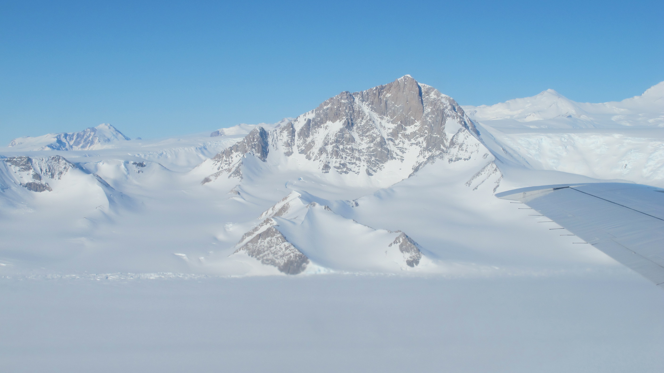
A view of the Transantarctic Mountains during IceBridge’s 2013 Antarctic campaign.
Although the Antarctic Ice Sheet is a continuous mass of ice, it is sometimes helpful to think of it as two separate masses. The West Antarctic and East Antarctic ice sheets are separated by the Transantarctics, with ice on the west side generally flowing toward the Western Hemisphere and ice on the east side flowing toward the eastern hemisphere. (In both cases, this is actually flowing north…away from the South Pole.)
East Antarctica is considerably larger than West Antarctica, and its ice sheet is thick – nearly three miles (five kilometers) in some regions . The ice surface of East Antarctica is high and home to some of the coldest and driest condition on Earth.
The East Antarctic Ice Sheet is considered to be more stable than the West Antarctic. One reason is the shape and elevation of bedrock beneath the ice. Heavy masses of ice push down on bedrock, depressing some areas below mean sea level. If those low-lying areas happen to be near the edge of the ice sheet — which is the case in much of West Antarctica — then ocean water can make its way under the ice, speeding up glacier flow.
This is one of the reasons that, while both portions of the ice sheet are losing mass, West Antarctica is moving much faster. Recent studies of West Antarctica found that many of its fast-moving glaciers are in an irreversible decline.
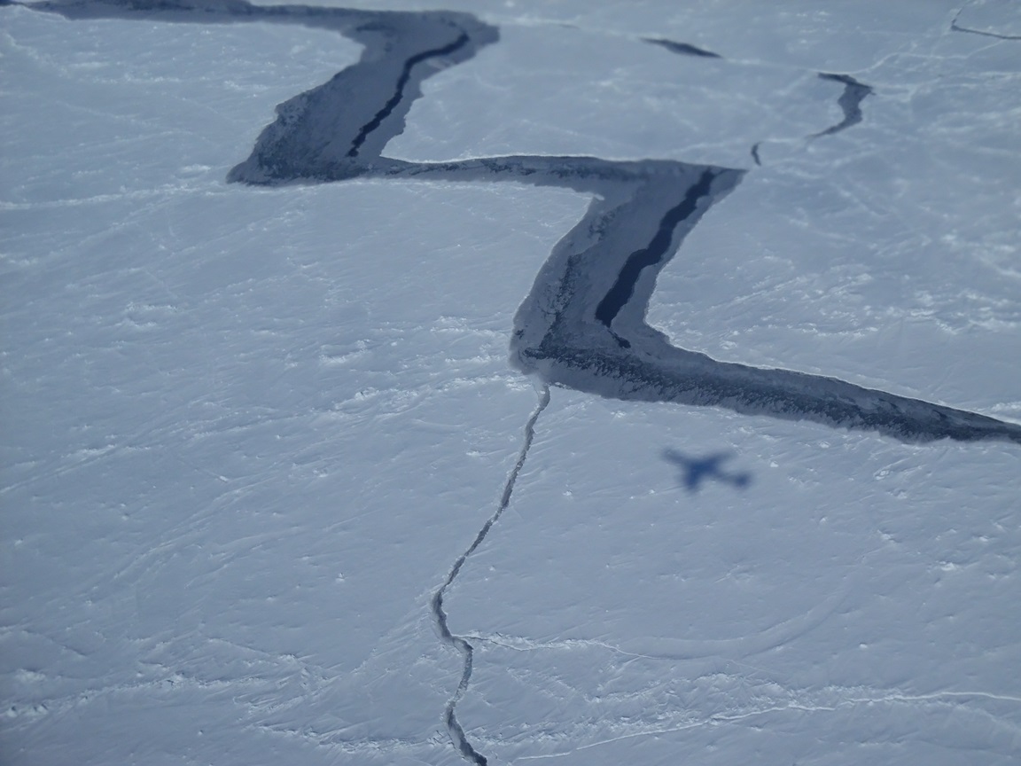
Shadow of the NASA DC-8 on sea ice in the Weddell Sea. Credit: NASA / Jim Yungel
Antarctica is surrounded on all sides by the Southern Ocean. During the winter, ocean water freezes, forming a layer of sea ice of roughly the same area as the Antarctic continent. In recent years, sea ice around the continent has been increasing.
The ocean around Antarctica is divided into several seas. Starting to the right of the Antarctic Peninsula on the map is the Weddell Sea, which extends to Cape Norvegia, a small point of land jutting off of East Antarctica. Moving clockwise we go around the East Antarctic coast all the way to the Ross Sea, south of New Zealand. Next comes the Amundsen Sea, where large West Antarctic glaciers like Pine Island and Thwaites drain. We complete our trip around Antarctica by coming to the Bellingshausen Sea, to the left of the Antarctic Peninsula.
For maps of Antarctica, including some that use imagery from the Landsat satellite, visit:
http://lima.usgs.gov/download.php
To use an interactive Antarctic atlas, visit:
http://lima.usgs.gov/antarctic_research_atlas
Tags: Antarctic 2014
Thanks, George, for this well written explanation. This is very useful for the general public!
When all the fossil fuel is burnt and all the ice is gone ( as it was in the late Cretaceous) this area will be the Antarctic Islands in a temperate ocean.
Is the Antarctic Peninsula a continuation of the Andes range? As the West Antarctic Ics melts and relieves pressure on he bedrock will there be an increase in the number of earthquakes along the range?
not much on the geography of AA-the west- east division by hemisphere is useful
Excellent write up on geography of Antarctica for school and college level students . Greatly appreciated.
Finally I know where North, South, East and West are in Antarctica.
Thanks for the great map.