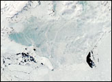
The tip of the Antarctic Peninsula showed dramatic seasonal changes in late January 2008. On January 24, 2008, the fast ice looked solidly frozen. Several days later, on January 30, 2008, the ice’s new blue hue suggested something had changed.
Published Feb 6, 2008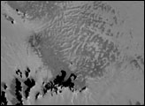

Melt ponds on the surface of Greenland’s ice sheet are an important indicator of the strength of the 2013 melt season.
Published Jul 9, 2013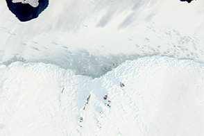
The land and sea along Antarctica’s Mawson Coast offer a study in ice forms.
Published Dec 31, 2011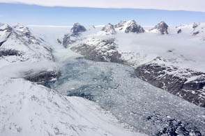
NASA aircraft return to the Arctic to assess the health of the region’s ice.
Published May 3, 2012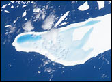
In January, 2004, astronauts on board the International Space Station took this detailed picture of melt water pooled on the surface of iceberg A-39D, a 2-kilometer wide, 11-kilometer long iceberg and drifting near South Georgia Island. The different intensities of blue are interpreted as different water depths. From the orientation of the iceberg, the deepest water (darkest blue) lies at the westernmost end of the iceberg. The water pools have formed from snowmelt—late January is the peak of summer in the Southern Hemisphere.
Published Mar 15, 2004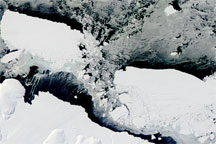
Acquired March 11, 2010, this true-color image shows Iceberg B-09B and an iceberg recently broken off the Mertz Glacier, as well as newly forming sea ice. Open ocean predominates on the leeward side of icebergs.
Published Mar 11, 2010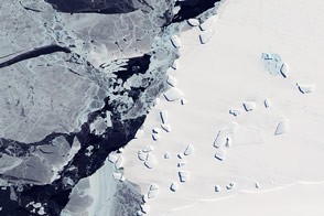
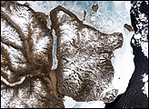
Acquired October 7, 2011, this natural-color image shows an ice menagerie off the coast of East Antarctica.
Published Oct 23, 2011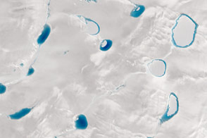
When it comes to the blue hue of meltwater lakes, darker means deeper; satellites can help scientists discover just how deep.
Published Sep 9, 2015alert message
