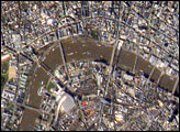
Numerous well-known landmarks appear in this detailed view of London taken from the International Space Station.
Published May 9, 2005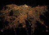
Buenos Aires is one of the larger cities seen by orbiting crews. Twelve million people, almost one third of all Argentines, live in this city, often called the “Paris of the South”.
Published Mar 16, 2003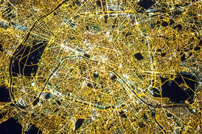
The capital city of Saudi Arabia has grown dramatically in the last half century.
Published Dec 3, 2012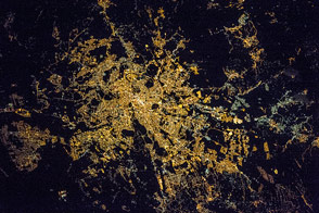
The radial pattern of highways echoes the ancient saying that “all roads lead to Rome.”
Published Jul 28, 2016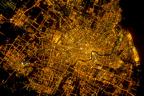
The bright lights of Shanghai’s city center and the distinctive new skyscrapers that form the skyline along the Pudong district make for spectacular night viewing from space.
Published Apr 16, 2012
Madrid is the political, economic, and cultural center of Spain.
Published Sep 12, 2016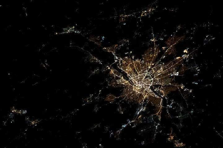
Divided by the Danube River, the city is actually a unification of three different older communities.
Published May 24, 2020
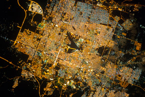
It is the capital of Utah, headquarters of the Church of Jesus Christ of Latter-day Saints, and “the crossroads of the West.”
Published Jan 6, 2014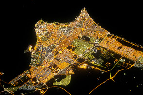
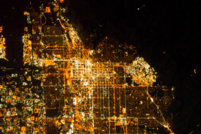
The patterns and colors of lighting reveal the urban geography of the capital city.
Published Sep 17, 2012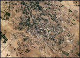
Commonly known as “the oldest city in the world,” Jericho is an important historical, cultural, and political center located northwest of the Dead Sea. This astronaut photograph illustrates the city center, and the original settlement mound of Tell es-Sultan. Total distance across the image is approximately 8 kilometers (5 miles). Two large refugee camps are located to the northwest and south of the city center. The high building density of the refugee camps contrasts sharply with the more open city center and irrigated fields (green polygonal patches) of Jericho, and illustrates one of the physical consequences of the ongoing Israeli-Palestinian conflict in the region.
Published May 2, 2005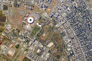
Astronauts have the best view of the city’s well-known “swept wing” city layout, which takes the form of a flying bird that is expressed in the curves of the boulevards. The stadium sits between the wings.
Published Jun 16, 2014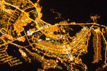
The developed areas of Brasília and its satellite cities are clearly outlined by street grids and highway lights in this astronaut photograph taken from the International Space Station.
Published Jan 31, 2011alert message
