The historical oasis on the coast of the Arabian Gulf is now an oil industry oasis.
Published Jun 3, 2013
Once an important port during World War II, the bay is comprised of a complex delta system that makes it a very scenic and popular tourist destination in Australia.
Published May 30, 2020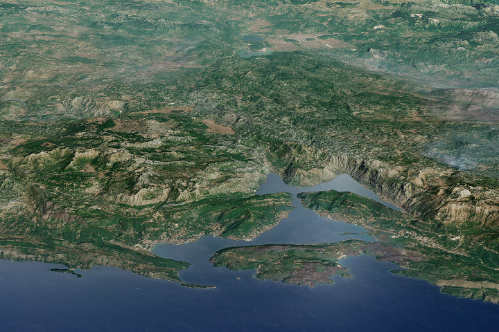
The stunning scenery in this bay in Montenegro has made it a popular destination for cruises ships.
Published Sep 17, 2017
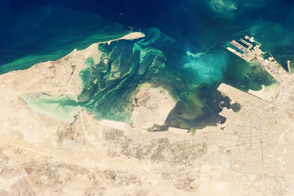
The Port of Suez is located in Egypt along the northern coastline of the Gulf of Suez. The port and city mark the southern terminus of the Suez Canal, which runs north-south through Egypt from the Mediterranean Sea to the Gulf of Suez.
Published Jan 28, 2008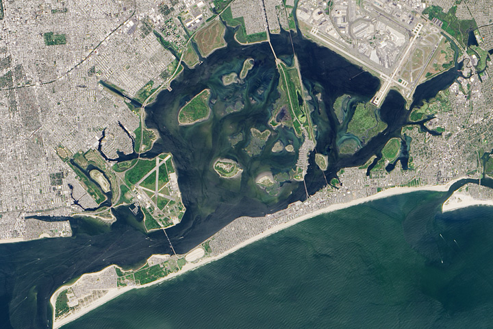
Despite the bay’s calm waters, constant reminders of the city break through.
Published Oct 5, 2017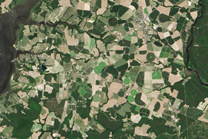
While farms remain a major source of water pollution, signs of improvements are beginning to emerge.
Published Aug 12, 2016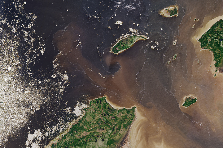
Wild patterns on the water's surface are evidence of the fluid dynamics that occur when fresh river water meets sea water.
Published Aug 20, 2018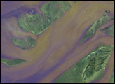
While the amount of pollution that wastewater treatment plants contribute to the Bay is declining, the spread of asphalt, pavement, and other impervious surfaces in suburbs and cities is increasing stormwater pollution.
Published Sep 20, 2016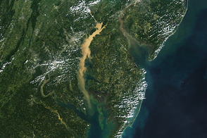
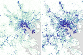
Ships, airplanes, and satellites all play a role in monitoring Chesapeake water quality, algae blooms, and dead zones.
Published Nov 2, 2016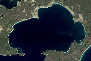
Rising and falling seas and ancient rivers formed a bay lined with the whitest sands in the world.
Published May 11, 2013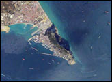
Gibraltar Bay, located near the southernmost tip of the Iberian Peninsula, is the central feature of this astronaut photograph. The famous Rock of Gibraltar that forms the northeastern border of the bay is formed of Jurassic-era seafloor sediments that solidified into limestone, a rock formed mostly of the mineral calcite, which is found in the shells of sea creatures. The limestone was subsequently lifted above the ocean surface when the African and Eurasian tectonic plates collided. The cities of La Linea and Algeciras bordering the bay, together with petroleum-processing facilities along the northern shoreline, are part of Spain, whereas the city of Gibraltar itself (to the west of and including the Rock) is under the jurisdiction of the United Kingdom.
Published Jan 8, 2007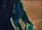
High tides in the funnel-shaped bay are anything but a bore when they collide with river water flowing in the opposite direction.
Published Oct 28, 2019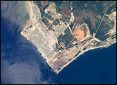
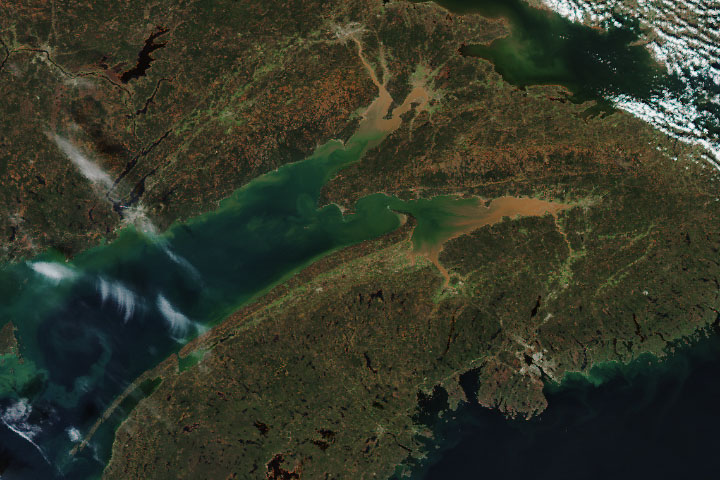
Seven Island Bay (left side of the image) is one of the largest and best-protected harbors on Quebec’s north shore of the Gulf of St. Lawrence. Because this is both a deep-water port and ice-free year round, Sept-Îles is one of Quebec’s busiest ports. Locally produced materials (iron ore, alumina) comprise the bulk of port traffic, but Sept-Îles also acts as a trans-shipment point for goods moving to Europe, the Far East, and South America.
Published Jun 27, 2005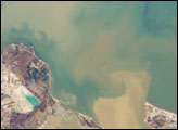
Muddy brown water fills Sandusky Bay, just south of Lake Erie in this astronaut photograph. The small city of Sandusky occupies the southeastern shore of the bay. The most striking aspect of this image is the flow of the brown water in and out of the mouth of the bay. Slight movement of lake surface water, driven mainly by wind, causes a small ebb and flow of bay water. Sediment-charged water is derived from agricultural fields along the Sandusky River upstream. Mud plumes in Lake Erie originate from prior pulses of muddy water from the bay. When this image was taken, some clear, lake water (blue-green strip) appeared to be flowing into the bay.
Published Feb 20, 2006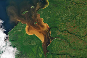
Dissolved organic matter from forests and wetlands stained the water dark brown near Rupert Bay. A similar process darkens tea.
Published Oct 1, 2016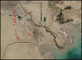
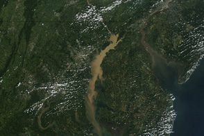
Mud clouds much of the Chesapeake Bay in this image from September 13, 2011.
Published Sep 16, 2011alert message
