Meltwater has carved sinuous channels on the DeVries Glacier in the Canadian Arctic.
Published Apr 12, 2017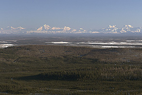
Operation IceBridge, an aerial ice surveying mission, has plenty of area to cover.
Published May 9, 2014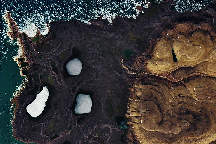
Plants that can survive in harsh environments like Canada’s Devon Island may be good candidates for eventually terraforming the Red Planet.
Published Aug 3, 2020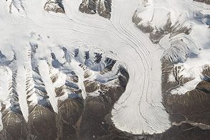
Colorful lakes and retreating glaciers are among the beautiful scenes waiting to be discovered within an image mosaic of the Arctic.
Published Feb 17, 2015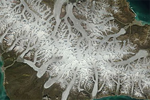
Acquired March 9, 2012, and July 22, 2012, these images show stark differences between winter and summer on Canada’s Bylot Island.
Published Nov 30, 2012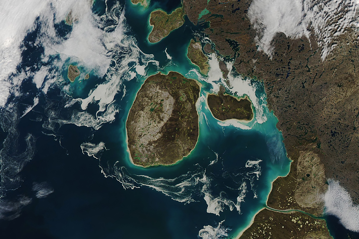
Sea ice that has been tinged brown is common in this part of the Canadian Arctic.
Published Sep 24, 2018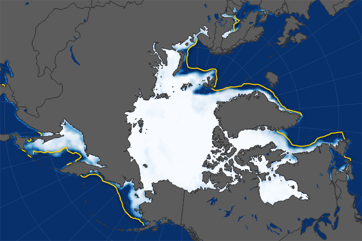
As Arctic sea ice extent shrinks each year, ships are cruising farther north.
Published Apr 12, 2018Image of the Day Water Human Presence Snow and Ice Remote Sensing
The history of ice can be read on the landscape of Canada's Victoria Island, now home to lakes, rivers...and caribou.
Published Apr 15, 2015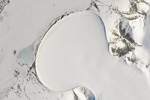
A piedmont-type glacier fans out across a plain in northeast Greenland.
Published Feb 20, 2015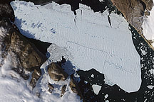
In August 2010, a NASA satellite tracked the chunk of ice as it slowly migrated down the fjord.
Published Aug 22, 2010
The ghostly white shapes northeast and immediately southwest of Wrangel Island are sea ice. Over the course of the satellite record, Arctic sea ice has advanced and retreated past Wrangel Island many times. From 1979 to 2000, the sea ice edge at the end of summer generally fell somewhere in the vicinity of Wrangel Island, but this is not the first summer when the sea ice edge has retreated well north of the island.
Published Aug 29, 2008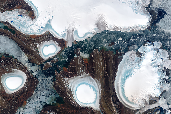
About half of this archipelago in the Russian high Arctic is covered in ice.
Published Oct 1, 2018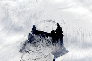
The rift in the glacier is now completely open, and a large iceberg is moving out into Pine Island Bay.
Published Nov 14, 2013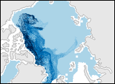
In the Arctic, sea ice extent fluctuates with the seasons. It reaches its peak extent in March, near the end of Northern Hemisphere winter, and its minimum extent in September, at the end of the summer thaw. In September 2007, Arctic sea ice extent was the smallest area on record since satellites began collecting measurements about 30 years ago.
Published Mar 25, 2008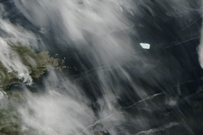
A massive ice island is lingering off the coast of Labrador, Canada, after an 11-month journey from the Petermann Glacier in Greenland.
Published Jul 2, 2011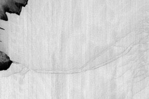
Thermal infrared imagery spots the cracks and a new ice island through the dark of the Antarctic winter night.
Published Jul 28, 2013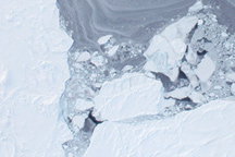
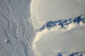
Taken from a low-flying airplane on March 26, 2011, these detailed photos of Arctic sea ice show the richly varied texture in the ice floe.
Published Apr 1, 2011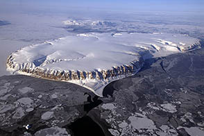
Scientists on NASA’s P-3B research plane get eye-popping views of rarely seen or photographed ice. The latest round of Operation IceBridge flights concluded on May 2, 2013.
Published May 2, 2013
alert message
