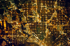
Like most cities in the western United States, the Dallas-Fort Worth area was laid out in a grid pattern.
Published Dec 31, 2012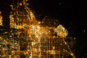
It is the capital of Utah, headquarters of the Church of Jesus Christ of Latter-day Saints, and “the crossroads of the West.”
Published Jan 6, 2014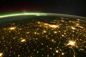
When viewed from the International Space Station, the night skies are illuminated with light from many sources.
Published Oct 24, 2011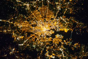
One of the largest seaports on the East Coast, “Charm City” was briefly the capital of the United States.
Published Nov 5, 2012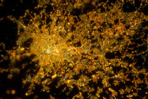
Milan, the largest city in Italy, is one of Europe’s major transportation, industrial, and commercial hubs, and a global center of fashion and culture.
Published Mar 14, 2011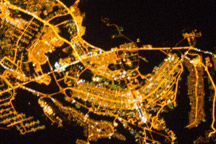
The developed areas of Brasília and its satellite cities are clearly outlined by street grids and highway lights in this astronaut photograph taken from the International Space Station.
Published Jan 31, 2011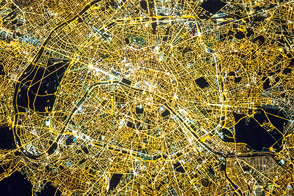
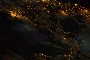
City lights trace the outline of Italy's “boot” and the island of Sicily.
Published Jul 4, 2011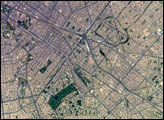
Located on the broad alluvial fan of the Rimac River, Lima is the capital of Peru and the only megacity (7.7 million inhabitants in 2002) located on the western coastline of South America.
Published Apr 18, 2005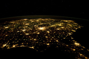
Atlanta, Jacksonville, and Charlotte fill the darkness with light.
Published Feb 13, 2012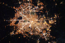
Taken on February 28, 2010, this astronaut photograph shows Houston at night. Different land uses appear at varying levels of brightness, with bright lights in Houston proper, and no lights in undeveloped areas.
Published Mar 22, 2010
The city of Seoul (originally known as Hanyang) has been the capital of Korea for more than 600 years. This astronaut photograph illustrates the Seoul urban area at night. Major roadways and river courses (such as the Han River) are clearly outlined by street lights, while the brightest lights indicate the downtown urban core (center of image) and large industrial complexes. One such complex is located at the far left of the image and occupies an island in the Yellow Sea. Very dark regions in the image are mountains or large bodies of water. Nighttime images have been used extensively in urban climate and urban growth research to map the extent of urban (bright) versus rural (dark) regions.
Published Jan 10, 2005alert message
