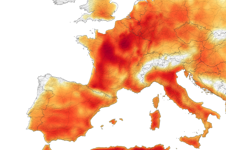
One month after experiencing record-breaking temperatures, Europe again is sweltering under a heatwave. And this one is more intense.
Published Jul 26, 2019Image of the Day Heat Land Human Presence Remote Sensing Temperature Extremes
If you live in the northern hemisphere, the past few weeks have been strange. In places where it should be seasonably hot, it’s just warm. In places where weather is usually mild in the summer, it has been ridiculously hot.
Published Aug 8, 2014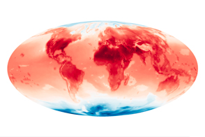
A new data set from the NASA Earth Exchange shows projected changes in temperature in response to different scenarios of increasing carbon dioxide.
Published Jun 12, 2015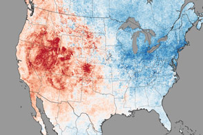
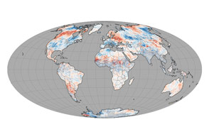
People in eastern North America shivered through February 2015, while those in the western part of the continent experienced unusually warm weather.
Published Mar 10, 2015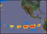

High-pressure ridges over the oceans drive warm-weather systems over the continents.
Published Jul 12, 2015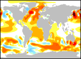
These maps show observed and modeled energy imbalances in the top 750 meters of the world’s oceans from 1993-2003.
Published Apr 29, 2005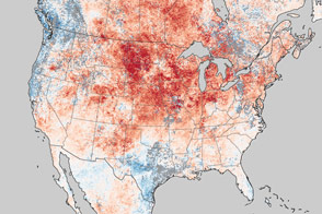
Unseasonably warm temperatures broke records across the United States.
Published Mar 21, 2012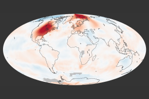
Temperatures were well above the norm for the month, setting records and rising well above the long-term trends.
Published Apr 17, 2012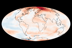
Analysis of global temperatures shows that the year was the 9th hottest in the past 130 years. Nine of the ten warmest years have occurred since 2000.
Published Jan 20, 2012
The Sun heats not only the air around us, but the land we walk on. Scientists are interested in the difference between the two.
Published May 2, 2012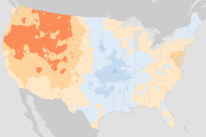
These maps compare January minimum temperatures and July maximum temperatures in the U.S. Climate Normals, a 30-year frame of reference. The new normal reflects a warming world.
Published Jul 6, 2011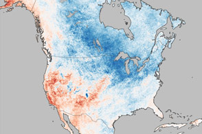
Though the talk in much of the United States was about polar vortices and wicked cold snaps, the wider world was actually warmer than normal.
Published Mar 20, 2014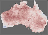
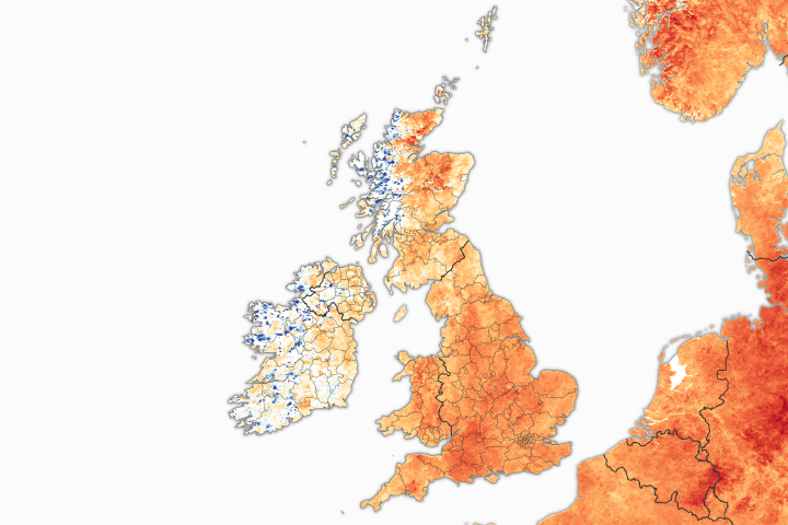
England, Scotland, and Wales all recorded their warmest winter day ever in February 2019.
Published Mar 5, 2019
This comparison shows how a forecast from the high resolution Goddard Earth Observing System Model, Version 5, the world’s highest resolution global climate model, stacks up against GOES satellite images showing actual cloud patterns for February 6, 2010.
Published Jun 9, 2010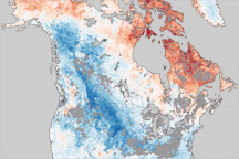
This color-coded map shows temperature anomalies for the United States, Canada, eastern Siberia, and Greenland for January 9 to 16, 2011.
Published Jan 26, 2011alert message
