
In May 2016, the reservoir behind Hoover Dam reached its lowest level since the 1930s.
Published May 27, 2016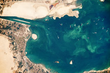
Ships line up to pass each other in the Suez Canal’s Great Bitter Lake in this astronaut photo from October 2, 2009.
Published Oct 26, 2009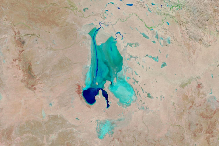
Floodwaters have worked their way through a series of parched channels, watering holes, and lagoons to start filling the iconic Australian lake.
Published May 28, 2019
Ongoing drought and diminished snowpack in the Rockies have combined with increasing demands downstream to cause the great reservoir to drop to historically low levels.
Published Aug 1, 2014
Inle Lake is home to floating tomato farms and booming tourism.
Published Apr 1, 2015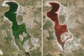
When the water gets saltier in Iran’s largest lake, the microscopic inhabitants can turn the water dark red.
Published Jul 26, 2016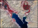
Lake Eyre did something in 2011 that it doesn’t do very often: it took on new water.
Published Dec 19, 2011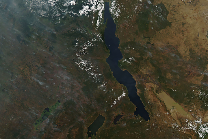
Long and short. Deep and shallow. Salty and fresh. Blue and brown. These are Africa’s Lake Tanganyika and Lake Rukwa.
Published Jun 20, 2019
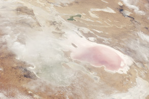
Acquired on April 10, 2010, and and March 7, 2009, these natural-color images show changes in a central Australian saltpan, Lake Frome. In 2010, water has seeped into the salt lake, leaving standing water in some areas and muddying much of the ground surface.
Published Apr 14, 2010
Persistent drought and intensive water use has proven too much for this lake in Chile.
Published Apr 18, 2019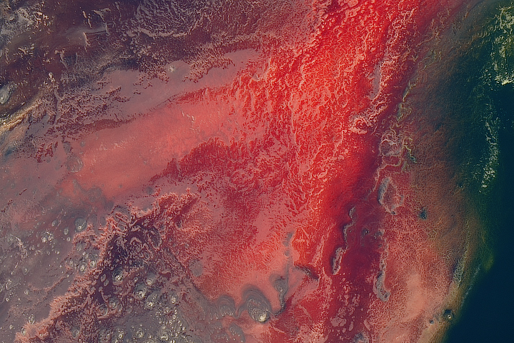
The lake is mostly inhospitable to life, except for a few species adapted to its warm, salty, and alkaline water.
Published May 8, 2017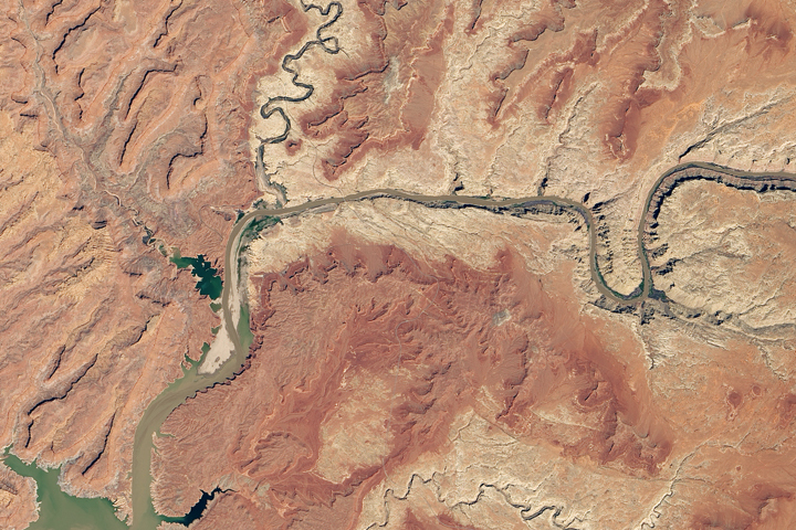
Heavy winter and spring snowfall provided much-needed meltwater, but the effects of long-term drought mean the lake is nowhere near its highs from the 1980s and 90s.
Published Oct 1, 2019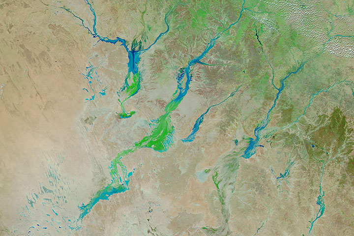
Big rain events in Queensland can alter the landscape for months as water—and then a carpet of vegetation—moves toward Lake Eyre.
Published Apr 3, 2019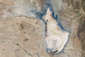
Drought and water-diversion projects have caused Bolivia’s second-largest lake to dry up.
Published Jan 23, 2016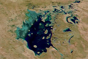
Rains from Tropical Cyclone Rusty raised water levels in Lake Disappointment in early March 2013.
Published Mar 4, 2013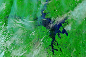
Acquired June 23, 2011, and May 26, 2011, these false-color images show changes in Dongting and Poyang Lakes, comparing drought to flood conditions.
Published Jun 23, 2011
In October 2016, one of America’s largest lakes reached its lowest level on record.
Published Nov 3, 2016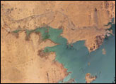
Heavy rains in the source regions of the Nile in the 1990s resulted in record water levels in Lake Nasser. In 1997, Lake Nasser began flooding westward down a spillway into the Toshka depression in southern Egypt, creating four new lakes over the next few years.
Published Jan 2, 2006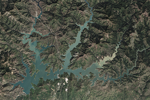
After four years of shrinking due to drought, the largest reservoir in California got a much-needed boost from El Niño-fueled winter precipitation.
Published Apr 7, 2016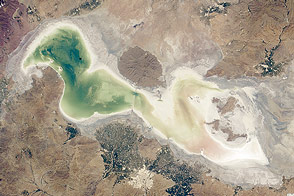
This shallow, saline lake in Iran is one of the largest in the Middle East. But drought and water withdrawals for farming are shrinking it.
Published Aug 4, 2014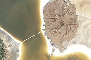
Lake Orumiyeh is one of the world’s great salt lakes, but it is shrinking.
Published Nov 9, 2011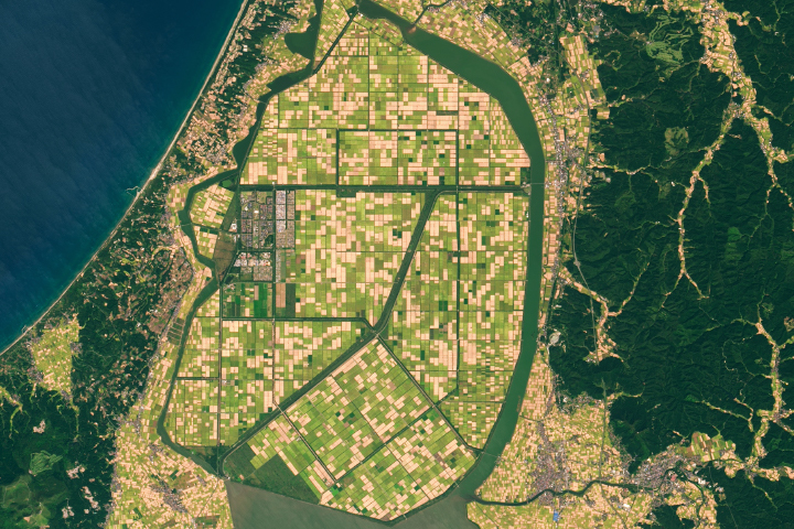
Lake Hachirō in northern Honshu was once Japan’s second largest lake.
Published Dec 1, 2019
Surging with fresh water from heavy winter snow melt, Lake Powell rose significantly in the summer of 2011 after many years of low levels.
Published Aug 12, 2011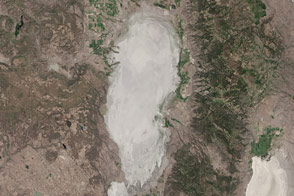
Drought conditions have dried this closed-basin lake straddling the California-Oregon border, but it’s not the first time.
Published Aug 12, 2015
For more than 100 years, groups in the western United States have fought over water. During the 1880s, sheep ranchers and cattle ranchers argued over drinking water for their livestock on the high plains. In 1913, the city of Los Angeles began to draw water away from small agricultural communities in Owen Valley, leaving a dusty dry lake bed. In the late 1950s, construction of the Glen Canyon Dam catalyzed the American environmental movement. Today, farmers are fighting fishermen, environmentalists, and Native American tribes over the water in the Upper Klamath River Basin. The Landsat 7 satellite, launched by NASA and operated by the U.S. Geological Survey, documented an extreme drought in the area along the California/Oregon border in the spring of 2001.
Published Sep 8, 2001alert message
