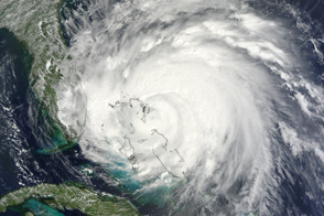
Large and dangerous, Hurricane Irene spans nearly 1,000 kilometers (600 miles) in this photo-like satellite image from August 25.
Published Aug 26, 2011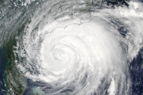
Hurricane Irene extends from central Florida to North Carolina in this image taken at 2:05 Eastern Daylight Time on August 26, 2011.
Published Aug 29, 2011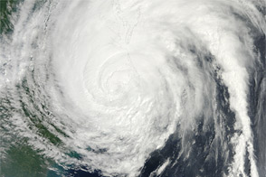
Acquired at 11:35 a.m. EDT on August 27, 2011, this natural-color image shows Hurricane Irene spanning hundreds of kilometers of the U.S. East Coast.
Published Aug 29, 2011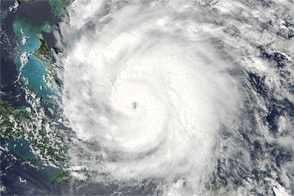
Acquired at 2:15 p.m. EDT on August 24, 2011, this natural-color image shows Hurricane Irene over the Caribbean, en route to the continental United States.
Published Aug 25, 2011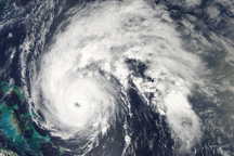
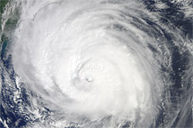
Hurricane Earl is a well-formed storm east of the Bahamas in this true-color image from September 1, 2010.
Published Sep 1, 2010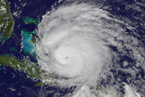
Category 3 Hurricane Irene has a distinct eye in this image taken just before 3 p.m. EDT on August 24, 2011.
Published Aug 24, 2011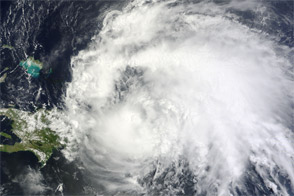
Acquired August 22, 2011, this natural-color image shows Hurricane Irene over Puerto Rico and eastern Hispaniola, potentially en route to the continental United States.
Published Aug 23, 2011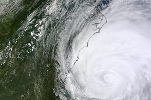
Hurricane Irene swirls off the East Coast of the United States in this image from August 26, 2011.
Published Aug 29, 2011
Satellites and astronauts observed the potent storm as it headed for landfall in the southeastern United States.
Published Sep 12, 2018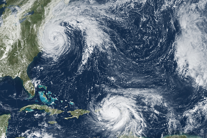
Hurricane Maria brought potent winds and dire warnings to Caribbean islands just two weeks after Irma devastated the region.
Published Sep 20, 2017Image of the Day Atmosphere Land Water Severe Storms Human Presence Remote Sensing
Acquired September 2, 2010, this natural-color image shows Hurricane Earl grazing the North Carolina coast.
Published Sep 3, 2010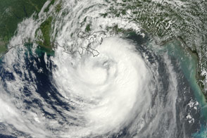
The storm was expected to make landfall on the anniversary of Hurricane Katrina, while marching straight up the Mississippi River basin.
Published Aug 29, 2012