The ASTER instrument on NASA’s Terra satellite captured this false-color image of the Morganza Floodway on May 18, 2011.
Published May 20, 2011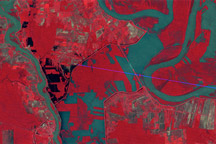
Observations by Landsat 1 from 1973 show the Morganza Floodway after its first and only opening in 57 years.
Published May 14, 2011
Acquired May 11, 2011, and April 21, 2007, these false-color images show the Mississippi River near Natchez, Mississippi. The image from May 2011 shows flooded conditions.
Published May 13, 2011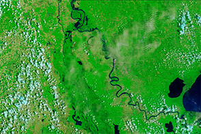
Acquired June 8, 2011, and June 9, 2010, these false-color images compare conditions along the Mississippi and Atchafalaya Rivers in Louisiana.
Published Jun 9, 2011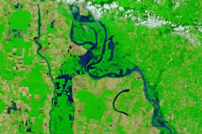
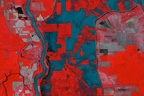
Acquired May 18, 2011, and May 4, 2011, these false-color images show flooded conditions along the Lower Mississippi River, including diverted water entering the Morganza Floodway on May 18.
Published May 18, 2011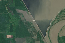
This image from the Advanced Land Imager on NASA's Earth Observing-1 satellite was acquired on May 15, 2011, about 24 hours after the Morganza Spillway was partially opened by the U.S. Army Corps of Engineers to ease flooding along the Mississippi River.
Published May 17, 2011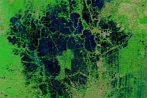
Although improved over the previous several weeks, flood conditions lingered around Ayutthaya and Bangkok in early December 2011.
Published Dec 16, 2011
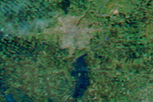
In the span of just five days, the MODIS sensor observed the snow melt and swollen rivers around Winnipeg, in Manitoba, Canada. This image shows extensive flooding on April 15, 2009.
Published Apr 16, 2009alert message
