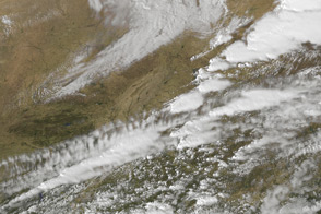
The interaction of warm and wet air from the Gulf of Mexico with the cold and dry jet stream caused an outbreak of severe thunderstorms and tornadoes in the eastern U.S.
Published Mar 6, 2012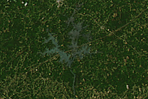
Three tornado tracks reveal the path of storms across Alabama and Georgia in this image from April 28, 2011.
Published Apr 29, 2011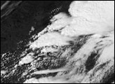
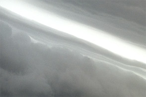
Taken June 29, 2012, this photograph shows a shelf cloud on the leading edge of a violent storm system that blew across the eastern United States.
Published Jul 3, 2012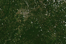
Brown tracks show the paths of tornadoes across and around Tuscaloosa, Alabama, in this image from April 28, 2011.
Published Apr 30, 2011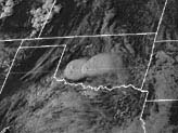
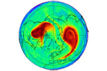
Winter turned fierce in the opening weeks of 2009, and part of the reason for the cold snaps and winter storms came from big changes in the atmosphere about 20 kilometers above the Earth.
Published Feb 7, 2009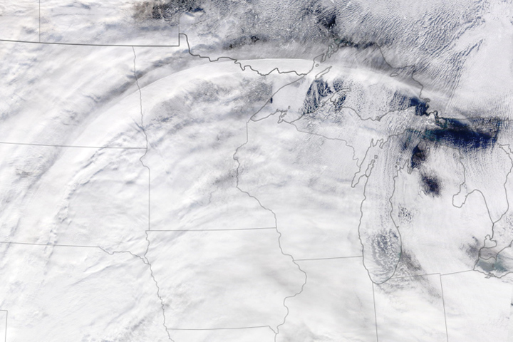
Circulation around a jet streak—a fast-moving pocket of air within the jet stream—formed this distinctive arc of clouds.
Published Dec 4, 2019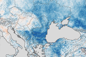
A convoluted jet stream plunged Europe into a severe cold snap in late January and early February 2012.
Published Feb 10, 2012
alert message
