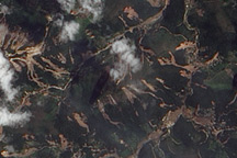
The Advanced Land Imager on EO-1 captured these true-color images of the hills north and west of Teresópolis, Brazil, where mudslides devastated the mountainous region in January 2011.
Published Feb 5, 2011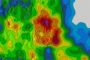
Torrential rain inundates southeastern Brazil, shown in this color-coded rainfall map covering December 30–January 6.
Published Jan 9, 2012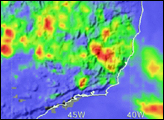
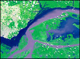
Acquired on December 1, and October 28, 2009, these false-color images show flood waters inundating land around two lagoons: Lagoa dos Patos and Lagoa Mirim.
Published Dec 4, 2009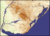
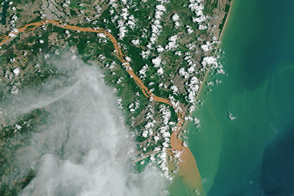
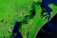
Contaminated water has turned the Rio Doce orange-brown as it flows into the Atlantic Ocean.
Published Dec 3, 2015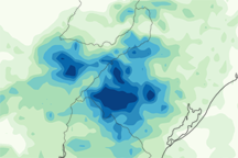
This image shows rainfall estimates for Argentina, Uruguay, and Brazil from November 19–25, 2009. Heaviest rainfall amounts appear in dark blue, and lightest rainfall amounts appear in page green.
Published Dec 7, 2009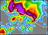
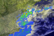
Several days of heavy rain caused widespread flooding in the southeastern Brazilian state of Santa Catarina at the end of November 2008.
Published Nov 26, 2008alert message
