
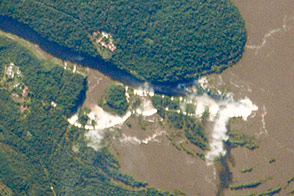
Straddling the border of Argentina and Brazil, the falls are the second most popular tourist attraction in South America.
Published Jun 6, 2016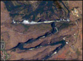
Victoria Falls, on the Zambezi River, is one of the most famous tourist sites in subsaharan Africa. Details of the Falls are visible in this image taken with the 800 mm lens by Astronaut Edward Lu from the Space Station on September 4, 2003. The positions of the falls are controlled by linear fault lines in the underlying basalt rocks. The falls have moved upstream (bottom to top) by intense river erosion, elongating the zig-zag gorge in the process. Prior positions of the strongly linear falls can be detected. The earliest on this cropped view may have been the longest (dashed line). The zig-zags represent subsequent positions, all with the characteristic water-worn lip on the upstream side. The falls will continue to erode northward.
Published Sep 22, 2003
Although not the highest or longest falls in the world, Victoria Falls is the world’s largest sheet of falling water.
Published Sep 1, 2019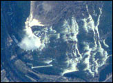
The Niagara River forms the U.S.-Canadian Border and allows Lake Erie to drain northwest into Lake Ontario. Lake Ontario is about 100 m lower than Lake Erie; the Falls and the rapids account for most of the elevation difference. The energy derived from water falling over the falls, with average total flows of 750,000 U.S. gallons (2.8 million liters) per second, fuel multiple power plants on the river. Power Plants downstream from the plant generate 4.4 million kilowatts of power for both Ontario and New York.
Published May 20, 2001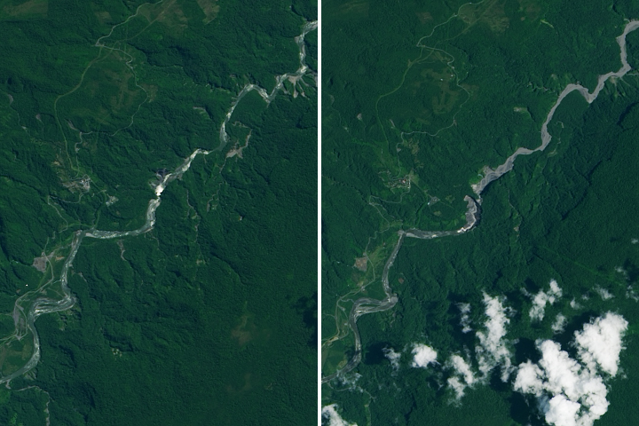
A newly formed sinkhole on the Coca River has diverted water originally headed towards the San Rafael Waterfall.
Published Mar 28, 2020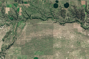
Cliffs, waterfalls, and a wide mix of vegetation line a river that winds through the Great Plains in Nebraska.
Published May 29, 2016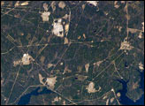
Situated between the South Carolina piedmont and the Atlantic Ocean, the Savannah River Site is an important part of the U.S. Department of Energy’s nuclear program. The southern half of the site (building clusters with reflective white rooftops) is shown in this astronaut photograph. Construction of the site—originally called the Savannah River Plant—began in 1951 for the purpose of generating radioactive materials necessary for nuclear weapons production during the Cold War. A total of five nuclear reactors occupy the central portion of the site and operated throughout 1953–1992. Following the end of the Cold War in 1991, activities at the Savannah River Site are now focused on disposal of nuclear wastes, environmental cleanup of the site itself, and development of advanced remediation technologies.
Published Mar 20, 2006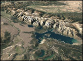
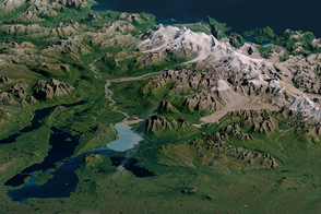
A national park and preserve almost twice as large as Yellowstone provides ample habitat for brown bears and salmon.
Published May 14, 2016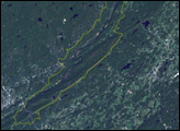
The park runs roughly 40 miles along the Delaware River and the Appalachian Mountains, which are immediately adjacent to the river.
Published Jan 9, 2005
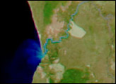
The river supplies Atlanta with its drinking water and a bit of recreational fun.
Published Nov 13, 2016
Trees have long been cherished here for timber and for the colors they bring to “the Fall Rhapsody.”
Published Oct 24, 2020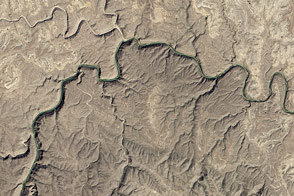
The eastern section of the Rio Grande Wild and Scenic River runs deep through the desert wilderness.
Published Jun 11, 2016
A satellite image offers inky evidence of the organic-rich freshwater that the Suwannee River delivers to the Gulf of Mexico.
Published Oct 27, 2018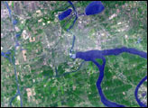
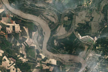
Acquired May 18, 2011, this natural-color image shows flooding along the Mississippi and Yazoo Rivers near Vicksburg, Mississippi.
Published May 19, 2011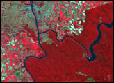
alert message
