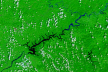
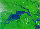
Acquired August 18, 2010, and August 21, 2009, these false-color images show evidence of continued flooding along the China-North Korea border in August 2010.
Published Aug 23, 2010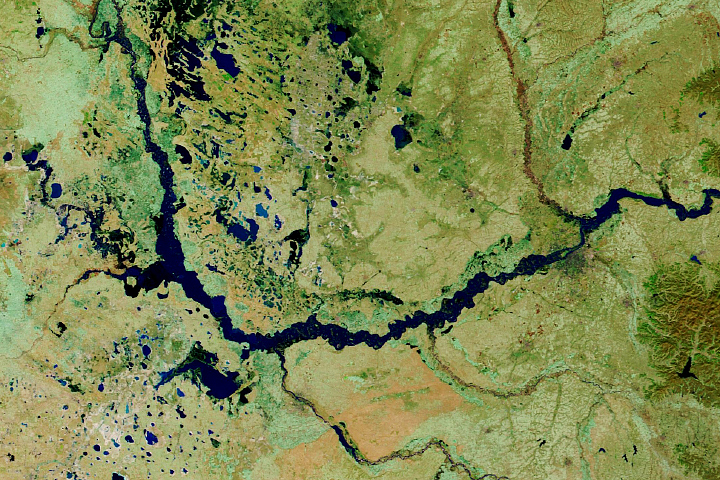
The 2020 monsoon has brought historic amounts of rain to the country.
Published Oct 30, 2020Image of the Day Land Floods Severe Storms Human Presence Remote Sensing
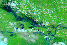
These false-color images show the difference in rivers and floodplains in the Indian state of Bihar in Mid-July and late August 2009.
Published Aug 31, 2009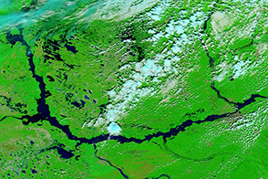
The Songhua River, a tributary of the Amur River, showed significant flooding on August 30 when the Terra satellite acquired this image.
Published Aug 30, 2013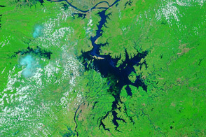
Acquired June 27, 2011, and May 28, 2011, these false-color images compare conditions along the Yangtze River before and after torrential rains.
Published Jun 28, 2011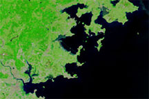
Acquired on May 25, 2010 (top), and May 2, 2010 (bottom), these false-color images show part of Fujian Province before and after heavy rains caused widespread flooding.
Published May 27, 2010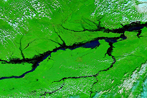
The Amur River and its tributaries continue to swell in the worst floods in a century.
Published Aug 28, 2013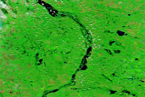
Acquired August 7, 2011, and July 7, 2011, these false-color images compare conditions along the Souris River, which flooded in the summer of 2011.
Published Aug 8, 2011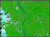
alert message
