The 2020 summer monsoon season has delivered historic amounts of rain to China. Since June, unusually strong, stationary weather systems have produced frequent storms and heavy rainfall in major river basins in central, southwestern, and northeastern China. By September, news outlets reported that the country had experienced at least 21 large scale floods in 2020—the most floods since 1996.
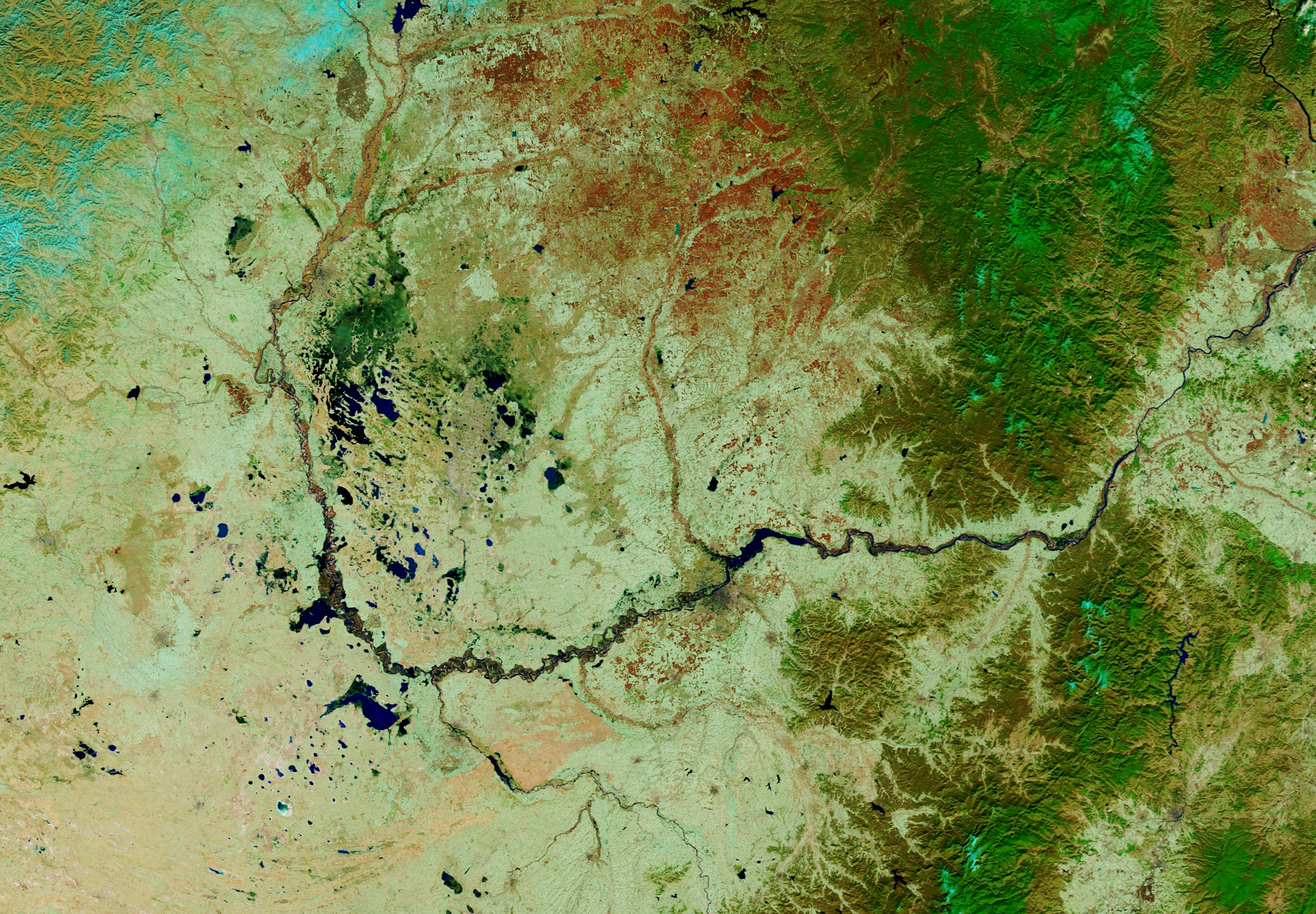
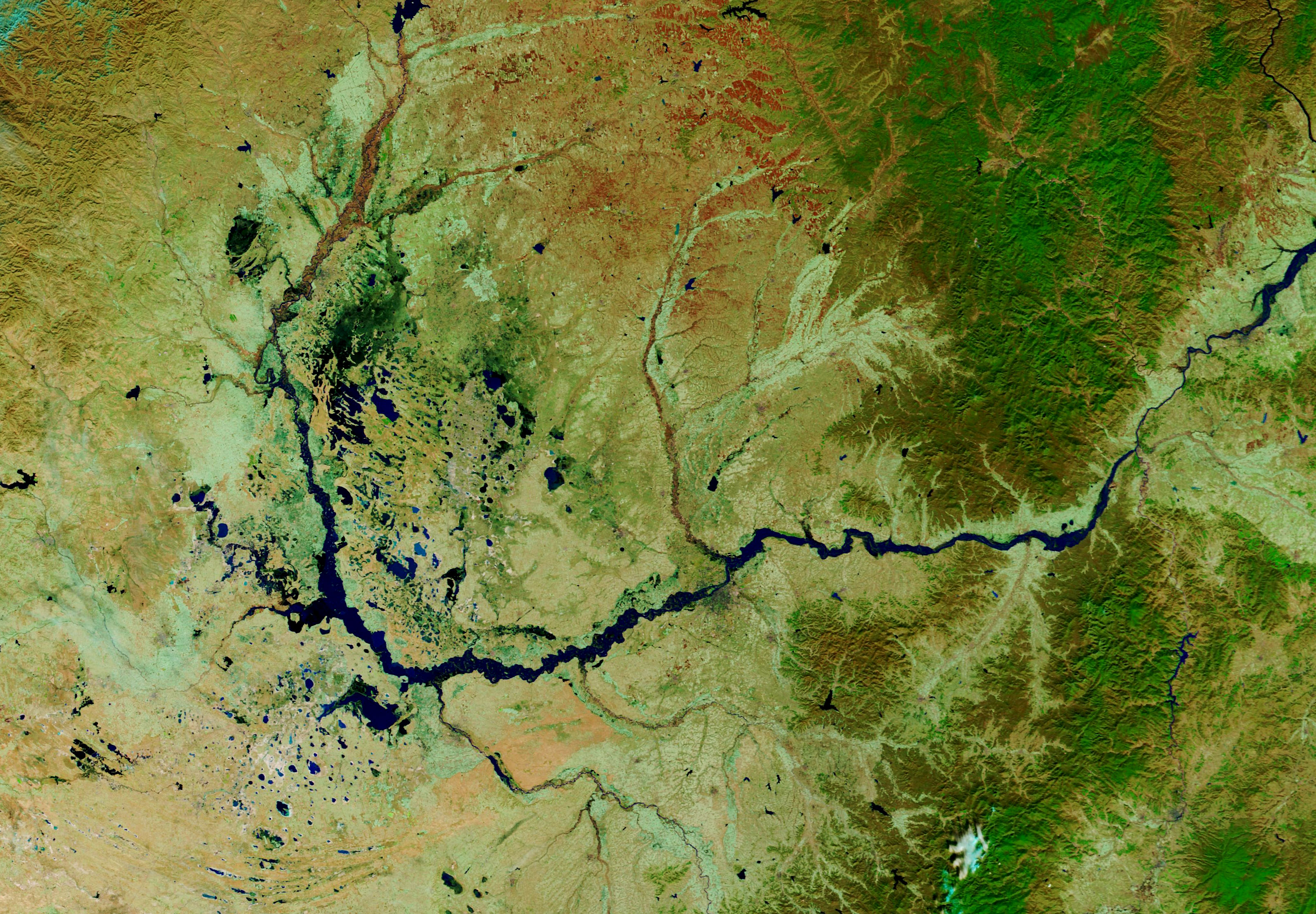
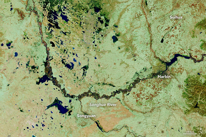
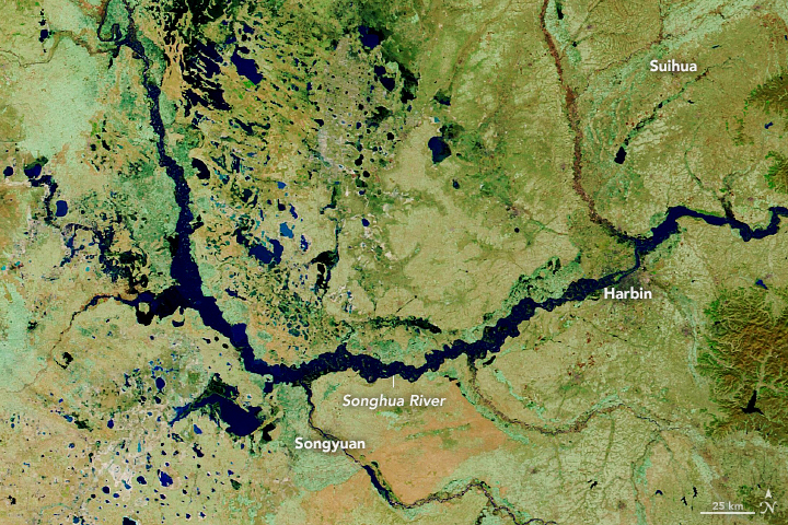
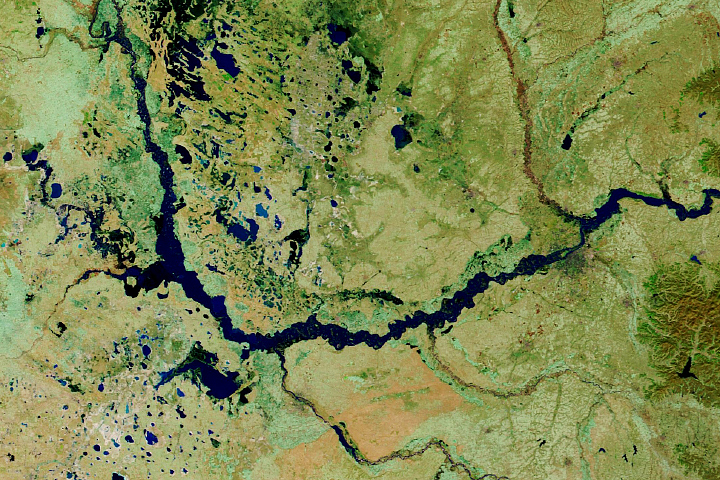
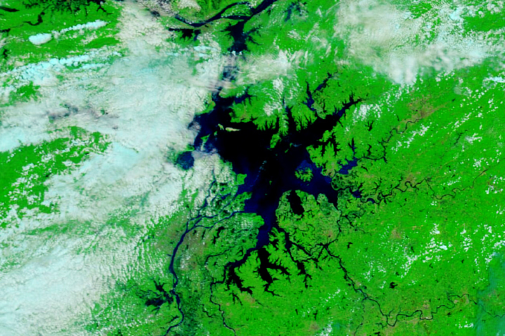
The Moderate Resolution Imaging Spectroradiometer (MODIS) on NASA’s Terra satellite captured these scenes of Songhua River in the Heilongjiang Province of northeast China on November 1, 2019 (left) and October 25, 2020 (right). These false-color images use infrared and visible light (bands 7-2-1) to better distinguish water from land. Vegetation appears green, water appears dark blue, and bare land appears brown.
In September, Typhoon Maysak brought persistent rainfall to the Heilongjiang Province and flooded nearby areas. The rains submerged buildings in Harbin, the provincial capital, and caused rivers to overflow. Water levels on the Songhau River, as well as 14 other rivers, exceeded warning levels, and authorities suspended water travel on the Songhau. Flood waves from the Mudan River also broke a dam located on the outskirts of Harbin.
The monsoon rains also brought major flooding to the Yangtze River and Yellow River basins. The Three Gorges Dam, which spans the Yangtze River, experienced the highest water levels since the dam began holding water. The flooding has destroyed croplands, affected millions of people across the country, and caused hundreds of deaths.
NASA Earth Observatory images by Lauren Dauphin, using MODIS data from NASA EOSDIS/LANCE and GIBS/Worldview. Story by Kasha Patel.
Image of the Day Land Floods Severe Storms Human Presence Remote Sensing
The 2020 monsoon has brought historic amounts of rain to the country.
Image of the Day for October 31, 2020
View more Images of the Day:


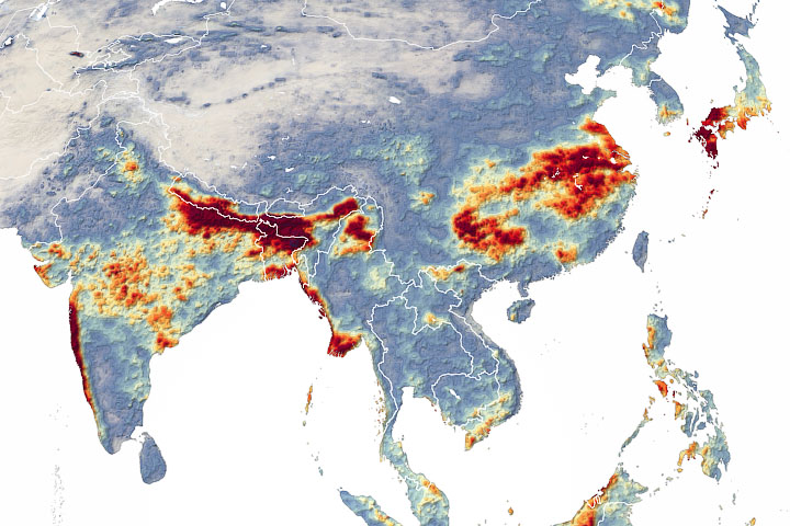
A series of extreme rainfall events led to extensive seasonal flooding in China, India, and Japan.
alert message