In April 2005, the A53a iceberg calved off the Larsen Ice Shelf and began drifting north. Nearly three years later, it began to disintegrate.
Published Mar 20, 2008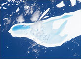
In January, 2004, astronauts on board the International Space Station took this detailed picture of melt water pooled on the surface of iceberg A-39D, a 2-kilometer wide, 11-kilometer long iceberg and drifting near South Georgia Island. The different intensities of blue are interpreted as different water depths. From the orientation of the iceberg, the deepest water (darkest blue) lies at the westernmost end of the iceberg. The water pools have formed from snowmelt—late January is the peak of summer in the Southern Hemisphere.
Published Mar 15, 2004
Fragments of Iceberg B-15J spread across the ocean east-southeast of New Zealand in late December 2011.
Published Dec 29, 2011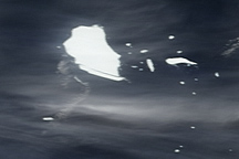
Captured between early November and early December 2009, these true-color images show the changes in iceberg B17-B as it drifts northward from Antarctica toward Australia.
Published Dec 19, 2009
After an 18-year voyage, a fragment of the largest iceberg ever recorded has drifted into dangerously warm territory.
Published Jun 6, 2018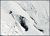
Landsat 8 captures a view of the ice separating from the ice shelf.
Published Nov 15, 2013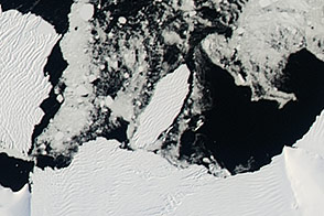
In early 2015, a new berg broke free from the Getz Ice Shelf.
Published Apr 21, 2015
Low stratus clouds frame a huge iceberg drifting in the South Atlantic Ocean.
Published Jun 4, 2016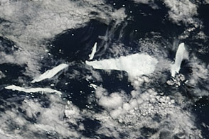
Acquired on November 25, 2011, this natural-color image shows two icebergs in the southern Pacific Ocean: B-15J and newly formed B-15Y.
Published Nov 30, 2011
This image could be a scene out of a spooky movie, but the reality is just as morbid.
Published Oct 31, 2018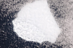
An unnamed berg of unknown origin drifted in the South Atlantic Ocean.
Published Dec 14, 2014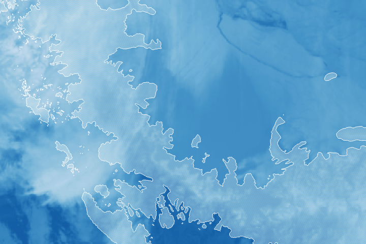
An iceberg about the size of Delaware has split off from the Larsen C ice shelf.
Published Jul 12, 2017Image of the Day Snow and Ice Remote Sensing Sea and Lake Ice
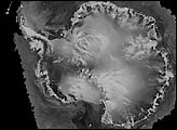
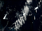
The mega-iceberg A53a (upper image) measured close to 50 kilometers by 22 kilometers, about seven times the area of Manhattan Island, in mid-January 2008 when astronauts took the photographs for this mosaic. The images were acquired from the International Space Station (ISS), located 780 kilometers to the north of the iceberg at an altitude of 341 kilometers; the perspective distorts the oblong shape of the iceberg, making it look squarer than it actually is.
Published Feb 25, 2008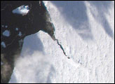
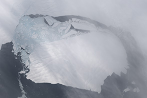
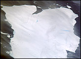
The iceberg A22A was photographed when it was about a third of the distance from South America towards Cape Town, South Africa. A22A is one of the largest icebergs to drift as far north as 50 degrees south latitude, bringing it beneath the daylight path of the International Space Station (ISS). A series of parallel lines can be seen in the lower image. These are probably “hummocks,” dunes of snow that have solidified, and they date back to the time when the iceberg was connected to Antarctica. A developing fracture in the ice can be seen in the lower, detailed view.
Published Jun 18, 2007alert message
