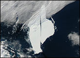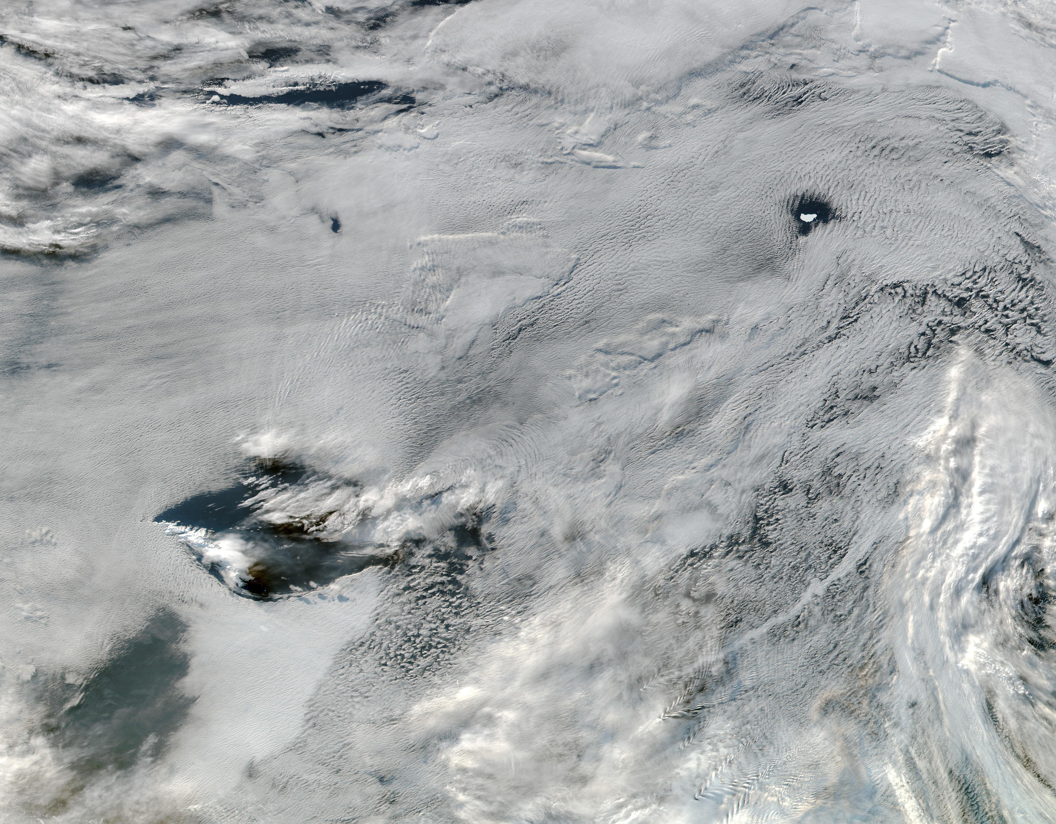
Cloudy skies often obscure satellite views of Earth and can hamper scientific research. But sometimes the sheer beauty and patterns in those clouds makes up for it. That was the case on June 1, 2016, when a satellite captured an image of low stratus clouds framing iceberg A-56 as it drifted in the South Atlantic Ocean.
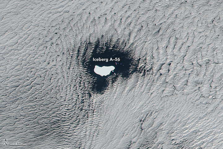
The top image shows a wide view of the area, acquired June 1 with the Visible Infrared Imaging Radiometer Suite (VIIRS) on the Suomi-NPP satellite. The second image shows a detailed view of the top image.
Measurements taken in May 2016 indicate that the iceberg is about 26 kilometers long and 13 kilometers wide (16 by 8 miles), according to the U.S. National Ice Center (USNIC). The iceberg’s dimensions equate to an area about five times the size of Manhattan.
Based on satellite imagery, it is hard to say for sure why the hole formed over the iceberg. On average, icebergs usually move slower than clouds (kilometers per day versus kilometers per hour). “It’s possible that a cloud bank moved into the vicinity of this iceberg and that the relatively unobstructed path of the clouds over the ocean surface was interrupted by the thermal instability created by the iceberg,” explained NASA glaciologist Kelly Brunt.
Steve Palm, a research meteorologist at NASA Goddard, agreed that the iceberg could have disrupted the air flow or modified the atmosphere in such a way to cause the clouds nearby to dissipate. “When an obstacle is big enough, it can divert the low level flow around it,” he said. “This causes divergence of the flow at low levels and a corresponding convergence and sinking motion above and downstream of the obstacle. The sinking motion warms and dries out the air causing a hole in the clouds. It is a common phenomenon often caused by islands.”
Brunt and Palm emphasized that these explanations are based solely on looking at the satellite images. Closer analysis of meteorological data or generated by atmospheric modeling could indicate other causes.
NASA image by Jeff Schmaltz, LANCE/EOSDIS Rapid Response. Caption by Kathryn Hansen.