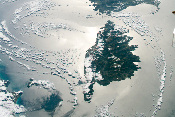
The play of sunlight on water gives definition to the jagged coastlines of Sardinia and Corsica.
Published Jun 14, 2020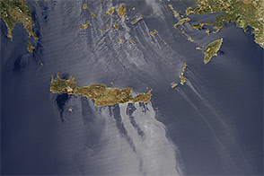
In addition to posing scientific challenges and opportunities, sunglint makes for some spectacular satellite images.
Published Sep 11, 2014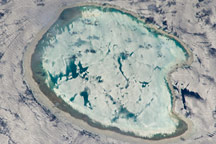
A photograph of an uninhabited atoll in the Indian Ocean has an almost surreal quality due to varying degrees of sunglint.
Published Apr 18, 2011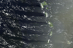
The combination of sunlight, islands, and wind painted this scene on the surface of the Caribbean Sea.
Published Apr 19, 2014
Natural vegetation and irrigated farmland along the Snake River Plain in Idaho use dramatically different amounts of water during the growing season.
Published Jan 26, 2010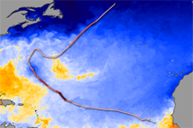
On land, the passage of a severe storm might be marked by fallen trees or swollen streams. In the ocean, a hurricane leaves a swath of cold water in its path. That trail of cold water marks the passage of Hurricane Bertha through the North Atlantic Ocean in this sea surface temperature image.
Published Jul 26, 2008

An arid region grew even drier between 2003 and 2009 due to human consumption of water for drinking and agriculture.
Published Mar 13, 2013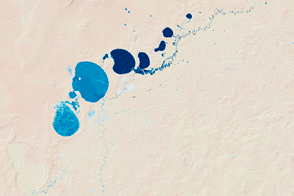
New maps show the fluctuating river and lake levels in the Murray-Darling Basin.
Published Jul 16, 2016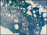
Marsh Island, located along the southwestern coastline of Louisiana, is a remnant of an abandoned lobe of the Mississippi River Delta formed approximately 5,000–7,500 years ago. It is composed primarily of organic-rich muds and brackish marsh vegetation, but some peat (layers of vegetation that have partially decomposed while submerged in water) is also present.
Published Dec 3, 2007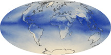
The tiny amount of water vapor in our atmosphere has an outsized influence on the planet as a potent greenhouse gas.
Published Oct 7, 2010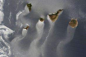
Sunglint reveals the wind and wave patterns in the wake of the Canary Islands.
Published Jun 20, 2013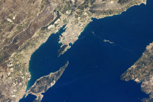
This astronaut photo from April 9, 2009, shows the Dalmatian coastline of the Adriatic Sea around Split, Croatia.
Published May 4, 2009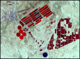
alert message
