The Earth Observatory has published its last Image of the Day on this website. Please join us on our new home at science.nasa.gov/earth/earth-observatory.
The play of light on water can reveal overlooked details and nuances to photographers and artists on Earth. The same thing can happen when looking from space.
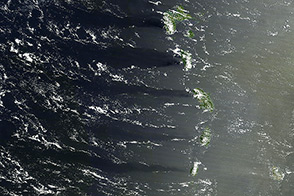
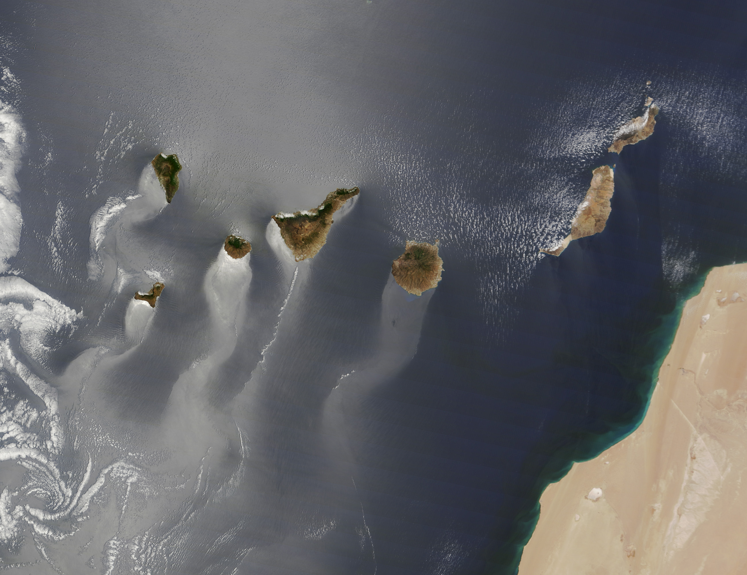
The Moderate Resolution Imaging Spectroradiometer (MODIS) on NASA’s Terra satellite looked down on the Canary Islands on June 15, 2013. The Atlantic Ocean has a silvery or milky color in much of the image, the result of sunglint. Sunlight is being reflected off of the ocean surface directly back at the satellite imager, revealing details about the water surface or circulation that are otherwise invisible.
In the image above, wavy, windsock-like tails stretch to the southwest from each of the islands. The patterns are likely the result of winds roughening or smoothing the water surface in different places. Prevailing winds in the area come from the northeast, and the rocky, volcanic islands create a sort of wind shadow—blocking, slowing, and redirecting the air flow. That wind, or lack of it, piles up waves and choppy water in some places and calms the surface in others, changing how light is reflected. Ocean currents, oil or pollution slicks, and internal waves can also alter surface patterns, though none are necessarily visible in this image.
According to sailors’ guides to the area, winds on the leeward side of the Canary Islands often blow in the opposite direction of the prevailing winds. The play of land and wind can also create a funnel effect, speeding up air flow around the coasts. The swirling nature of the leeward wind field is shown in a long, helical trail of clouds stretching southwest from Tenerife (the second island from the right).
NASA image courtesy Jeff Schmaltz LANCE/EOSDIS MODIS Rapid Response Team, GSFC. Caption by Mike Carlowicz, with assistance from Jeff Schmaltz and Will Stefanov.