
Acquired on August 31, 2010, this image combines a grayscale image of Hurricane Earl with a cloud height profile.
Published Sep 2, 2010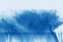
Acquired on August 29, 2010, this image combines a natural-color image of Hurricane Earl with a cloud height profile.
Published Sep 2, 2010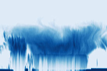
These photo-like and radar images together show the structure of the Category 1 Hurricane Jimena shortly after it make landfall over Baja California on September 2, 2009.
Published Sep 5, 2009
Acquired August 31, 2012, these images show a photo-like view of Tropical Storm Leslie and a sideways view of the storm’s vertical structure.
Published Sep 8, 2012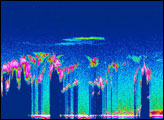

Cloudsat’s radar captured a unique view of Sandy's internal cloud structure.
Published Nov 1, 2012
Super Typhoon Choi-wan is formidable in these images, with tightly spiraling bands of clouds and a distinct eye. A vertical cross section of the storm reveals towering clouds and a clear eye surrounded by dense clouds.
Published Sep 17, 2009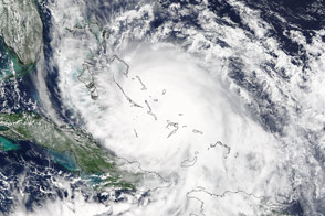
Forecasters expected the third hurricane of the 2015 Atlantic season to follow a trajectory away from the U.S. East Coast, but large amounts of precipitation could not be ruled out.
Published Oct 3, 2015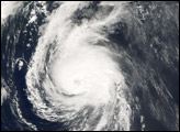
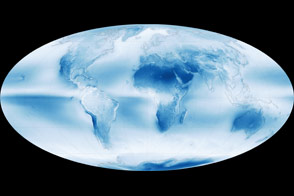
Data collected by a sensor on the Aqua satellite reveals the global distribution of clouds.
Published May 8, 2015
Actinoform clouds pop up off the western coast of Australia.
Published Feb 7, 2020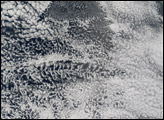
CloudSat captured a vertical slice of the potent storm on July 5.
Published Jul 8, 2014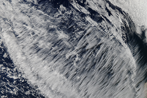
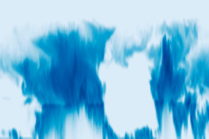
A striking display of high-altitude clouds over the Pacific Ocean are clearly cirrus, but further classification remains elusive.
Published May 29, 2015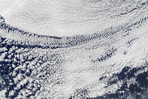
Whether a patch of clouds contains open or closed cells offers a clue about whether rain is falling below.
Published Feb 6, 2016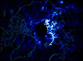
alert message
