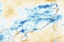
A broad swath of usually intense rainfall covers flooded regions in southern China and northern Vietnam in this rainfall anomaly image.
Published Jul 6, 2009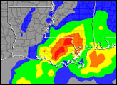

This color-coded map shows approximate rainfall amounts over Japan, where unprecedented floods struck some areas in early July 2012.
Published Jul 13, 2012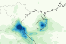
This color-coded image shows rainfall amounts from October 11 to October 17, 2010, over Southeast Asia. The highest rainfall occurs over north-central Vietnam and Hainan.
Published Oct 18, 2010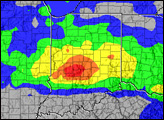
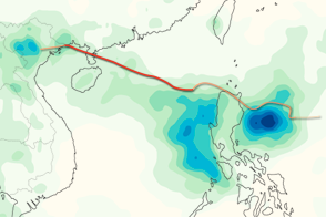
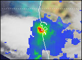
This color-coded image shows rainfall totals and the storm track for Typhoon Kai-tak in August 2012.
Published Aug 20, 2012
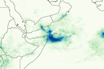
This image shows flood-inducing rainfall over Yemen between October 20 and October 27, 2008.
Published Oct 31, 2008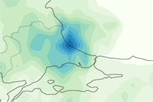
This image shows rainfall estimates for northwestern Turkey and the surrounding region from September 2 to September 9, 2009. The lightest amounts appear in pale green, and the heaviest amounts appear in blue.
Published Sep 11, 2009alert message
