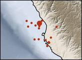
A strong earthquake struck off the Venezuelan coast on September 12, 2009.
Published Sep 15, 2009
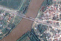
The day after a powerful 7.3-magnitude earthquake shook Honduras, Taiwan’s Formosat-2 satellite captured this detailed, photo-like image showing the collapsed span of the earthquake-damaged Democracy bridge.
Published Jun 3, 2009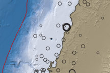
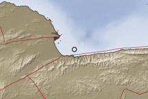
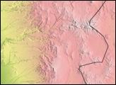
This map of topography and water depth reveals subduction’s influence on the West Coast of South America near the epicenter of the 8.8-magnitude earthquake that struck Chile on February 27, 2010.
Published Mar 2, 2010
alert message
