
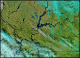
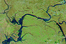
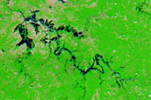
Acquired March 12, 2011, and February 12, 2011, these false-color images show parts of the Ohio and Mississippi Rivers before and after melting snow raised water levels.
Published Mar 14, 2011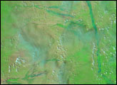
Heavy rainfall and melting snow, plus some ice jams, raised rivers to their highest stages in nearly 20 years.
Published Mar 20, 2015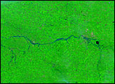
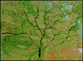
As the ground began to thaw and snow melted, the Dnieper River and its tributaries swelled with spring run-off. According to news reports, the rivers caused some damage as flood waters inundated small cities along their banks. The Moderate Resolution Imaging Spectroradiometer (MODIS) on the Aqua satellite captured this image of the river system on April 4, 2004. Four major rivers are shown running into the Dnieper, the large river that forms the trunk of this tree-like structure. On the far right is the Desna River, with the Seym River branching off of it. The center right branch is formed by the Sozh River and its tributaries. The center left branch is the Dnieper, and running into it from the top left is the Byarezina River. The far left branch is formed by the Prypyats River.
Published Apr 8, 2004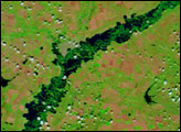
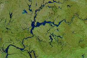
Acquired on May 9, 2010 and April 29, 2010, these false-color images show changes in the Green and Ohio Rivers caused by severe flooding.
Published May 14, 2010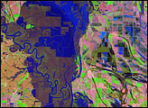
Meandering across a wide, relatively flat plain, the White River of Arkansas is no stranger to flooding. With regularity, spring rains push the river over its banks, inundating the flood-adapted forest that surrounds it. The river reached its fifth highest crest of 33.78 feet on April 19, 2008.
Published Apr 26, 2008alert message
