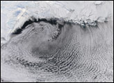
Vortex wind patterns swirling over sea ice in the Bering Sea in mid-January 2006 have created stunning cloud street patterns.
Published Jan 25, 2006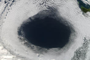
A high near Tasmania left a gaping hole in the clouds.
Published Jun 8, 2012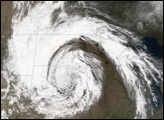
In late April 2006, a spring snow storm hammered the northern Plains of the midwestern United States.
Published Apr 20, 2006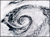
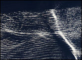
Like a massive, ethereal bird gliding into the Persian Gulf, a large cluster of wave clouds spans the Arabian Sea from Oman to India. This cloud formation is likely an undular bore, which is created in the interaction between the cool, dry air in a low-pressure system with a stable layer of warm, moist air.
Published Jun 9, 2007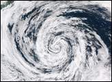
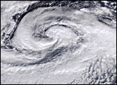
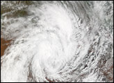
The MODIS instrument aboard NASA’s Aqua satellite captured this true-color image of a large low pressure system spinning in the Gulf of Alaska on August 17, 2004 at 22:45 UTC. This area of the world is famous for strong, persisent low pressure systems because of the persistent flow of semi-permanent pressure systems north (the polar easterlies) and south (the subtropical high) of the area.
Published Aug 19, 2004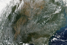
The MODIS instrument on NASA’s Terra satellite captured this view of a high pressure system dominating the eastern half of the United States on September 23, 2010.
Published Sep 28, 2010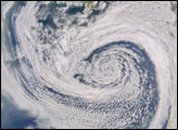
alert message
