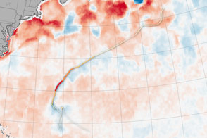
Hurricanes feed off of warm ocean surfaces, consuming the heat and dragging up cool water from below.
Published Oct 19, 2016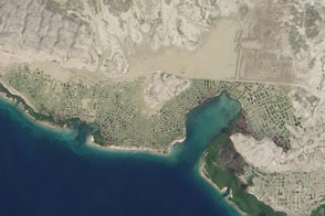
The scope of the destruction on the Caribbean island nation is so dramatic it can be seen from space.
Published Oct 15, 2016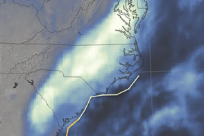
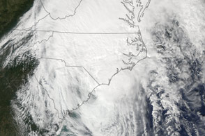
The storm has come and gone, but the effects linger due to exceptional rainfall.
Published Oct 11, 2016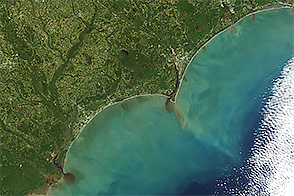
When the Terra satellite captured this image, floodwater was spilling into the Atlantic Ocean.
Published Oct 11, 2016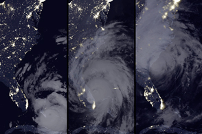
Hurricane Matthew knocked out power for more than one million customers as it grazed the coasts of Florida, Georgia, and South Carolina.
Published Oct 9, 2016Image of the Day Atmosphere Life Severe Storms Human Presence Remote Sensing
The Aqua satellite captured this image of Matthew as the storm churned along the coast of South Carolina.
Published Oct 8, 2016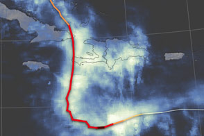
Satellites observed more than 800 millimeters (30 inches) of rain falling in parts of Haiti.
Published Oct 7, 2016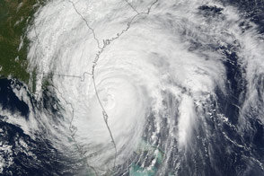
Hurricane Matthew closed in on the Atlantic coast after devastating Haiti earlier this week. The storm’s western eyewall brushed parts of Florida.
Published Oct 7, 2016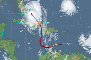
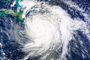
Hurricane Matthew strengthened as it approached the east coast of Florida.
Published Oct 7, 2016Image of the Day Severe Storms Human Presence Remote Sensing
At the time of landfall on October 4, 2016, Hurricane Matthew became the strongest storm to hit Haiti in more than 50 years.
Published Oct 5, 2016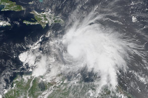
Tropical Storm Matthew gained strength and reached hurricane status on September 29, 2016.
Published Sep 30, 2016