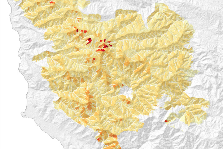
Hillslope-scale erosion maps helped response teams decide how and where to focus recovery efforts following the Soberanes fire in California.
Published Aug 18, 2017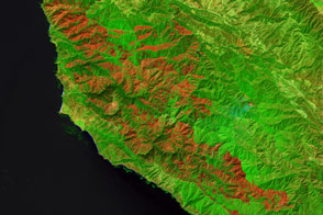
Burning since late July, the Soberanes fire in California has left an extensive mark on the landscape.
Published Sep 21, 2016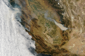
Researchers believe recent fire seasons give a taste of the more active wildfires of the future. Such fires are likely to increase air pollution, even as emissions from industry and motor vehicles have fallen in recent decades.
Published Aug 23, 2016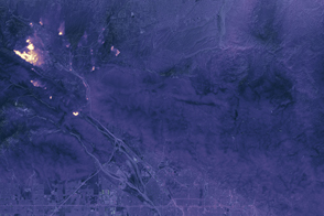
Landsat 8 captured a view in the dark with its Thermal Infrared Sensor.
Published Aug 19, 2016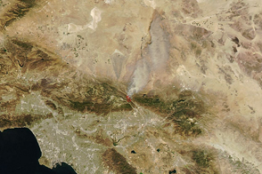
Dry, windy weather intensified the blaze near San Bernardino.
Published Aug 17, 2016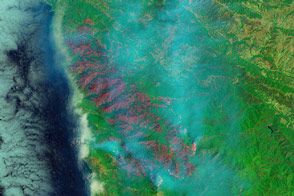
The Soberanes Fire has been burning for 11 days and may continue for weeks.
Published Aug 2, 2016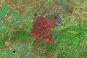
False-color images reveal the hot spots and charred land left behind by the fire.
Published Jul 25, 2016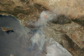
The blaze near Angeles National Forest has led to the evacuation of 10,000 homes.
Published Jul 25, 2016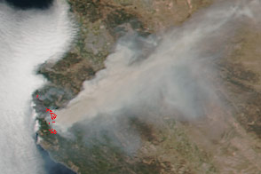
Dry, windy weather promoted the blaze near Big Sur and Monterey.
Published Jul 25, 2016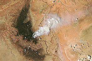
Fire charred forests along the North Rim of the Grand Canyon in July 2016.
Published Jul 20, 2016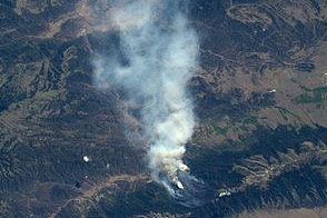
Colorado’s Beaver Creek and Hayden Pass fires continue to blaze.
Published Jul 14, 2016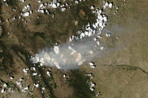
The Hayden Pass Fire has forced the evacuation of more than 100 homes since July 8.
Published Jul 12, 2016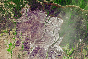
As the Sherpa fire charred thousands of acres west of Santa Barbara in June 2016, NASA’s DC-8 flew over and sampled the fire’s smoke.
Published Jul 2, 2016
An expansive, destructive wildfire north of Los Angeles is visible from space by day and night.
Published Jun 28, 2016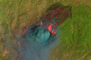
Peer through the billowing plume of smoke to see the hot spots associated with the Cedar fire in eastern Arizona.
Published Jun 23, 2016