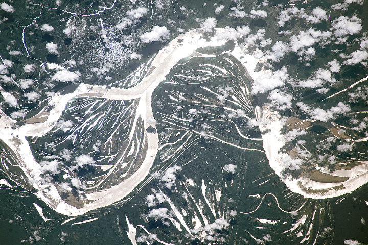
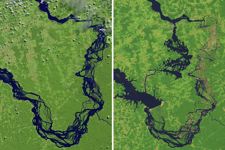
The largest river in the world is full of bends and meanders, a result of the water course snaking back and forth across the landscape over time.
Published Jul 2, 2018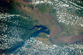
Two rivers meet near the port city of Santarém in the interior of Brazil.
Published Nov 2, 2015
Astronauts use the Sun’s reflection point to reveal features that are otherwise difficult or impossible to see.
Published Dec 1, 2014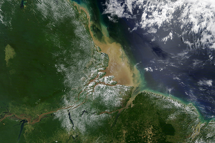
Most of the sediment that flows into the Atlantic Ocean from the mouth of the river comes from thousands of miles upstream.
Published Oct 2, 2020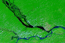
The impact of severe drought on the Negro River, a tributary of the Amazon River, and other rivers in the basin is dramatically evident in this pair of images, which show that every body of water has shrunk in 2010 compared to 2008.
Published Dec 11, 2010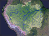
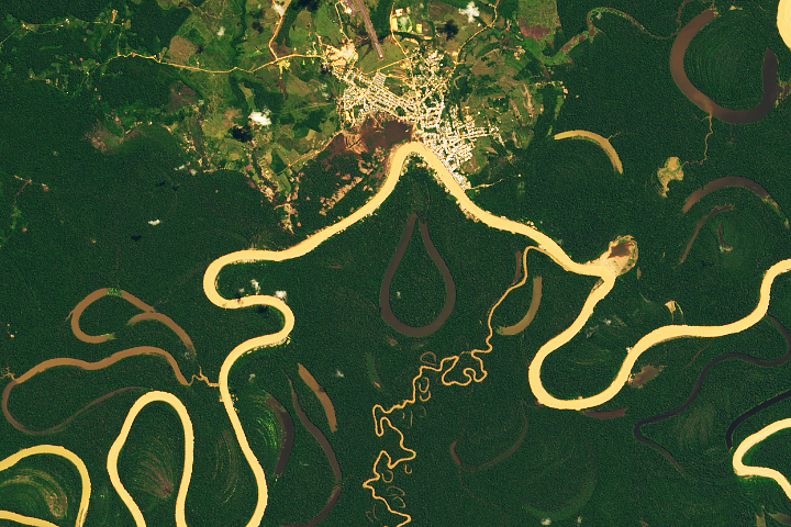
Heavy sediment loads play a role in making it one of the most sinuous rivers in the Amazon Basin.
Published Nov 13, 2019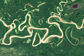
Lowland rivers that carry large volumes of sediment are on the move.
Published Dec 4, 2014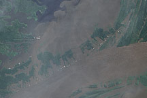
In June 2009, the waters of the Amazon surrounded the villages near its confluence with the Negro River, seeping into the cleared land and filling what had been pale green angular shapes with murky brown water.
Published Jul 17, 2009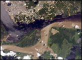
The largest river on the planet, the Amazon, forms from the confluence of the Solimões (the upper Amazon River) and the Negro at the Brazilian city of Manaus in central Amazonas. At the river confluence, the muddy, tan-colored waters of the Solimões meet the “black” water of the Negro River. The unique mixing zone where the waters meet extends downstream through the rainforest for hundreds of kilometers, and is a famous attraction for tourists from all over the world. The tourism contributes to substantial growth in the city of Manaus. Twenty years ago the large park near the city center (center) lay on the eastern outskirts of Manaus.
Published Feb 12, 2005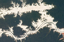
In this astronaut photo, the mirror-like reflection of sunlight off water makes the Trombetas River and Lake Erepecu in the Brazilian Amazon stand out from the deep green forest.
Published Sep 21, 2009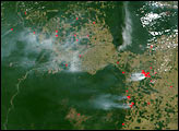
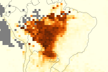
This series of images shows aerosols (particles in the air) over the Amazon each September, the peak of the fire seasons, from 2005 through 2008. The amount of aerosols was unusually high in 2007, and unusually low in 2008.
Published Jun 30, 2009Image of the Day Atmosphere Land Life Human Presence Remote Sensing
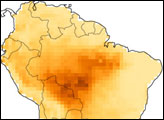
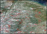
In 2005, at the tail end of a multi-year dry spell, the annual dry season in the Amazon south of the equator ballooned into an unrelenting drought. Agricultural fires, now a fixture on the Amazon frontier from August through mid-October, invaded adjacent forests on a large scale. Thick smoke hung over the forest off and on for months.
Published Mar 12, 2008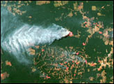
Construction of the Belo Monte Dam has transformed a major tributary of the Amazon River in northern Brazil.
Published Oct 6, 2017