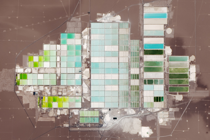
Chile’s Salar de Atacama has the world’s largest reserve of lithium, which is a key ingredient in rechargeable batteries.
Published Feb 9, 2019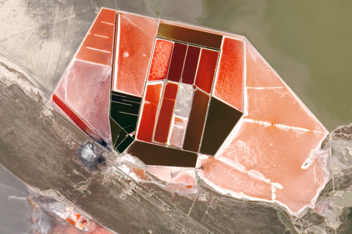
Makgadikgadi Pan is one of the largest salt flats in the world.
Published Jul 1, 2019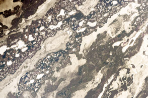
Hundreds of lakes and ponds dot this inland delta in Argentina.
Published Dec 5, 2016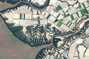
Aquaculture along the coast of the Gulf of Fonseca shows the delicate balance between coastal development and conservation.
Published Jun 15, 2012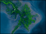
Time, weather, and human intervention have all shaped the Mississippi Delta in Louisiana, a giant bird’s foot shape protruding into the Gulf of Mexico. The Mississippi River deposits sediment into the ocean, and over 25 years, NASA Landsat satellites observed changes in the delta’s shape.
Published Oct 7, 2007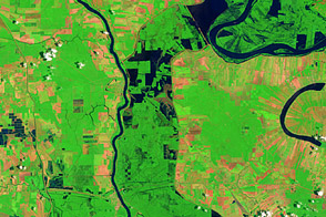
These false-color images compare conditions along the Mississippi River and Atchafalaya Basin in June 2011, during heavy flooding, and three years earlier.
Published Jun 13, 2011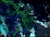
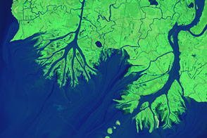
While most of the Mississippi River’s delta plain is losing ground, new land is forming at the mouths of the Wax Lake Outlet and the Atchafalaya River.
Published Feb 12, 2015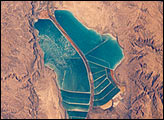
The complex of Jordanian salt evaporation ponds at the southern end of the Dead Sea has expanded significantly over the past dozen years. The western margin of the salt ponds marks the Jordan-Israel border. In August 1989, when the crew of Space Shuttle mission STS-28 photographed the region, the northern extension did not exist and the large polygonal ponds in the northwestern and northeastern sectors had not been subdivided. In the view taken by the STS-102 crew in March 2001, one can see that there has also been expansion at the southeastern end, and that levees now segment the northeastern wedge into four ponds.
Published May 13, 2001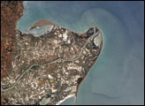
The Ebro River Delta, located along the eastern coast of Spain, is one of the largest wetland areas in the western Mediterranean region.
Published Jul 26, 2004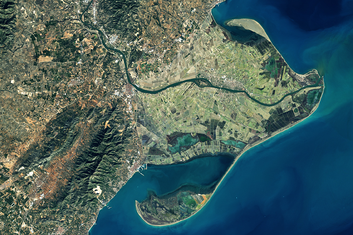
Spain's Ebro Delta has recently experienced tremendous shape-shifting.
Published Mar 13, 2018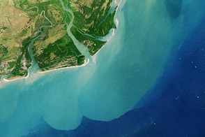
One of Africa’s largest river systems reaches the Indian Ocean with less water and sediment today than in the past.
Published Dec 12, 2013
These false-color images compare conditions along the Mississippi and Yazoo Rivers around Vicksburg in June 2011, during heavy flooding, and three years earlier.
Published Jun 14, 2011