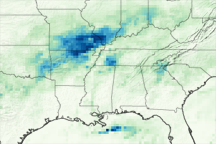
A slow-moving weather system brought a deluge to the U.S. South, flooding communities in multiple states.
Published Mar 16, 2016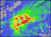
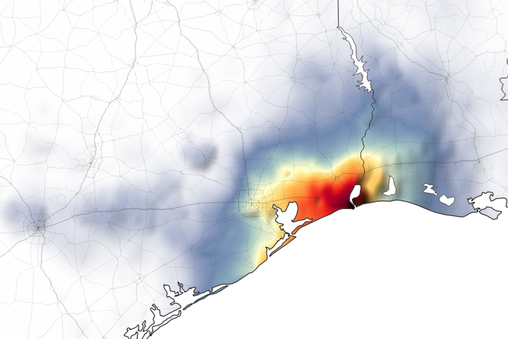
Parts of Houston and Beaumont are underwater after the remnants of Tropical Storm Imelda moved through the area.
Published Sep 20, 2019Image of the Day Land Water Floods Severe Storms Human Presence Remote Sensing
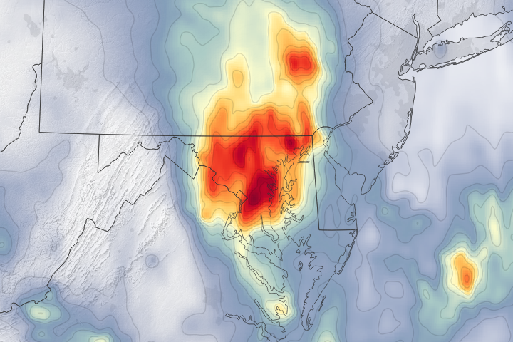
A dip in the jet stream pulled moist, tropical air from the Caribbean to the Eastern Seaboard and triggered several days of intense rains.
Published Jul 25, 2018Image of the Day Water Floods Severe Storms Human Presence Remote Sensing
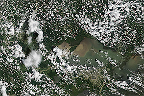
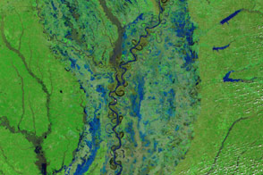
After a slow-moving storm system brought severe flooding to southern Louisiana, sediment poured into Lake Pontchartrain.
Published Aug 18, 2016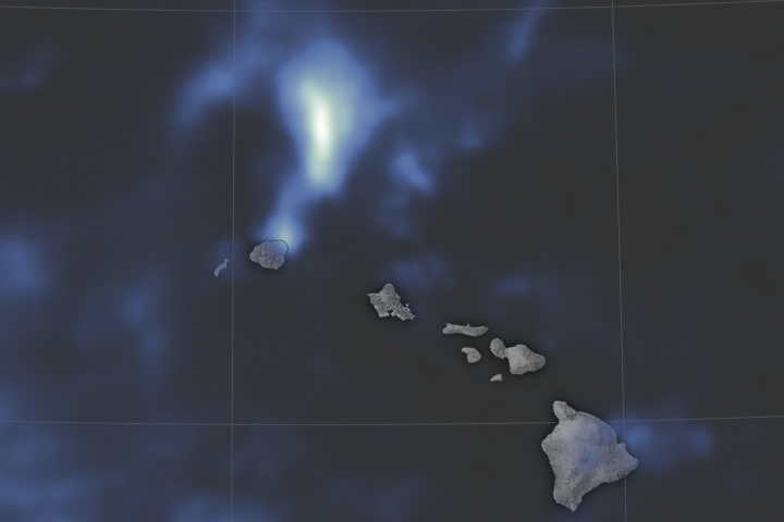
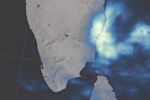
Torrential flooding on the northern shore of Kauai may have set a national record for the most rainfall ever in a 24-hour period.
Published May 2, 2018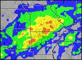
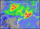
An early spring storm system advanced out of the Southern Plains in mid-March 2008, causing widespread flooding. Strong southerly winds developed ahead of an area of low pressure located over the Southern High Plains and drew moisture up from the Gulf of Mexico across Texas and Louisiana. This warm, moist air collided with a frontal boundary, producing repeated bouts of thunderstorms and heavy rain from central Texas through Oklahoma and into Kansas and Missouri.
Published Mar 21, 2008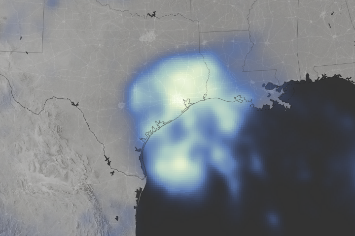
Space-based measurements show regions where Harvey delivered unprecedented rainfall.
Published Aug 30, 2017Image of the Day Land Water Severe Storms Human Presence Remote Sensing
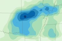
This map depicts rainfall for the Midwestern U.S. from April 19 to 25, 2011, when severe rains added to spring melt to bring dozens of rivers above flood stage.
Published Apr 27, 2011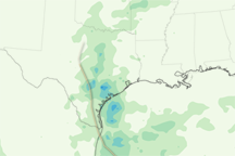
Tropical Hermine’s track inland is defined by a trail of heavy rain in this rainfall map from September 2-8, 2010.
Published Sep 11, 2010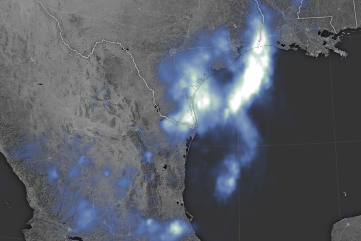
A tropical system dumps nearly a foot of water over many parts of southeastern Texas.
Published Jun 22, 2018Image of the Day Atmosphere Land Water Floods Human Presence Remote Sensing
NASA’s IMERG team observes the deluge over the city of Chennai and the state of Tamil Nadu.
Published Dec 9, 2015
Record rainfall in the Houston area led to severe flooding.
Published Apr 21, 2016