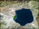
The Uvs Nuur Basin sits on the northern edge of the Central Asian steppes, bounded on all sides by mountains. Though largely arid, the basin is dotted with water. A large salt lake, the Uvs Nuur Lake, sits at the center of the basin, and several smaller lakes are scattered across the 600 kilometers east to west and 120 kilometers north to south that make up the basin.
Published Oct 11, 2007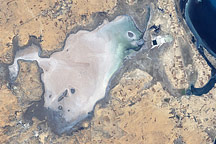
Along Tunisia’s southeastern coast is a flat plain of about 150 square kilometers (58 square miles) that lies below sea level. Known as Sebkhat El Melah (or Sebkha El Melah), it is in an evaporite basin.
Published Dec 7, 2008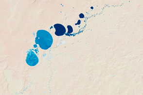
New maps show the fluctuating river and lake levels in the Murray-Darling Basin.
Published Jul 16, 2016
Water from the Kaidu River made it possible to turn part of the Taklamakan Desert into an oasis for agriculture, but it has also disturbed the water table.
Published Aug 18, 2012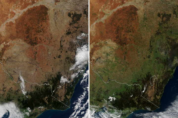
After two years of severe drought, abundant rain finally fell over the Australian state and turned the landscape green.
Published Jun 22, 2020
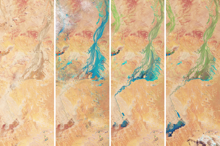
Flood water from northern Queensland drained toward a large basin in Australia’s interior—painting the desert landscape green.
Published May 4, 2018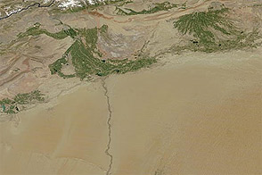
Acquired January 26, 2011, and August 6, 2011, these images compare conditions in China’s Tarim Basin in winter and summer.
Published Aug 10, 2011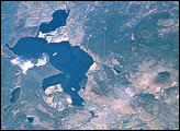
The Klamath Basin, on the California-Oregon border, had been in the news because of water shortages due to the drought in the United States’ Pacific Northwest. Diverse interest groups have come into conflict over the limited availability of Klamath Project water. In order to protect endangered Sucker Fish and threatened Coho Salmon in Upper Klamath Lake, the U.S. Bureau of Reclamation cut off the flow of irrigation water to farmers in the project in April 2001.
Published Aug 19, 2001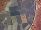
Sections of Australia have been experiencing their worst drought in 100 years. Astronauts aboard the International Space Station documented conditions in Australia in 2002, including these images of Lake Tandou in the Menindee Lake system along the Darling River. The Menindee Lakes are part of an innovative water conservation project. This lakebed is protected from flooding and is used for agriculture—primarily cotton, sunflower and grains. It is one of several interconnected lakes that sit along the lower Darling River like a string of pearls. Other lakes function as water capture reservoirs to support controlled water flow for environmental and agricultural needs down river, and to provide flood mitigation.
Published Dec 1, 2002
Long, parallel dunes cross borders in one of Australia’s driest deserts.
Published Oct 16, 2015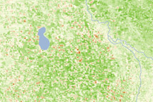
This pair of images shows vegetation conditions in southeastern Australia&rsquos; Wheatbelt in 2005, the last year this decade with favorable growing conditions, and 2009, at the end of three consecutive years of drought.
Published Dec 12, 2009
Using Landsat to track patterns in irrigation may help water managers sketch out a more sustainable future for the Ogallala Aquifer in the central United States.
Published Jul 9, 2018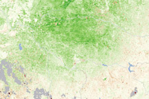
This vegetation map reveals that plants in southeastern Australia’s Wheatbelt were flourishing under abundant spring rains.
Published Dec 23, 2010