In February 2013, a winter storm brought more than a foot of snow to many towns and cities across the central United States.
Published Feb 22, 2013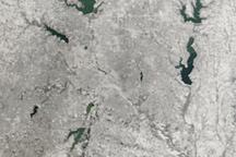
Clear skies allowed the MODIS instrument on NASA’s Terra satellite to capture this view of snow over Dallas, Texas, on February 6, 2011, as the city hosted the Super Bowl.
Published Feb 8, 2011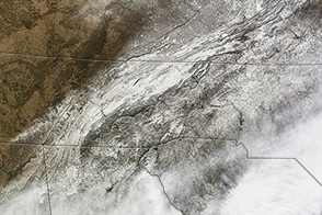
In January 2014, a large storm dropped snow and ice on a part of the United States unaccustomed to wintery weather.
Published Jan 31, 2014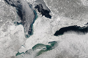
Acquired February 9, 2013, this image shows a blanket of snow left by a nor’easter.
Published Feb 11, 2013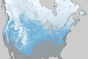
What a difference one year has made in the snow cover over North America.
Published Mar 30, 2012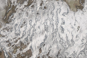
Acquired December 19, 2012, this natural-color image shows snow cover stretching across multiple states in the western United States.
Published Dec 21, 2012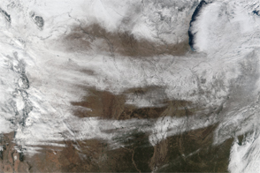
Unusually cold weather in the U.S. delayed flights and slicked roads.
Published Jan 9, 2017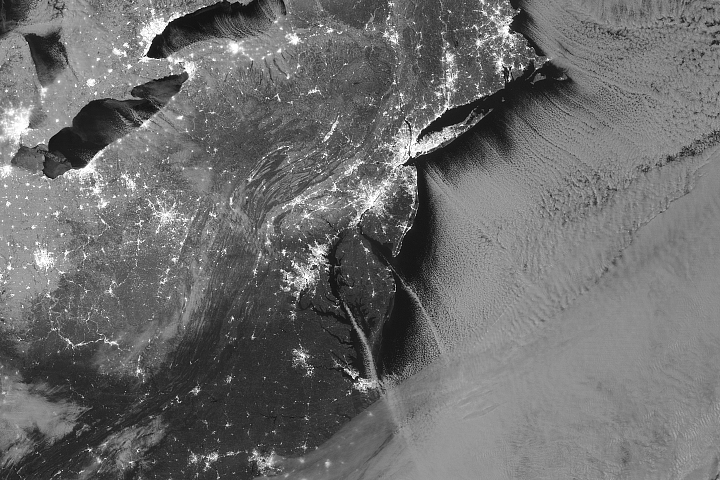
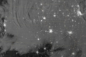
City lights shone brightly in the United States as revelers welcomed the new year.
Published Jan 2, 2018
Snow covers the ground in a solid swath from eastern Arizona to the edge of a massive winter storm in Indiana and Michigan in these images from February 2, 2011.
Published Feb 2, 2011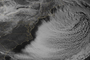
The snowpack near Boston is greater than in all but two reported locations in Alaska.
Published Feb 18, 2015
This satellite map of snow cover shows that every state in the contiguous U.S., except for Florida, received snow in January 2011.
Published Feb 25, 2011
The waxing gibbous Moon and the snow and ice on the mountains and lakes give the landscape extra visual definition.
Published Feb 5, 2020Image of the Day Atmosphere Land Unique Imagery Remote Sensing
Snow cover sprawled across the northeastern United States in early March 2013, in the wake of a winter storm.
Published Mar 12, 2013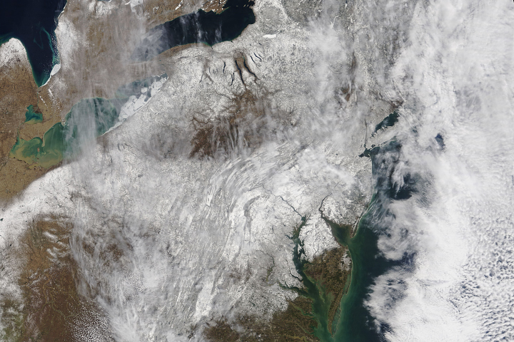
A blanket of snow imparted a wintery appearance to the eastern United States for the first few days of spring 2018.
Published Mar 23, 2018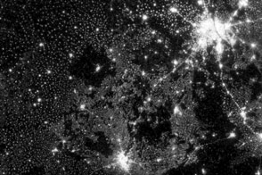
New images from Suomi NPP are an order of magnitude better than previous satellite views of city lights.
Published Dec 14, 2012Image of the Day Land Fires Unique Imagery Human Presence Remote Sensing
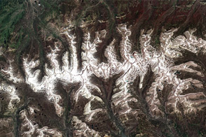
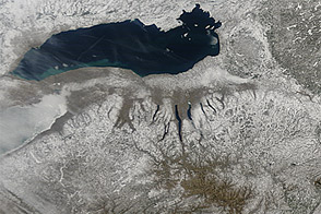
A cold spring and unusually snowy winter led to this uncommon view of winter snow on Utah’s Uinta Mountains in July.
Published Jul 22, 2011