
Colorful, mineral-rich salt flats are nestled between the Promontory Mountains and the Great Salt Lake.
Published Oct 4, 2020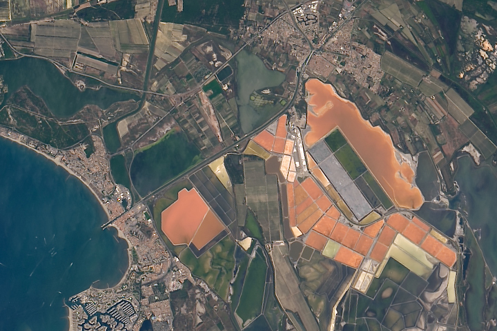
The salt produced from tidal marshes in southern France is the product of ideal climate conditions and careful management.
Published Apr 4, 2019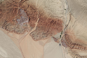
In this active tectonic environment, salt squeezes through faults in the rock until it reaches the surface and flows like a glacier.
Published Oct 25, 2015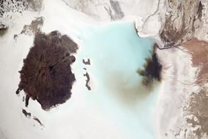
The colorful salt flat is a product of mineral-rich waters and a dry, flat landscape.
Published Oct 8, 2012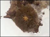
The largest salar (salt flat) in the world, Salar de Uyuni, is located within the Altiplano of Bolivia in South America. This astronaut photograph features the northern end of the salar and the dormant volcano Mount Tunupa (image center). This mountain is high enough to support a summit glacier, and enough rain falls on the windward slopes to provide water for small communities along the base. The dark volcanic rocks comprising Mt. Tunupa are in sharp contrast with the white, mineral-crusted surface of the salar. The major minerals are halite (common table salt) and gypsum (a common component of drywall).
Published Dec 12, 2005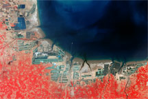
China’s Bo Hai coast is one example of the rapid expansion of aquaculture in the late twentieth century.
Published Feb 8, 2009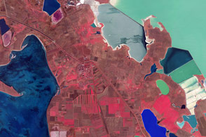
False-color satellite images offer a new perspective on familiar features.
Published Apr 16, 2016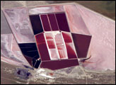
This detailed astronaut photograph shows the salt ponds of one of Africa’s major producers of soda ash (sodium carbonate) and salt. Soda ash is used for making glass, in metallurgy, in the detergent industry, and in chemical manufacture. The image shows a small part of the great salt flats of central Botswana known as the Makgadikgadi Salt Pans.
Published May 13, 2007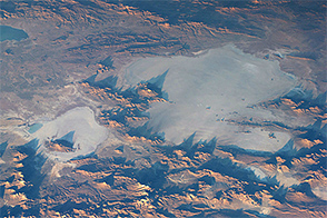
The evaporation of several prehistoric lakes contributed to the formation of Salar de Uyuni, the world’s largest salt flat.
Published Dec 9, 2014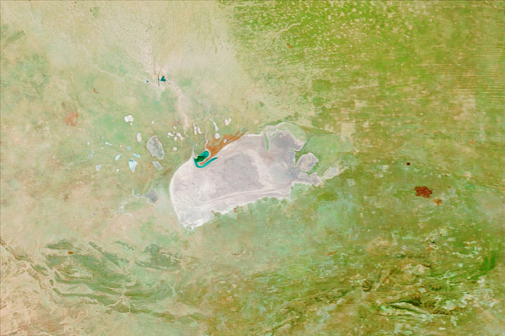
Repeated pooling and evaporation of water built this expansive salt pan in northern Namibia.
Published Sep 14, 2020
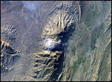
The Zagros Mountains in southwestern Iran present an impressive landscape of long linear ridges and valleys. Formed by collision of the Eurasian and Arabian tectonic plates, the ridges and valleys extend hundreds of kilometers. Stresses induced in the Earth’s crust by the collision caused extensive folding of the preexisting layered sedimentary rocks. Subsequent erosion removed softer rocks, such as mudstone and siltstone while leaving harder rocks, such as limestone and dolomite. This differential erosion formed the linear ridges of the Zagros Mountains. This astronaut photograph of the southwestern edge of the Zagros mountain belt includes another common feature of the region—a salt dome (Kuh-e-Namak or “mountain of salt” in Farsi).
Published Apr 17, 2006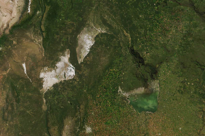
Sometimes the slow grind of plate tectonics can determine where and when lakes exist.
Published Apr 24, 2019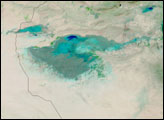
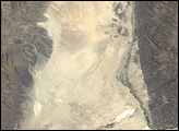
The rocks of Dasht-e Kavir tell tales of a much wetter environment millions of years ago.
Published Feb 17, 2013