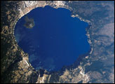
Crater Lake is formed from the caldera of Mount Mazama. Part of the Cascades volcanic chain, Mount Mazama sits between the Three Sisters volcanoes to the north and Mount Shasta to the south. The catastrophic eruption of Mount Mazama that occurred approximately 7,700 years ago destroyed the volcano while simultaneously forming the basin for Crater Lake. Eruptive activity continued in the region for perhaps a few hundred years after the major eruption. Evidence of this activity lingers in volcanic rocks, lava flows, and domes beneath the lake surface; the small cone of Wizard Island is the only visible portion of these younger rocks. Although considered a dormant volcano, Crater Lake is part of the United States Geological Survey Cascades Volcano Observatory seismic monitoring network.
Published Sep 18, 2006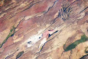
It is one of the great tectonic features of Africa—caused by fracturing of the Earth’s crust—and includes the classical geologic structures associated with a rift valley.
Published Apr 2, 2012
The landscape of the Afar region in northern Ethiopia results from tectonic forces working deep below the surface, both splitting Africa apart and producing volcanic eruptions. Lava from a November 2008 eruption at the Erta Ale Range remained visible months later.
Published Feb 4, 2009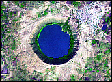
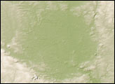
India’s Lonar Crater began causing confusion soon after it was identified. Lonar Crater sits inside the Deccan Plateau—a massive plain of volcanic basalt rock leftover from eruptions some 65 million years ago. Its location in this basalt field suggested to some geologists that it was a volcanic crater. Today, however, Lonar Crater is understood to result from a meteorite impact that occurred between 35,000 and 50,000 years ago.
Published Apr 13, 2008
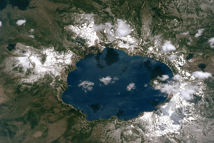
The deepest lake in the United States is a haven for fishermen.
Published Jul 31, 2017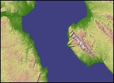
Germany’s Ries Crater (or Nördlinger Ries) is not easily discerned in space-based images. The crater’s existence was probably just as subtle to the medieval Europeans who established a settlement inside it and unknowingly matched their 1-kilometer- (0.6-mile-) wide city to the likely diameter of the meteorite that formed the crater.
Published Mar 9, 2008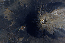
The volcano was almost continuously active from the 1500s until 1760.
Published Jun 17, 2009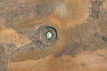
Wolfe Creek Crater is the second largest crater in the world from which meteorite fragments have been collected. Because of its excellent preservation, the crater clearly shows the classic features that result from a large meteorite striking the Earth.
Published Feb 24, 2008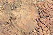
Acquired April 30, 2010, this natural-color image shows Goat Paddock Crater in northwestern Australia. The slightly elliptical crater spans roughly 5 kilometers.
Published May 23, 2010