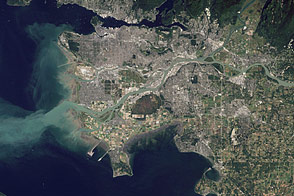
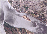
Flowing past the city of Vancouver, the Fraser River delivers a thick plume of sediment to the Strait of Georgia.
Published Mar 14, 2012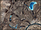
This false-color image from April 1, 2002, shows numerous braided channels and oxbow lakes along the Songhua River in northeastern China, just upstream of the city of Harbin.
Published Dec 27, 2005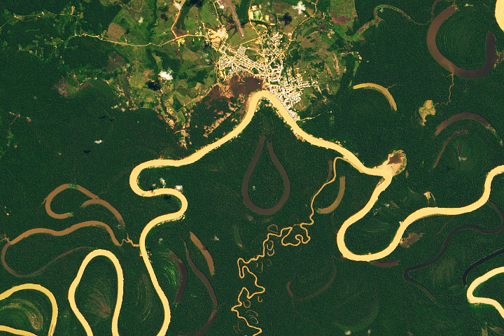
Heavy sediment loads play a role in making it one of the most sinuous rivers in the Amazon Basin.
Published Nov 13, 2019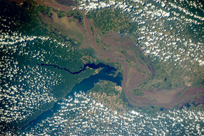
Two rivers meet near the port city of Santarém in the interior of Brazil.
Published Nov 2, 2015
A satellite image offers inky evidence of the organic-rich freshwater that the Suwannee River delivers to the Gulf of Mexico.
Published Oct 27, 2018
Buenos Aires, the largest city in Argentina, sits near the outflow of the second largest river in South America.
Published Jun 1, 2015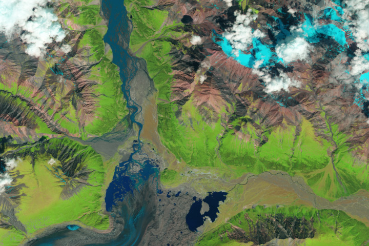
The Kaskawulsh River stole most of the water from the Slims River, dramatically reshaping the region’s drainage.
Published Apr 28, 2017
Trees have long been cherished here for timber and for the colors they bring to “the Fall Rhapsody.”
Published Oct 24, 2020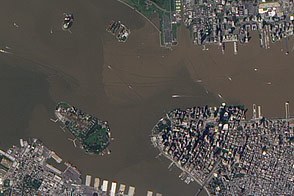
These images from September 12, 2011, and September 2, 2010, compare conditions in the Hudson River near Ellis Island. In the wake of storms, sediment filled the river in 2011.
Published Sep 13, 2011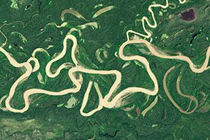
Lowland rivers that carry large volumes of sediment are on the move.
Published Dec 4, 2014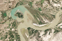
Between 1992 and 2009, a section of the lower Indus River changes course following the formation of an oxbow lake.
Published May 9, 2010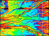
Corrientes, Argentina (sits on the east bank of the Paraná River, South America’s third largest river. Corrientes is located just inside Argentina, across the river from the southwestern tip of Paraguay.
Published Nov 8, 2004
As they prepare for a satellite that will measure the height and areal extent of rivers in unprecedented detail, hydrologists have released a better map of North American river widths.
Published Jul 9, 2015
Acquired May 1, 2011, this natural-color image shows the James River completely filling the river valley near Jamesville, South Dakota.
Published May 3, 2011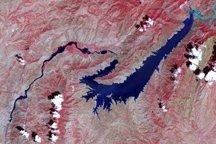
This false-color image shows the central part of the Vakhsh River, including the Nurek Dam and reservoir.
Published Nov 25, 2008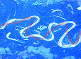
The Mamore River drains north from the Andes Mts. in lowland Bolivia. An image taken in July 2003 from the International Space Station (ISS007-E-10797, 14 June 2003, 12:36 GMT) shows an 85 km stretch of the river south of the lowland town of Trinidad in the Beni Province. Numerous changes in river pattern are visible in the decade since Landsat imagery of the same area was acquired.
Published Aug 18, 2003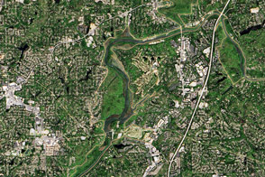
The river supplies Atlanta with its drinking water and a bit of recreational fun.
Published Nov 13, 2016
Floods and new infrastructure have long since separated the distinctive bend in the river that was portrayed by landscape painter Thomas Cole in 1836.
Published Oct 15, 2017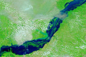
Acquired September 8, 2012, and September 23, 2009, these false-color images compare conditions along the Benue River, which flooded in 2012.
Published Sep 12, 2012