
Located on the highly populated Hawaiian island of Oahu just west of Honolulu, Pearl Harbor is the historic center of events on “the day that will live in infamy”—December 7, 1941—when the Japanese fleet launched a surprise air attack on Pearl Harbor and other strategic military targets on Oahu. The ISS-6 Space Station crew obtained this high-resolution image of Pearl Harbor in March 2003, enabling detailed observations of the harbor and its multiple uses.
Published Jul 12, 2004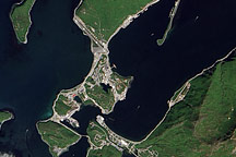
The remote port of Dutch Harbor, Alaska, is the launching point for a June 2010 NASA research cruise into the Arctic.
Published Jun 15, 2010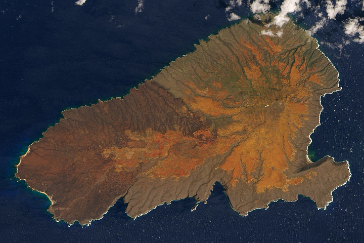
The Hawaiian island has been scarred by volcanic eruptions, livestock grazing, penal colonies, bombs, and fire. Yet there is hope for healing.
Published Mar 23, 2020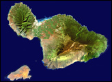
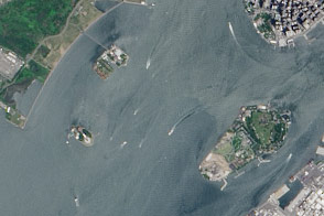
A pair of modest oyster flats turned into two of most important islands in the United States.
Published Mar 20, 2016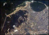
Founded by Alexander the Great in 331 BC on the Mediterranean coast of Egypt, Alexandria became a center of trade and learning in the ancient world. he Eastern Harbor was the main port in the Middle Ages. This detailed image taken by Space Station crew members using an 800-mm lens provides a view of the modern port facilities in the Western Harbor, where wharves and many moored ships can be detected.
Published May 31, 2004
Over a period of approximately four years a major island near the mouth of the Amazon River has been dramatically modified as the arms of the river have shifted. Between 2000 and 2005 the channel on the west side of the island has shifted to the northwest by eroding ~200 meters of the mainland shoreline and accreting (sediment on the west side of the island.
Published Mar 7, 2005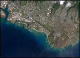
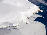
Bouvet Island is known as the most remote island in the world; Antarctica, over 1600 kilometers (994 miles) to the south, is the nearest land mass. Located near the junction between the South American, African, and Antarctic tectonic plates, the island is mostly formed from a shield volcano—a broad, gently sloping cone formed by thin, fluid lavas—that is almost entirely covered by glaciers.
Published Oct 6, 2008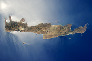
Crete is the largest and most heavily populated island of Greece.
Published Aug 15, 2011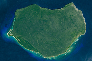
The small Puerto Rican island is a natural reserve that has been nicknamed the “Galapagos of the Caribbean.”
Published Feb 28, 2016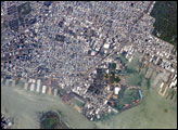
his astronaut photograph captures the dense urban fabric of Brooklyn, New York City’s largest borough (population of 2.6 million), characterized by the regular pattern of highly reflective building rooftops (white). Two main arteries from Manhattan into Brooklyn—the famous Brooklyn Bridge and neighboring Manhattan Bridge—cross the East River along the left (north) side of the image.
Published Jul 30, 2007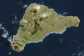
The island once looked very different from how it does today.
Published Apr 16, 2017
The most interesting geology lies just offshore and below the water line of this Northwest Australian island.
Published Aug 3, 2015
In the western Pacific Ocean, a new volcanic island that formed in the shadow of Nishino-shima has merged with it. The island has doubled in size as the eruption continues.
Published Apr 4, 2014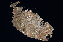
Acquired August 12, 2009, this true-color image shows the Mediterranean island of Malta, the largest island in the Republic of Malta archipelago.
Published Dec 13, 2009