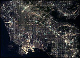
After sunset the borders of "The City of Angels" are defined as much by its dark terrain features as by its well-lit grid of streets and freeways.
Published Apr 6, 2003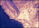
September 5, 2007, marked the end of a week-long heat wave that led to 31 deaths and triggered power outages across southern California. Not surprisingly, the hottest areas, shown in yellow, correspond with sparsely vegetated desert regions.
Published Sep 8, 2007
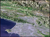
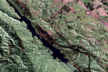
Reservoirs, lakes, and mountainsides are brimming with water and snow, though scientists caution that underground aquifers are a long way from having the same bounty.
Published Apr 21, 2017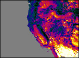
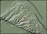
Where the Pacific plate and North American plate meet, the intense pressure of the collision creates an 800-mile-long fracture zone.
Published Jun 23, 2009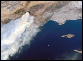
The Day Fire started in Los Padres National Forest north of Los Angeles on September 4, 2006. Easterly winds on September 17 blew the smoke westward, out to sea, and International Space Station astronauts observed this wind shift. In this astronaut photograph, the forested mountains north of Los Angeles appear dark green, and the smoke appears gray. Dense farmland appears at the south end of California’s Central Valley, in the upper left corner. Near top center, the western corner of the Mojave Desert is framed by a “V” of mountains. In the Mojave just beyond the top edge of the image (visible in the large version) are dry lakes that appear as white patches; one of these lakes acts as a landing site for the Space Shuttle.
Published Sep 25, 2006