On May 18, 1980, Mount Saint Helens volcano erupted. Because the eruption occurred in an easily accessible region of the U.S., Mount St. Helens has provided unprecedented opportunities for U.S. researchers to collect scientific observations of the geology of an active volcano and document the regional ecological impact and recovery from an eruption.
Published May 17, 2004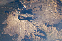
Nearly three decades after the catastrophic eruption of Mount St. Helens, the impact on the forest in the blast zone is still obvious in this astronaut photograph. South of the mountain, lush green forests cover the landscape, while north of the mountain, vegetation remains sparse.
Published Jan 1, 2009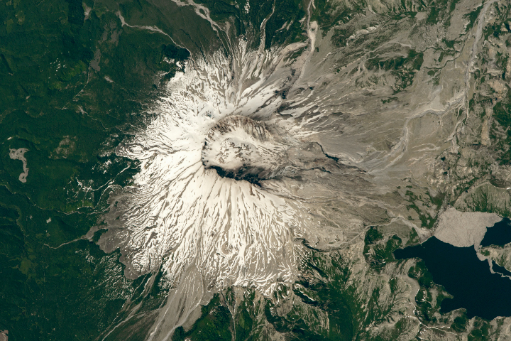
The area around the volcano has been left to recover naturally from the disaster, which it has done quite nicely, if slowly.
Published Jul 22, 2018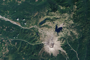
Over 33 years, life has reclaimed the land from the wreckage of the 1980 volcanic eruption.
Published Oct 20, 2013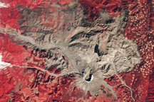
A trio of images documents the devastation and recovery of the landscape around Mt. St. Helens Volcano following its cataclysmic 1980 eruption.
Published May 18, 2010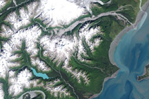
The glacier-covered Redoubt Volcano is one of many that line Alaska’s southern shores. In late January 2009, the volcano started to rumble once again.
Published Feb 11, 2009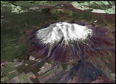

Satellites in orbit and scientists on the ground still monitor the mountain and track its recovery.
Published May 16, 2015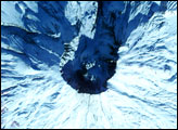
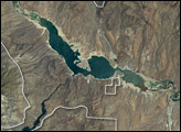
The most striking feature is Roosevelt Lake, an artificial lake created by the construction of Roosevelt Dam across the Salt River. The National Monument is surrounded by the Tonto National Forest, which includes low plains, desert scrubland, and alpine pine forests.
Published Sep 4, 2005
The landscape is a recently formed set of basaltic lava flows that creates a foreboding landscape of sharp obsidian, cinder and spatter cones, twisted rivers of solidified rock, pit craters, and a network of caves from lava tubes.
Published Oct 16, 2005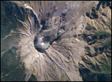
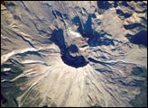
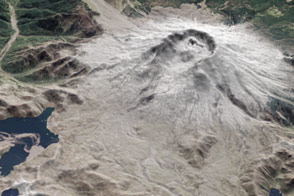
Early in October 2004 Mt. St. Helens rumbled back to life with earthquakes, minor eruptions of steam and ash, and renewed growth of the summit lava dome. Fortuitous trajectories of the International Space Station provided the ISS crew excellent views of the area.
Published Oct 25, 2004