
On May 18, 1980, Mount St. Helens gave way to a cataclysmic flank collapse, avalanche, and explosion that killed 57 people and displaced many others. The event dramatically reshaped the volcano and surrounding land in southwest Washington.
Now, 35 years later, satellites in orbit and scientists on the ground still monitor the mountain and track its recovery. The image above shows a three-dimensional view the mountain, looking toward the southeast, as it appeared on April 30, 2015. The image was assembled from data acquired by the Operational Land Imager on Landsat 8 and the Advanced Spaceborne Thermal Emission and Reflection Radiometer (ASTER) on Terra.
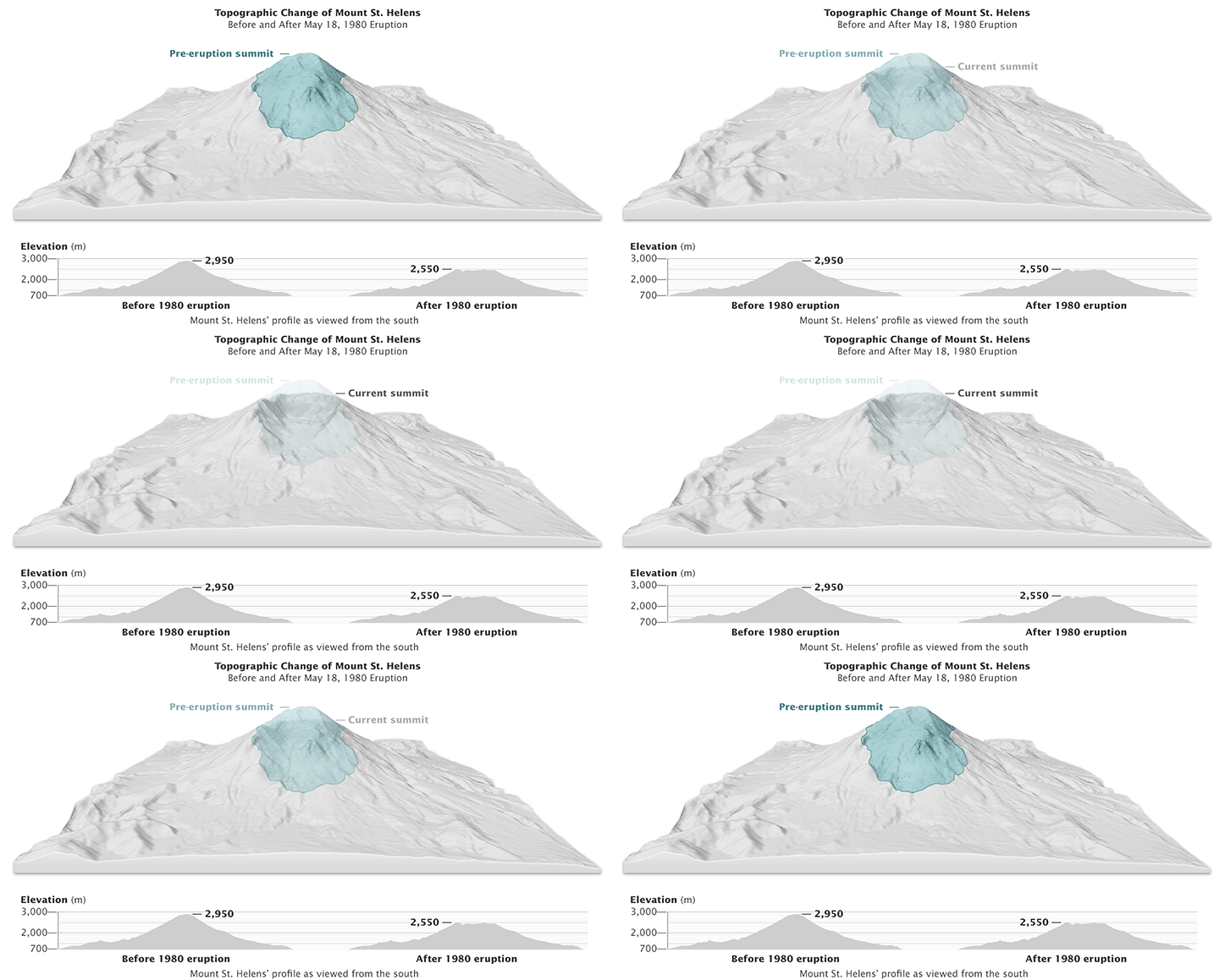
The mountain’s north flank was the site of the collapse and lateral explosion that devastated 390 square kilometers (150 square miles) of the landscape. The visualization below, based on digital elevation models from the U.S. Geological Survey, shows the elevation of the volcano’s summit before and after the blast.

Deposits from the landslide on the north flank—one of the largest in recorded history—buried the valley of the North Fork Toutle River with debris up to 180 meters (600 feet) deep in some places. Rivers have since reworked their way across the landscape, and new vegetation has greened up much of the land. The Pumice Plain still looks barren in the satellite imagery, but ground surveys note that small plants have regrown here too.
Not all of the recovery, however, is natural. According to Steve Malone, an emeritus professor at the University of Washington, much of the blow-down area was replanted and fertilized to get commercial crops, such as timber, growing again. “Only within the monument have things been left to recover naturally.”
Scientists also keep a vigilant watch on the inside of the crater, where two lava domes have formed. In the image at the top of this page, the dome in the crater’s foreground grew until 1986, at which time the volcano became quiet again. Renewed activity in 2004—followed by a phase of lava extrusion that lasted until 2008—formed a second lava dome immediately behind the first.
On the left side of the top image, log rafts are still visible in Spirit Lake. These drifting rafts are composed of floating trees, thousands of which were uprooted and carried there in 1980. The raft is gradually shrinking in size from year to year as trees sink to the bottom of the lake.
Not visible in this image, however, is the 2,600-meter-long (8,500-foot-long) drainage tunnel constructed in 1985 to carry water from the lake, through a ridge, and into a nearby creek. Eruption debris had blocked the natural outlet into North Fork Toutle River, so the tunnel was built to control the water level and prevent a potentially disastrous flood. News reports say the tunnel is becoming constricted and “needs work.”
NASA Earth Observatory images by Jesse Allen and Joshua Stevens, using Landsat data from the U.S. Geological Survey and ASTER GDEM2 data from NASA/GSFC/METI/ERSDAC/JAROS, and U.S./Japan ASTER Science Team. Caption by Kathryn Hansen.