Images related to Vanishing Marshes of Mesopotamia

Mesopotamian Marshes
Image

Mesopotamian Marshes

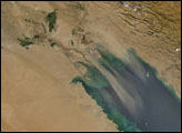
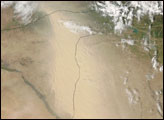
The Al Hawizah Marshes comprise the largest remaining tract of wetlands in the Mesopotamian Marshlands of Iran and Iraq. In the last 10 years, damming and diversion of waters from the Tigris and Euphrates Rivers, and draining of wetlands has led to a loss of 85% of wetlands that once covered about 20,000 square km (7,725 square miles).

Published Mar 3, 2002

Image of the Day Land Life

Reclaiming Mesopotamia’s Marshes
Image

Reclaiming Mesopotamia’s Marshes

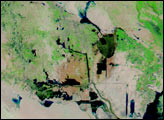
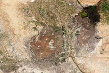
A pair of natural-color images documents dramatic changes in Mesopotamian wetlands between 2002 and 2007.

Published May 6, 2009

Image of the Day Land Life Human Presence

Lilongwe and Landsat Grew Up Together
Image

Lilongwe and Landsat Grew Up Together

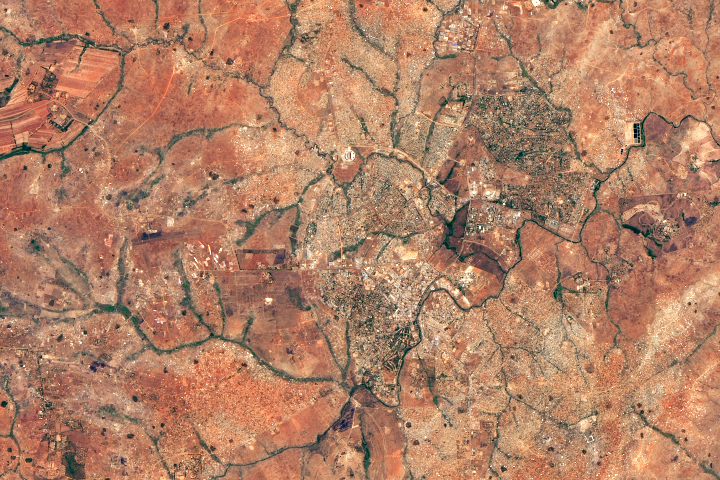
A fishing town became a bustling city after Malawi’s president moved the capital there.

Published Dec 19, 2018

Image of the Day Human Presence

Floods in Iran
Image

Floods in Iran

Published Jan 13, 2004

Floods

Dust Storm Blows Across Iraq
Image

Dust Storm Blows Across Iraq

Published Apr 19, 2005

Dust and Haze

Rising Waters in St. Paul
Image

Rising Waters in St. Paul

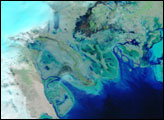
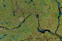
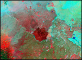
Acquired on March 17, 2010 (top), and August 5, 2009 (bottom), these false-color images show differences in vegetation and river levels at different times of year.

Published Mar 20, 2010

Land Floods

The Growth of Manila
Image

The Growth of Manila

Satellite imagery reveals Manila’s rapid growth.

Published Oct 14, 2015

Image of the Day Land Human Presence

A Blackwater River Meets the Sea
Image

A Blackwater River Meets the Sea

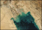
A satellite image offers inky evidence of the organic-rich freshwater that the Suwannee River delivers to the Gulf of Mexico.

Published Oct 27, 2018

Image of the Day Land Life Water

Syrian Desert
Image

Syrian Desert

Published Dec 23, 2002

Image of the Day Land

Dust Storm in Southern Iraq
Image

Dust Storm in Southern Iraq

Published Sep 13, 2004

Dust and Haze