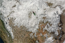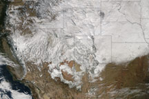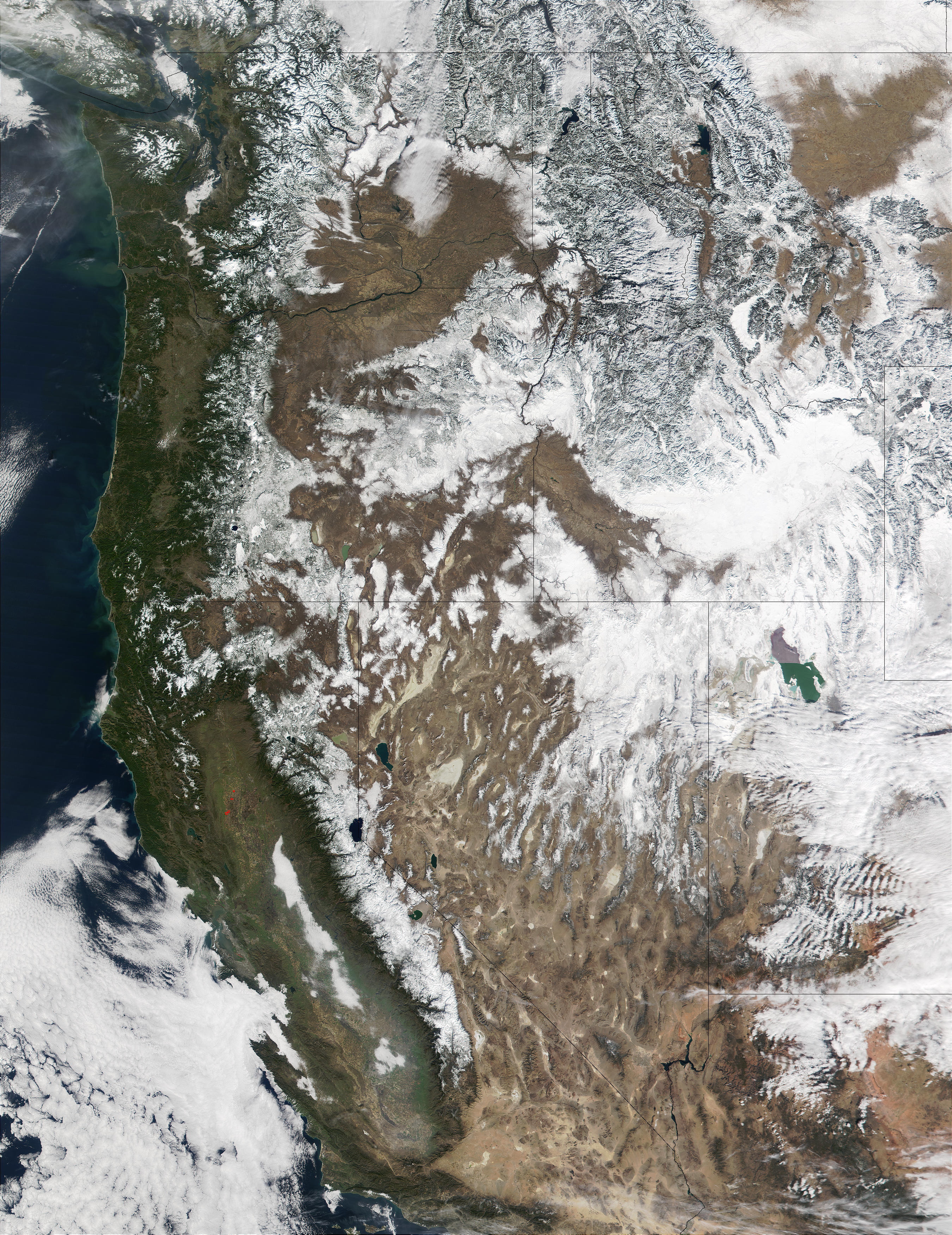
On Thursday (Feb. 14, 2002), the cloud cover that often overshadows the western United States this time of year broke to provide those at the Olympic Games with a beautiful day. The nearly cloud-free day was captured by the Moderate-resolution Imaging Spectroradiometer (MODIS), flying aboard NASA’s Terra spacecraft. A thick layer of snow blankets northernmost Nevada, northern Utah, most of Idaho and western Wyoming. The snow surrounds and highlights Utah’s Great Salt Lake. Just south of the lake, clouds can be seen hovering over southern Utah. (In general, clouds appear streaky and uneven on a satellite image, and snow cover appears solid with definable borders.) North of the Great Salt Lake, one can clearly discern the light gray Northern Rocky Mountains cutting through Idaho and up into Canada. Moving southwest, the spine-like Sierra Nevada mountains separate the greenery of Southern California from the brown deserts of Arizona and Nevada.
For an interesting contrast, compare this MODIS image to the MISR mosaic image of the Western United States during the summer (See Western United States Beyond the Four Corners).
To access this image at a resolution of 500 meters per pixel, click on the image above. To access a full-resolution image at 250 meters per pixel, visit the MODIS Rapidfire Image Gallery.
Image courtesy Jacques Descloitres, MODIS Land Rapid Response Team at NASA GSFC