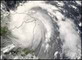
The 2007 Atlantic hurricane season had been running for several months before it saw its first hurricane, Dean. Dean began as a wave-like disturbance in the cloud bands off South America, which gathered together to form a storm system on August 13. By August 18, Dean had grown in power to become a Category 4 hurricane, swirling in the Caribbean Sea. The storm caused great damage to Jamaica and Grand Cayman Island, among other Caribbean islands, and as of August 19, it was forecast to come ashore on the Mexican Yucatan Peninsula not far from the border with Belize. Forecasters at the National Hurricane Center were also expecting the storm to continue to gather power to Category 5 strength.
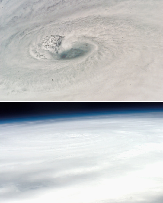
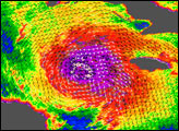
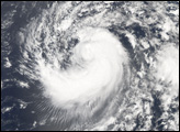
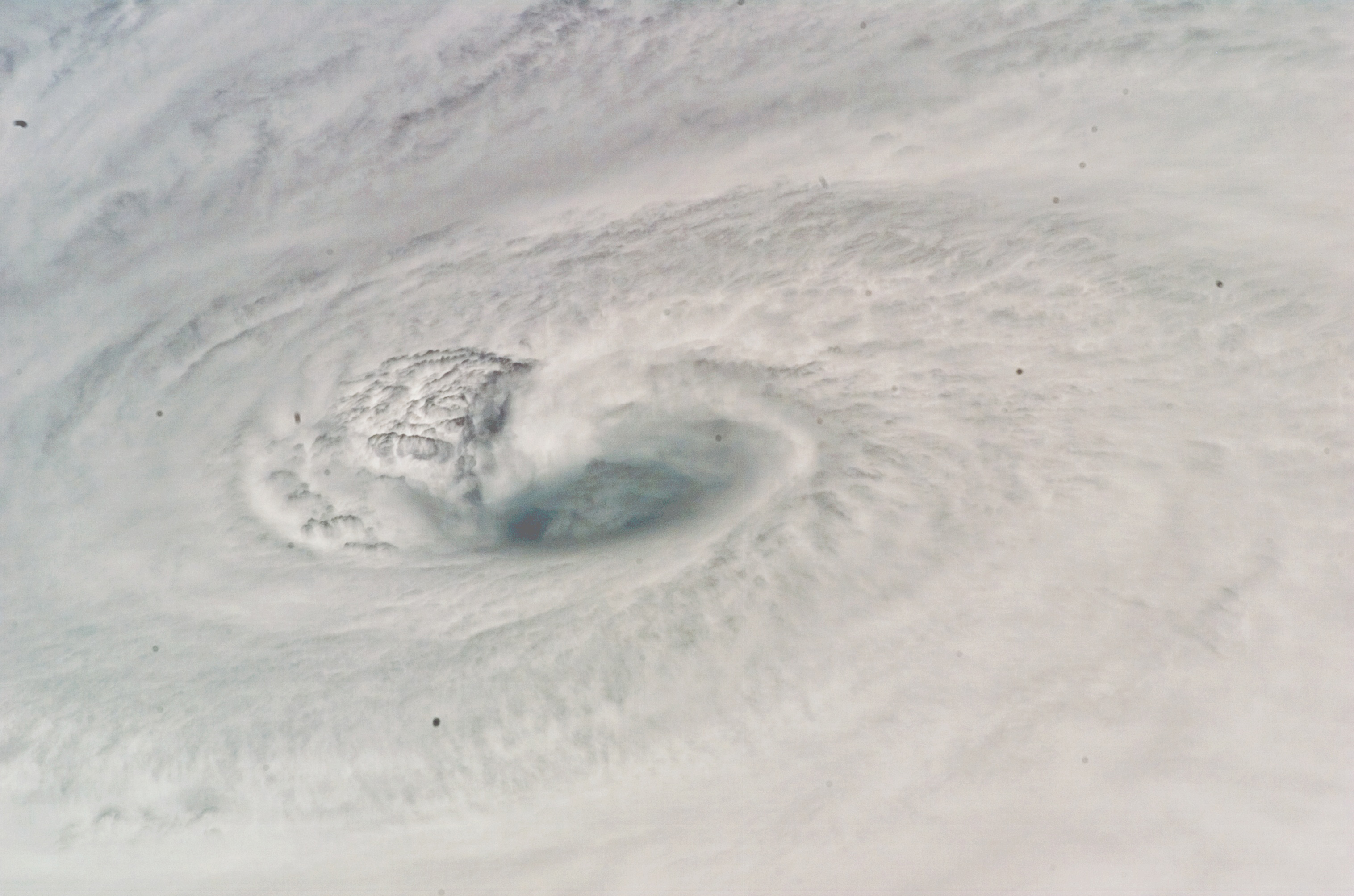
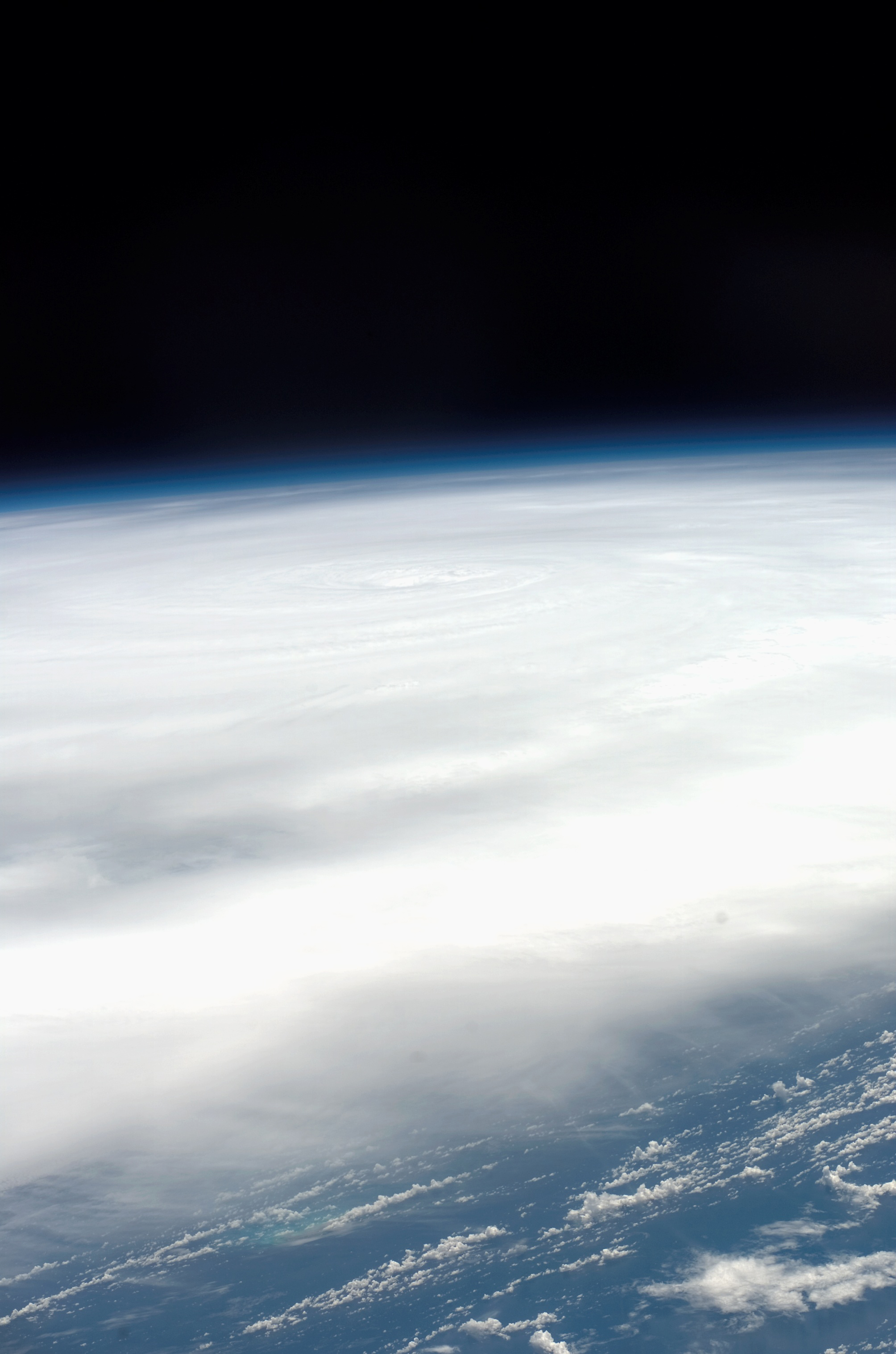
While weather and Earth science satellites are known for getting a perspective on storms as they orbit the Earth, they were not the only sensors viewing Hurricane Dean from high above. Astronauts aboard the International Space Station and the crew of the Space Shuttle Endeavour passed over the storm on August 18. These two photographs were taken by astronauts on Endeavour moments from each other. The first is a close-up of the eye of the storm, the second is a wider-angle view, both taken by a handheld camera around noon local time.
Hurricane Dean showed a deep and well-defined eye at the center of the storm, with powerful thunderstorms around the eyewall sending up tall towers of clouds. In the close-up view, these towering clouds appear to be casting shadows on the cloud deck below them. The deep eye of the storm has a clear three-dimensional shape in these oblique angle photographs, but the camera angle does not allow us to see down the bottom of the storm. At the time of these photographs, Hurricane Dean was passing just south of Jamaica as a Category 4 storm with sustained winds as high as 240 kilometers per hour (150 miles per hour).
NASA photographs provided courtesy of NASA Public Affairs Office.


