The Earth Observatory has published its last Image of the Day on this website. Please join us on our new home at science.nasa.gov/earth/earth-observatory.
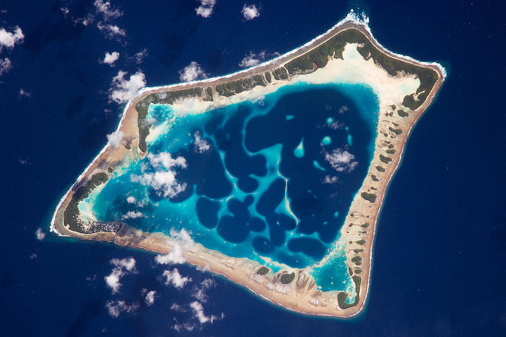
About halfway between Australia and Hawaii, the Pacific island nation of Tuvalu is an isolated archipelago composed of nine coral islands. All told, its mean elevation is 2 meters (6 feet) above sea level, and its land area amounts to about 3 percent of that of New York City. As a low-lying island nation, Tuvalu faces more frequent and severe floods as sea levels rise.
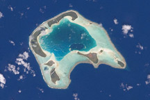
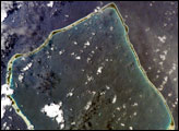
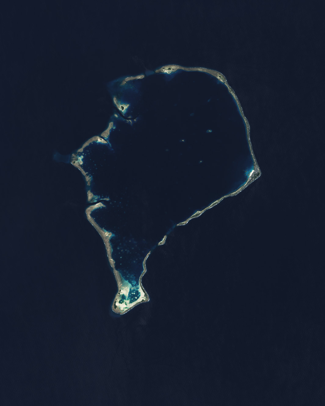
The largest island in the group, Funafuti Atoll, is featured in this image, acquired by the OLI (Operational Land Imager) on Landsat 8 in September 2023. Seven main passages allow ships to enter the atoll’s central lagoon. The Funafuti Conservation Area encompasses reefs and islets on the western side of the atoll. To the east, Tuvalu’s largest islet is home to more than half of the nation’s population of about 12,000 people.
Researchers looked to Funafuti for early field studies into how coral atolls form. Based on observations made on the 1831–1836 voyage of the HMS Beagle, Charles Darwin proposed that the origins of the ring-like islands were volcanic. By his thinking, atolls evolved from barrier reefs that formed around extinct mid-ocean volcanoes, where corals continued to grow up as the land subsided.
Decades later, from 1896–1898, the Royal Society sponsored a series of expeditions to Funafuti to test Darwin’s theory. Scientists drilled down more than 300 meters (1,000 feet) into carbonate rock without hitting any volcanic material. Subsequent analysis suggested they would have needed to drill approximately twice that deep to reach volcanic rock. The drill site is marked with a commemorative plaque.
While the volcanic theory is still generally accepted today, some geologists have since argued that sea level fluctuations can drive atoll formation. According to an alternative model of atoll development, flat-topped banks of carbonate rocks formed in tropical shallow-water environments between about 5 million and 2.5 million years ago, when global sea levels were relatively high and unfluctuating. As the climate cooled, sea levels dropped, leaving the flat expanses exposed. Slightly acidic rainwater would have then pooled on the rocks and gradually dissolved them from the center out. When sea levels rose again, corals would colonize the raised outer rims.
Regardless of how much sea level fluctuations factor into atoll formation, they are a profound concern to those living on Funafati and other Tuvaluan islands today. Scientists expect sea level rise to worsen the effects of tides, waves, and storms, increasing the frequency and severity of periodic flooding on the islands.
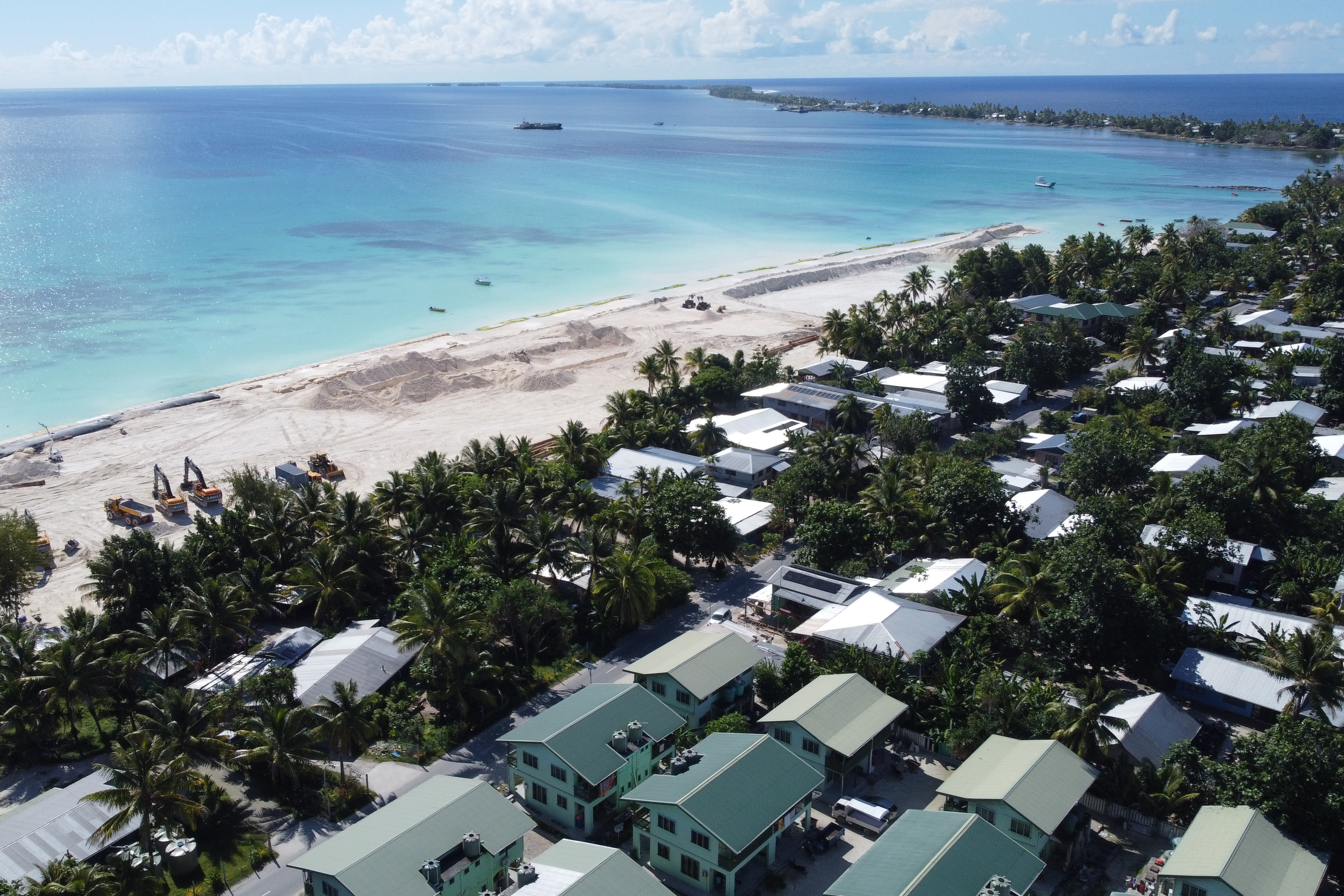
NASA’s Sea Level Change Team is providing scientific support to the nation’s efforts to adapt to these climate-related threats. In a 2023 assessment, NASA scientists reported that sea level in Tuvalu was nearly 15 centimeters (6 inches) higher than it was 30 years prior. The average rate of increase—5 millimeters (0.2 inches) per year—is already 1.5 times faster than the global average and is expected to more than double by 2100. Much of the land area and critical infrastructure will sit below the average high tide level by 2050, the report stated.
The NASA science report is designed to advance the goals of the Rising Nations Initiative, a project set in motion by the U.N. Global Centre for Climate Mobility. It argues that increased scientific monitoring could improve planning for potentially catastrophic events. The country is already taking action to fortify coastal infrastructure on Funafuti and other islands through the Tuvalu Coastal Adaptation Project.
NASA Earth Observatory image by Wanmei Liang, using Landsat data from the U.S. Geological Survey. Photograph by James Lewis/TCAP/UNDP. Story by Lindsey Doermann.