The ring shape is the result of coral reefs building up around a former volcanic island in the South Pacific.
Published Apr 6, 2009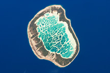
This astronaut photograph shows Mataiva Atoll, the westernmost atoll of the Tuamotu Archipelago.
Published Aug 30, 2010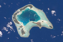
This astronaut photograph shows Tetiaroa Island, part of the Society Islands archipelago in the southern Pacific Ocean. Tetiaroa is an atoll comprised of thirteen small islets.
Published Feb 16, 2009
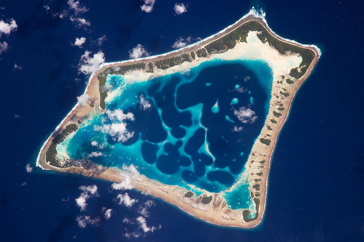
This astronaut photograph depicts Apataki Atoll, an atoll in the Tuamotu Islands in the south Pacific. Atolls are ring-like coral islands that nearly or entirely enclose a lagoon. The atoll traces the perimeter of what was once the coastline of a volcanic island. In 1722, Dutch navigator Jakob Roggeveen became the first European to see the Apataki Atoll. It was later visited by Captain Cook in 1774.
Published Mar 6, 2006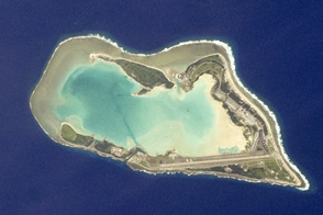
This atoll of islands and reefs formed around a submerged volcano.
Published Oct 15, 2012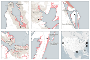
The nation’s problem is also NASA’s problem: Half to two-thirds of our space infrastructure and assets stand within 5 meters of sea level.
Published Sep 8, 2015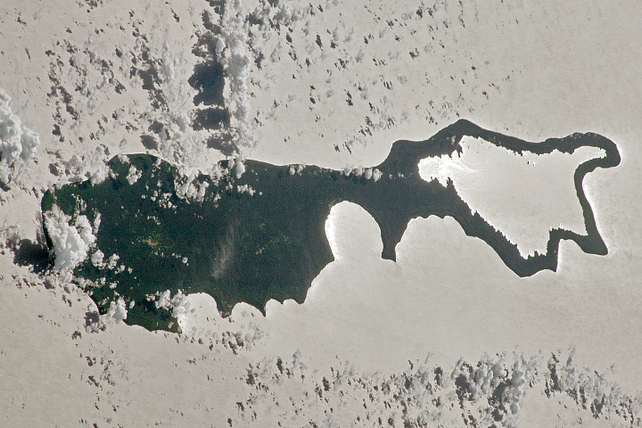
The dark shape of Rennell Island, including its raised coral atoll, stands out amid the sunglint.
Published Apr 9, 2023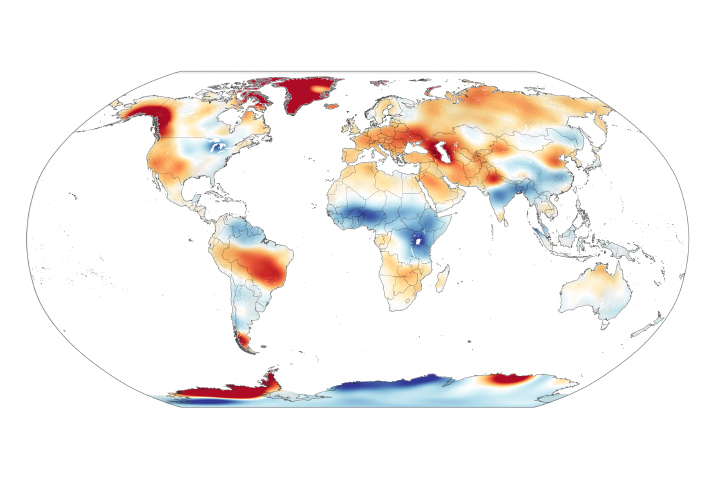
Scientists measure ice’s gravitational pull on a pair of satellites, allowing them to estimate ice loss and its contribution to sea level rise.
Published Nov 5, 2020
The acceleration has been driven mainly by increased ice melting in Greenland and Antarctica, and it has the potential to double the total sea level rise projected by 2100.
Published Feb 20, 2018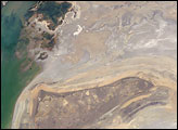
The arrow-shaped island in the Aral Sea used to be a 35-kilometer-long visual marker, indicating the Aral Sea to astronauts. An image from the present International Space Station increment shows how much the coastline has changed as the sea level has dropped during the last three decades.
Published Aug 15, 2005alert message
