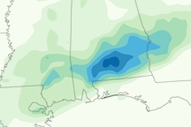
Over a foot of rain fell on parts of South Dakota and Iowa in late June 2024, sending water over the banks of rivers. Overflowing rivers destroyed homes and bridges and inundated farm fields in the Midwestern states.
A front of dense moisture, drawn north from the Gulf of Mexico, parked over southeastern South Dakota and northwestern Iowa on June 20 and 21, unleashing torrential rainfall. Mitchell and Sioux Falls, South Dakota, recorded 6.5 and 7.7 inches of cumulative rain, respectively. It was the wettest two-day period for these cities in the National Weather Service’s (NWS) climate record, dating back to 1893. In Canton, South Dakota, near Iowa’s border, about 15 inches of rain fell on those days, according to NWS estimates.
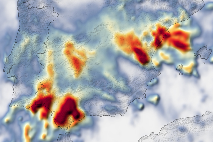
The front brought rain to already saturated soils, according to the NWS National Water Center. The Great Plains region had already received 150–200 percent of its normal rainfall between mid-May and mid-June. Using soil moisture data from NASA’s Short-term Prediction Research and Transition (SPoRT) center, NWS forecasted that the ground may not be able to absorb more water.
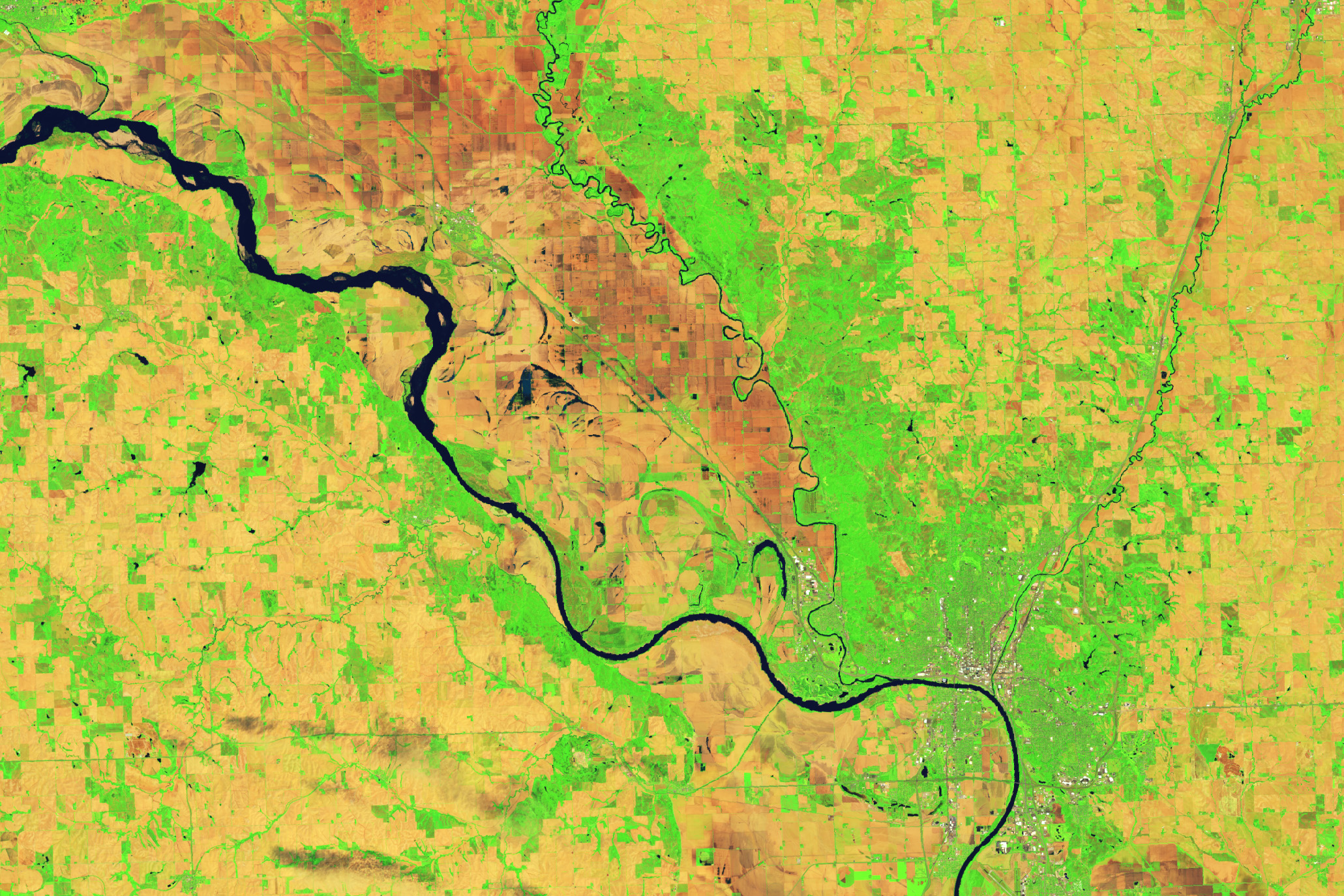
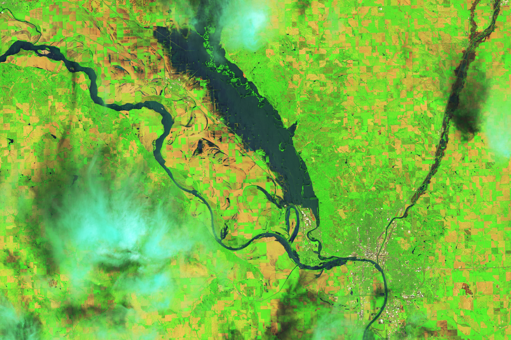
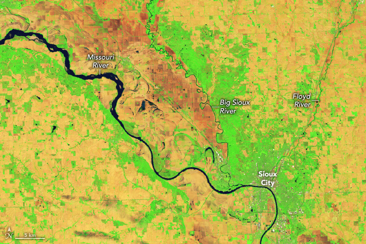
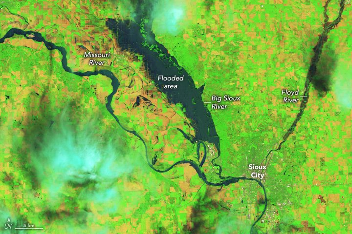
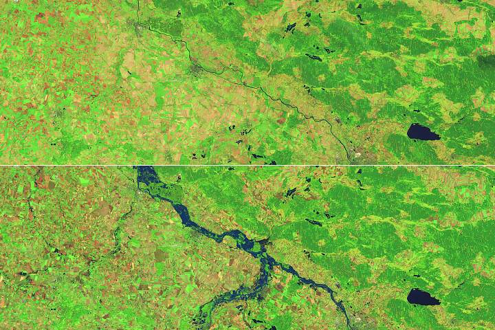
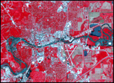
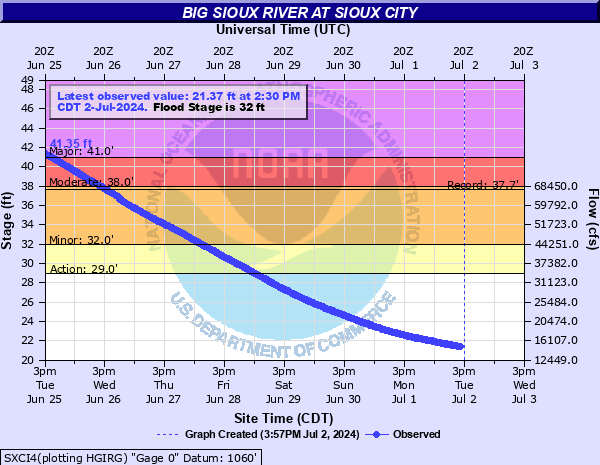
The Big Sioux River, which runs along the Iowa-South Dakota border, rose to record heights after back-to-back days of heavy rainfall. On June 23, the level of the river in Sioux City, Iowa, reached almost 45 feet—7 feet higher than the previous record. That evening, a steel railroad bridge connecting North Sioux City, South Dakota, with Sioux City, Iowa, collapsed into the Big Sioux River.
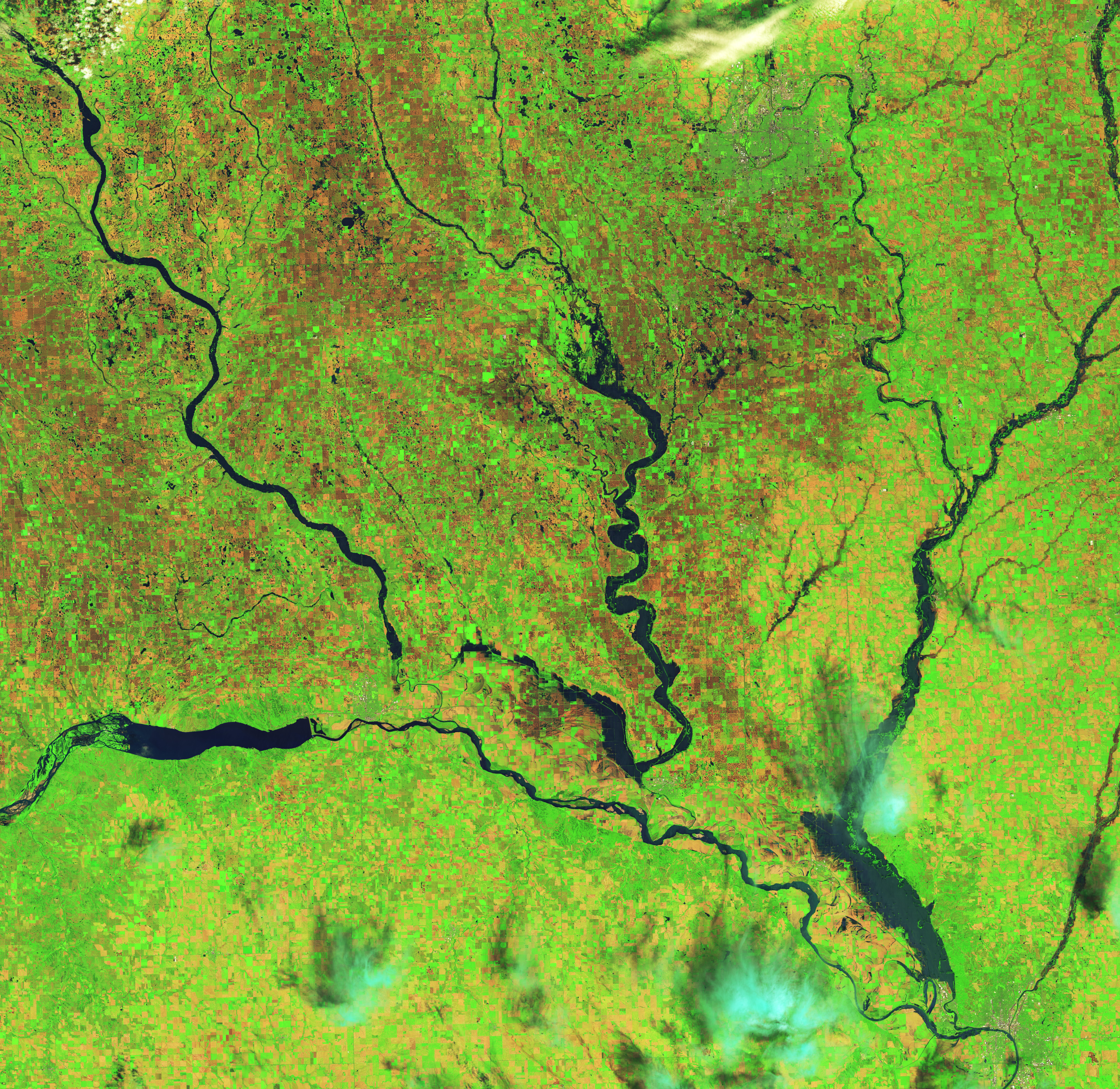
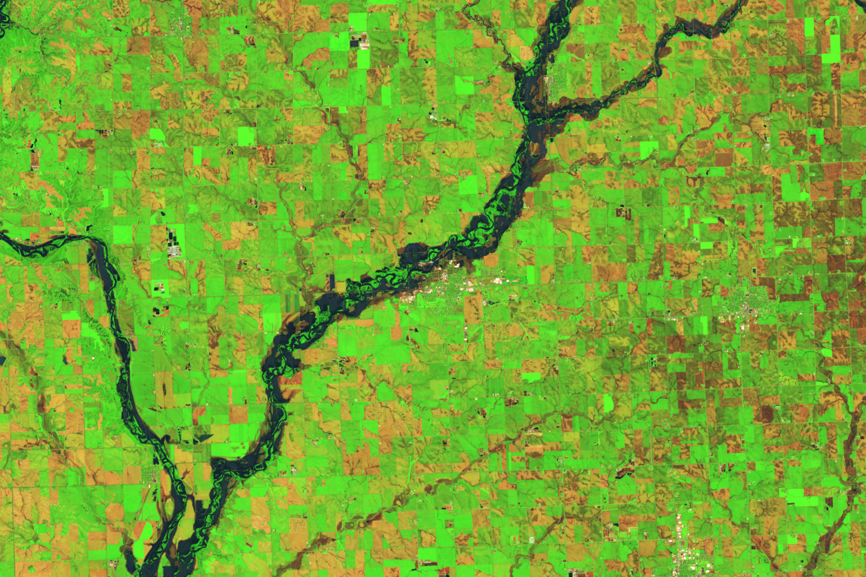
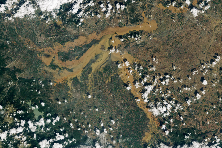
The images above, acquired by the OLI (Operational Land Imager) on Landsat 8 and the OLI-2 (Operational Land Imager-2) on Landsat 9, show Sioux City on June 9 (left) and June 24 (right). Water had overtopped the banks of the Big Sioux River in the June 24 image, inundating adjacent farmland. The images are false-color to emphasize the presence of water, which appears dark blue. The image below shows a wider view of southeastern South Dakota and northwestern Iowa on June 24.
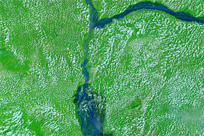
In northwestern Iowa, about a foot of rain fell over two days near the town of Rock Valley, 50 miles (80 kilometers) southeast of Sioux Falls. Excessive rain filled the Rock River, bringing it to an all-time high of 27 feet (19 feet is the major flooding stage). The river broke a levee in Rock Valley on the morning of June 22, sending a torrent of floodwater across the town and forcing 4,000 residents to evacuate, according to news reports. The false-color image below, acquired by Landsat 8, shows water spilling over the banks of the Rock River near Rock Valley on June 24.
Next, the front passed over southern Minnesota and caused water levels to build along several rivers in the state. According to news reports, rising waters on the Blue Earth River washed out a portion of the Rapidan Dam, near Mankato.
As of June 25, the water levels of many rivers in this part of the Great Plains had begun to fall but were still in major flooding stage, according to the NWS.
NASA’s Disasters program has been activated in support of the floods in Iowa. As new information becomes available, the team will be posting maps and data products on its open-access mapping portal.
NASA Earth Observatory images by Wanmei Liang, using Landsat data from the U.S. Geological Survey. Story by Emily Cassidy.


