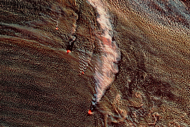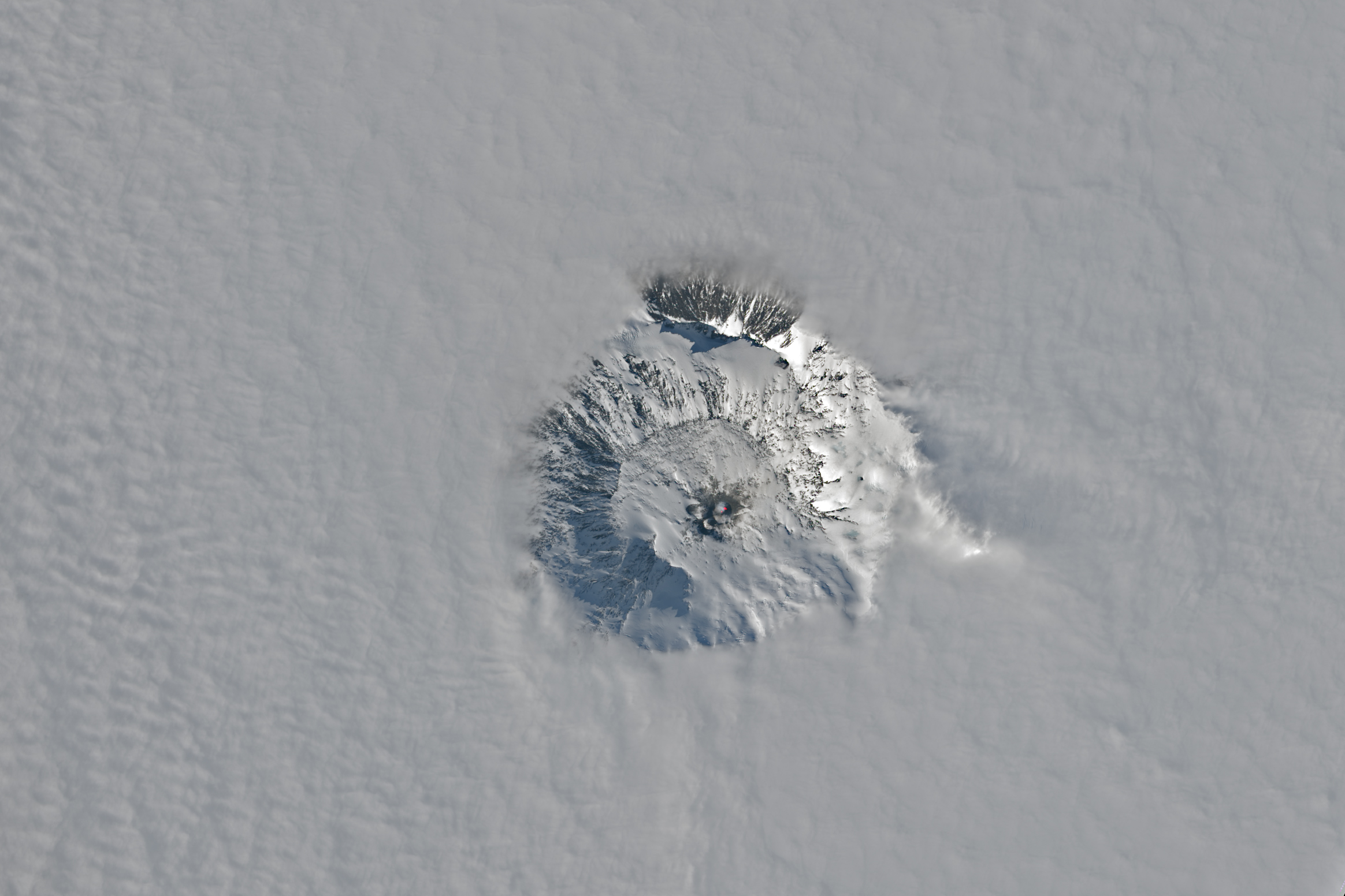
The summit crater of Mount Erebus, the world’s southernmost active volcano, appeared above the clouds on a late-spring day in 2023. The OLI-2 (Operational Land Imager-2) on Landsat 9 captured this view of the stratovolcano on November 25.
Mount Erebus is one of several volcanoes forming Ross Island off the coast of West Antarctica. At 3,794 meters (12,450 feet) above sea level, it looms over McMurdo Station, located just 35 kilometers (22 miles) away. These volcanoes occur in a rift zone where extension has caused the crust to thin and allowed magma to migrate up through faults to the surface.
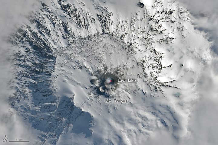
In the detailed view (above), the Landsat image includes the shortwave infrared signal (red) produced by heat from a lava lake in the summit crater. The lake has been active since at least 1972 and is one of only a few long-lived lava lakes on Earth. It constantly churns and occasionally spews bombs of molten rock in Strombolian eruptions. Geologists want to learn why an active lava lake has persisted here for so long. Recent research suggests one reason could be the magma’s low water content, which makes it less volatile as it approaches the surface.
Erebus was active prior to the emergence of this lava lake, including in 1841 when British Royal Navy officer James Clark Ross first sighted it during his Antarctic exploration. Mount Erebus and neighboring Mount Terror were named for warships retrofitted for use in that expedition and numerous other polar voyages.
NASA Earth Observatory images by Lauren Dauphin, using Landsat data from the U.S. Geological Survey. Story by Lindsey Doermann.