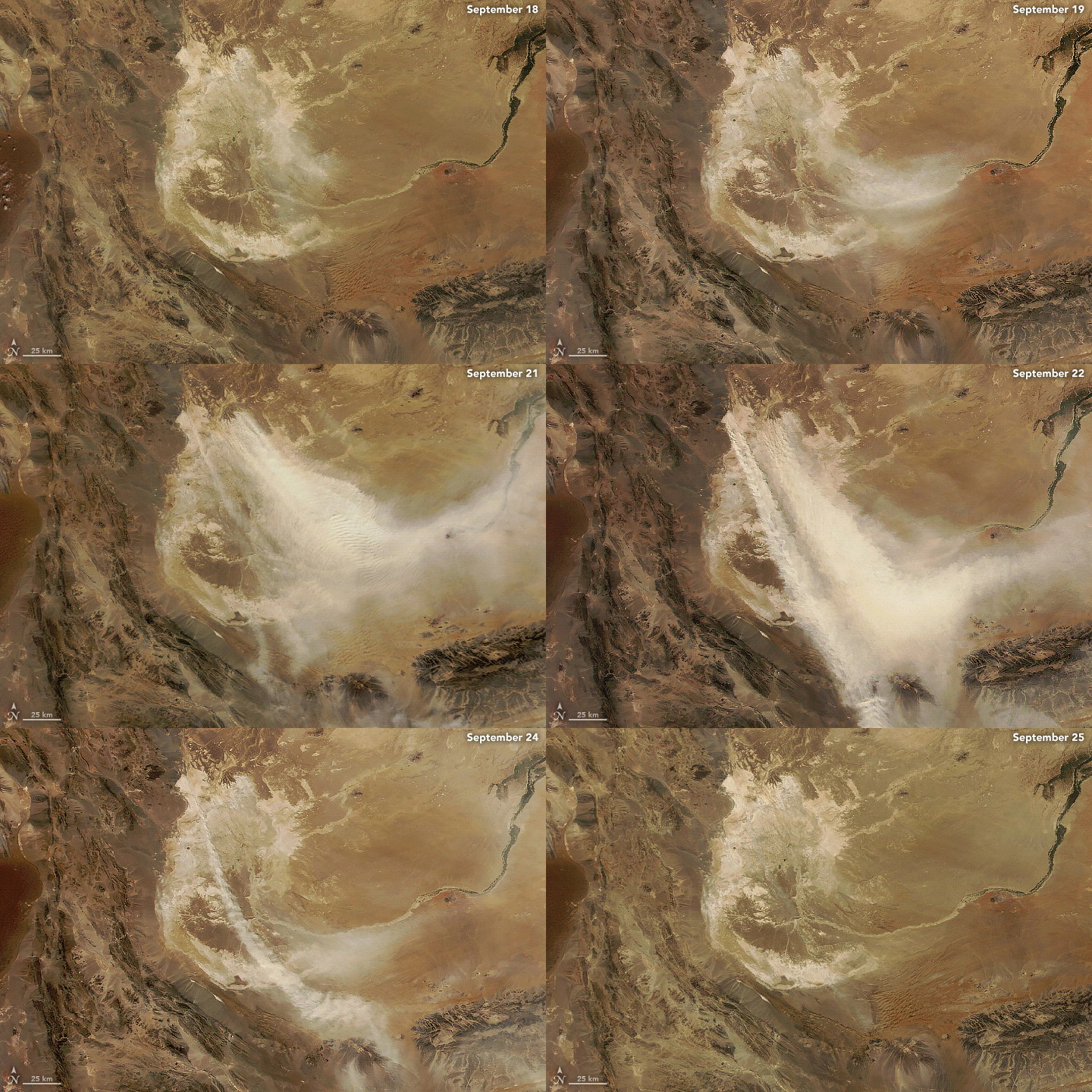

A dust storm swept across portions of Iran, Afghanistan, and Pakistan in mid-September, posing health hazards for many residents in its path. This image, acquired by the VIIRS (Visible Infrared Imaging Radiometer Suite) instrument on the NOAA-NASA Suomi NPP satellite, shows thick plumes of dust blowing hundreds of kilometers across the arid region on September 22, 2023.
The dust appears to emanate from the ephemeral Hamun wetlands, which partially surround the Iranian city of Zabol. When dry, this area becomes a hotspot for dust storms due to a persistent weather feature known as the Levar wind (or “120-day wind”), which blows out of the northwest from late-May to late-September. The animation below shows how winds transported dust for several days between September 18 and 25. It includes VIIRS and MODIS (Moderate Resolution Imaging Spectroradiometer) images from the Terra, Suomi NPP, and NOAA-20 satellites.

More than 1,300 people in Iran’s Sistan and Baluchestan province sought medical attention for respiratory, heart, and other ailments, according to news reports. Three people reportedly perished in accidents stemming from poor visibility.
Since 1999, low water levels in the Hamun wetlands have led to a marked increase in dust events originating there, with most storms occurring during the 120-day winds. Water levels are influenced by rainfall and the flow of the Helmand river, which runs from the Hindu Kush mountains across Afghanistan before terminating at the wetlands. More frequent drought since 1999, along with increasing upstream demands on water resources for agriculture and other uses, have amplified the drying.
In addition to the adverse human health effects of poor air quality, the storms can cause school closures, transportation hazards, and crop damage. During a period of drought from 2000 to 2004, researchers estimated that the economic cost of dust storms in southeastern Iran exceeded 200 million U.S. dollars.
Other areas where shrinking lakes have contributed to increases in dust storms include Owens Lake in California, Lake Ebinur in China, and the Aral Sea in Central Asia.
NASA Earth Observatory images by Michala Garrison, using VIIRS data from NASA EOSDIS LANCE, GIBS/Worldview, and the Joint Polar Satellite System (JPSS); VIIRS data from NASA EOSDIS LANCE, GIBS/Worldview, and the Suomi National Polar-orbiting Partnership; MODIS data from NASA EOSDIS LANCE and GIBS/Worldview; and additional data from OpenStreetMap. Story by Lindsey Doermann.