The Earth Observatory has published its last Image of the Day on this website. Please join us on our new home at science.nasa.gov/earth/earth-observatory.
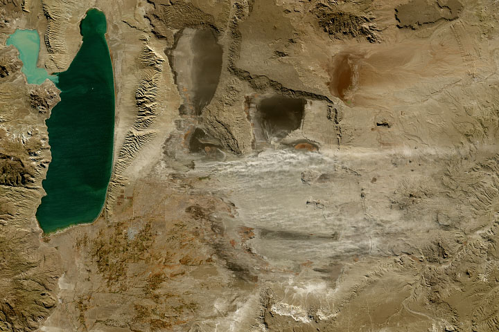
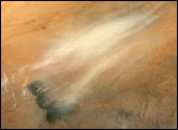
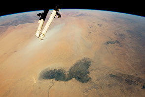
Persistent drought and upstream water withdrawals have put Lake Hamun (also spelled Hamoun) in a precarious position in recent decades. Amidst great year-to-year variability, the seasonal lake and wetlands in the Sistan Basin of eastern Iran and southern Afghanistan have been shrinking over time. The change has reduced vegetation cover and exposed silt and dust that has turned the area into a major source of dust storms.
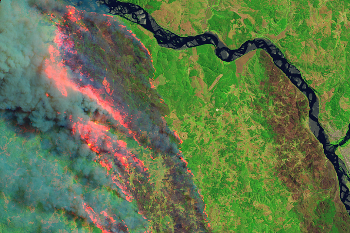
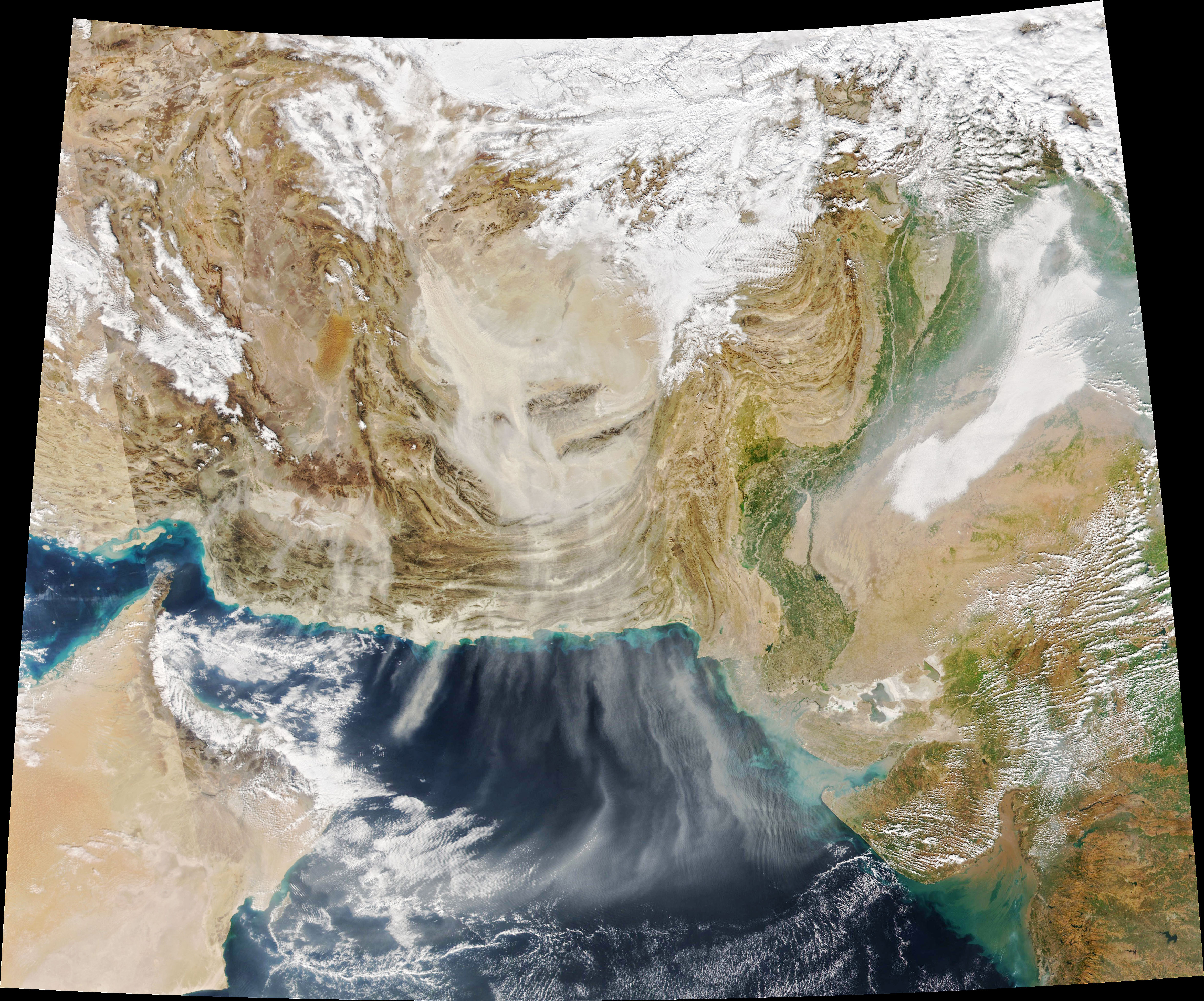
While dust storms are most common in the summer, they happen year-round as long as the lake is dry and the winds are strong. That was the case on January 12, 2023, when the Visible Infrared Imaging Radiometer Suite (VIIRS) on the NOAA-20 satellite captured this image of dust streaming from the dry lake bed. The dust began blowing on January 11 and subsided by January 13. When the lakebed is dry—as has been the case for long stretches in 2001, 2002, 2004, 2018, 2021, and 2022—the volume of airborne dust increases by 40 percent, according to a team of researchers based in Iran.
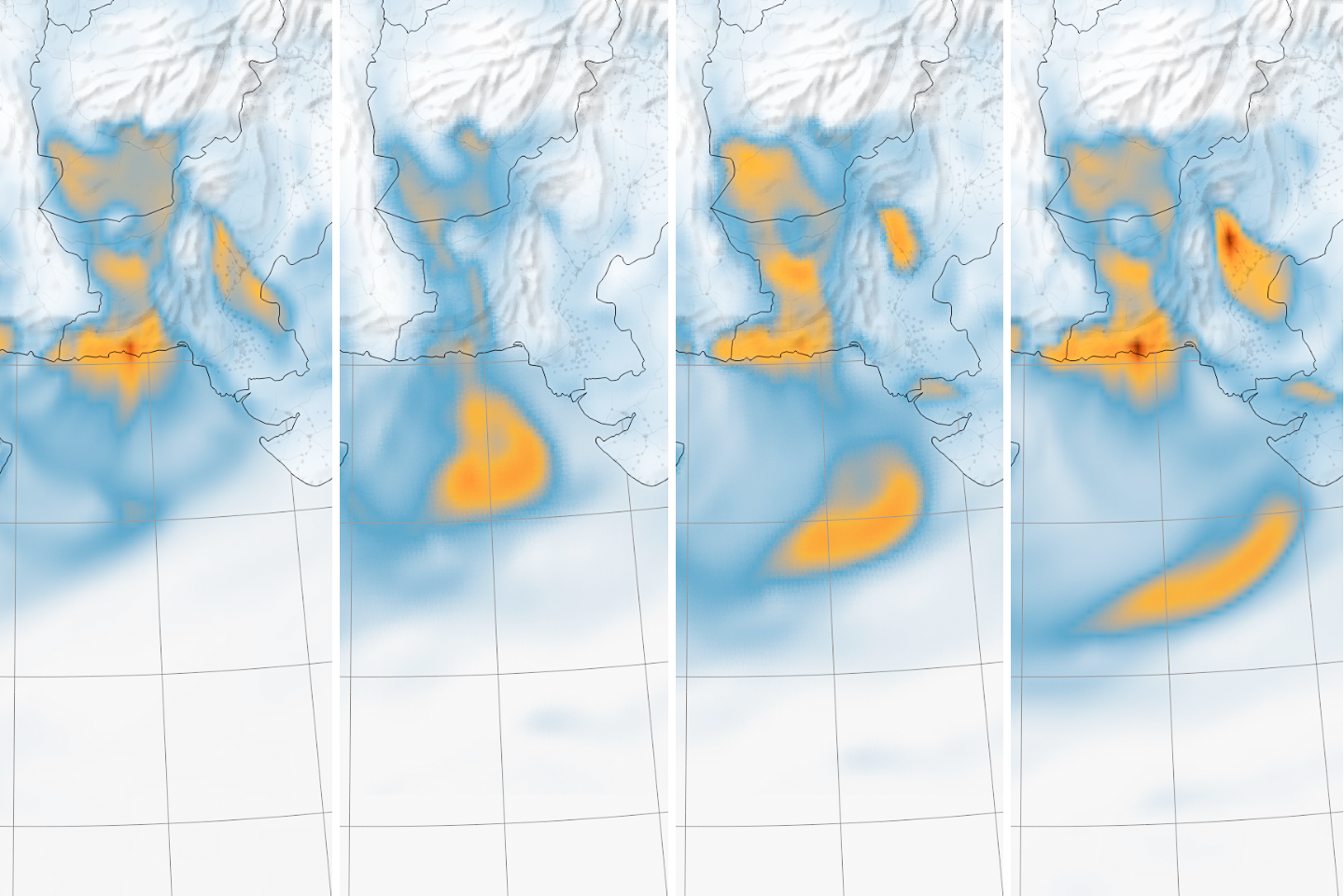
The series of maps below show dust spreading toward the south over Pakistan, India, and the Arabian Sea during six-hour intervals on January 12. The data used to generate the maps came from NASA’s Goddard Earth Observing System (GEOS) modeling system, which assimilates data from a variety of satellite, aircraft, and ground-based observing systems.
This is just one dust storm in one location, but the cumulative effect of the world’s dust storms can have significant effects on Earth’s atmosphere. A research team led by University of California, Los Angeles (UCLA) scientists announced in January 2023 that airborne dust has likely increased by 55 percent on a global scale since pre-industrial times, largely due to increases in dust storms in Asia and North Africa. They based their conclusions on ice core data, satellite observations, and several global weather and atmospheric transport models.
Airborne dust can affect Earth’s climate—generally causing cooling—by scattering sunlight and altering certain types of clouds. The UCLA-led team calculated that the increase in airborne dust has likely masked roughly 8 percent of the warming caused by greenhouse gases since the preindustrial era—something that some current global climate models and projections do not account for.
“Our findings imply that greenhouses gases alone could cause even more climate warming than models currently predict,” UCLA atmospheric physicist Jasper Kok said in a statement. “This is of tremendous importance because better predictions can inform better decisions of how to mitigate or adapt to climate change.”
However, Kok and his colleagues also underscore that uncertainties remain in the calculations they used to determine the climate effects of atmospheric dust. Future research should focus on “constraining dust optical properties through in situ and remote sensing observations,” they noted in their study.
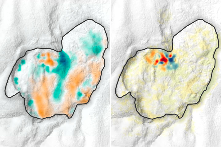
One source of data they expect will be especially useful for doing that is an imaging spectrometer currently in orbit on the International Space Station. The Earth Surface Mineral Dust Source Investigation (EMIT) mission is collecting data on the color and composition of Earth’s surface in major dust-producing regions. The data will be used to create a more accurate map of surface mineralogy in arid, windswept areas that researchers will use to refine climate models.
NASA Earth Observatory images by Joshua Stevens, using VIIRS data from NASA EOSDIS LANCE, GIBS/Worldview, and the Joint Polar Satellite System (JPSS) and GEOS-5 data from the Global Modeling and Assimilation Office at NASA GSFC. Story by Adam Voiland.